Summary: – Remote Sensing software is designed to process, analyse, and visualize data sensors capture on satellites, drones, or aircraft. Discuss 10 best Remote sensing software’s, and their features, advantages and disadvantages.
A Complete Overview of Remote Sensing Software
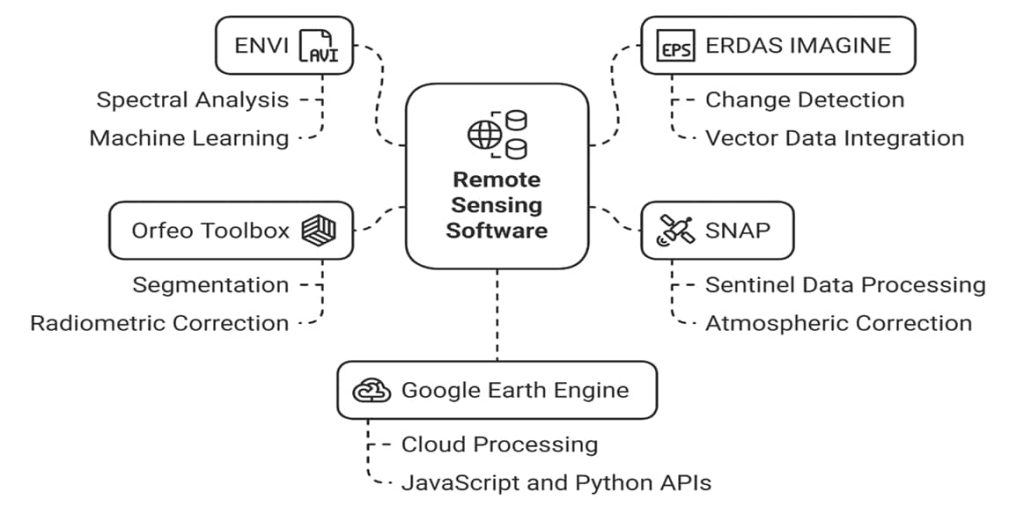
Remote sensing software is mainly used to work with images taken by satellites, drones, or aircraft. It helps users process and improve these images so that useful information can be extracted. Common tasks include image classification (like identifying land use types such as forests, water, or buildings), image enhancement (making features clearer), and detailed analysis (such as detecting changes over time). This type of software is essential in environmental monitoring, agriculture, disaster assessment, and other studies where understanding the Earth’s surface is important. Examples: ERDAS IMAGINE,
ENVI, SNAP (Sentinel Application Platform).
This software enables the interpretation of imagery and spectral data to extract meaningful information about the Earth’s surface, such as land use, vegetation health, water bodies, urban development, and environmental changes.
These tools support image classification, change detection, atmospheric correction, and feature extraction. Remote sensing software is widely used in environmental monitoring, disaster management, agriculture, forestry, and geospatial research.
Best Remote Sensing Software’s
Some software is paid license, and some open source. In below see the list of best Remote Sensing software’s.
1. ERDAS IMAGINE
The ERDAS IMAGINE incorporates Geospatial Image processing and analysis, Remote Sensing, and GIS into a single powerful, convenient platform Developed by Hexagon Geospatial.
- Developer: Hexagon Geospatial
- Platform: Windows
- Applications: Agriculture, forestry, urban studies, defense
- Strengths: Strong photogrammetry suite, integration with GIS
- Limitations: High cost, primarily Windows-based
Features:
- Image processing and classification
- Orthorectification, Mosaicking, Reprojection, Elevation extraction
- Point cloud processing
- Spatial Modeler’s graphical editing
- Machine Learning and Deep Learning Artificial Intelligence algorithms
| Pros | Cons |
|---|---|
| ✅ Advanced remote sensing tools for raster, classification, and analysis ✅ Supports LiDAR and Radar (SAR) processing ✅ Object-based image analysis (OBIA) ✅ Orthorectification and photogrammetry capabilities ✅ Integrates well with other Hexagon products (like GeoMedia) | ❎ Expensive licensing ❎ Steep learning curve ❎ Windows-only platform ❎ Lower adoption in academic/open-source communities |
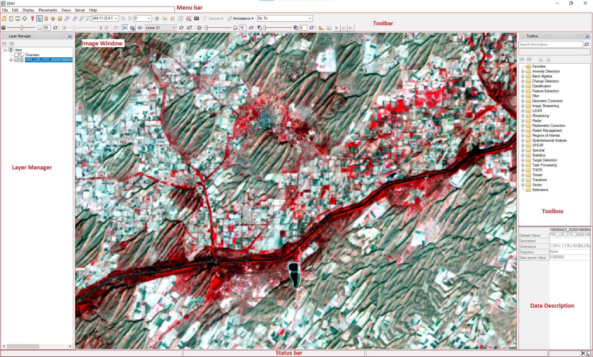
2. ENVI
ENVI is the image processing and analysis software. It is used by image analysis, GIS professionals and scientists to extract timely, reliable and accurate information from geospatial imagery. ENVI supports more than 200 different types of data.
- Developer: L3Harris Geospatial
- Platform: Windows, Linux
- Applications: Land cover classification, mineral mapping, vegetation analysis
- Strengths: User-friendly GUI, extensive toolsets, integration with ArcGIS
- Limitations: Expensive license, steep learning curve for advanced functions
Features:
- Science-based analytics are accurate and reliable for extracting meaningful information
- Spectral indices, elevation data or data transforms to create more robust classifiers
- Defense, disaster response, Urban development, Transportation and other industries
- Preprocessing tools such as calibration, atmospheric correction and color space transforms create consistent input data for deep learning models.
- Geospatial deep learning technology built on TensorFlow
| Pros | Cons |
|---|---|
| ✅ Advanced spectral analysis (hyperspectral & multispectral support) ✅ User-friendly, modern interface ✅ Strong preprocessing tools (atmospheric, radiometric, geometric) ✅ Integration with ArcGIS ✅ SAR and LiDAR data analysis support | ❎ High licensing cost ❎ Steep learning curve for advanced features ❎ Performance can lag with very large datasets |
3. PCI Geomatica
PCI Geomatics is the developer of Geomatica, it is a complete and integrated desktop software that features tools for remote sensing, digital Photogrammetry, geospatial analysis, map production, mosaicking and more.
- Developer: PCI Geomatics company
- Platform: Windows
- Applications: Land cover classification, analyze satellite imagery
- Strengths: Freeview- load multiple types of satellite images
- Limitations: Expensive license, steep learning curve for advanced functions
Features:
- Faster data processing
- Allows users to load satellite and aerial imagery can be performed advanced analysis
- Uses educational, commercial, and military users
| Pros | Cons |
|---|---|
| ✅ High-performance orthorectification and photogrammetry ✅ Excellent satellite image processing tools (RADARSAT, SPOT, etc.) ✅ Focused on accuracy for large-scale mapping and mosaicking ✅ Advanced SAR processing and interferometry tools | ❎ Expensive commercial license ❎ Steep learning curve, especially for new users ❎ Not ideal for general GIS tasks compared to QGIS or ArcGIS |
4. QGIS
QGIS is a user friendly Free and Open-Source Geographic Information System (GIS). QGIS licensed under the GNU (General Public License), it’s an official project of the Open-Source Geo-Spatial Foundation (OSGeo).
- Developer: OSGeo (Open-Source Community)
- Platform: Windows, Linux, macOS
- Applications: Academic research, NGO work, planning
- Strengths: Free, highly customizable
- Limitations: Some plugins may lack documentation
Features:
- Open source, Plugin support
- Supports vector, raster, and database formats
- Support for remote sensing imagery and raster classification
- Tools for spatial analysis, geoprocessing, buffering, clipping, overlay, etc.
| Pros | Cons |
|---|---|
| ✅ Open-source and free to use ✅ Active community and frequent updates ✅ Highly customizable with plugins ✅ Good integration with databases (PostGIS, SpatiaLite) ✅ Strong Python support (PyQGIS) | ❎ Some plugins may be unstable or poorly documented ❎ May lack enterprise-grade support and polish compared to Esri ❎ Steeper learning curve for some advanced tools |
5. GRASS
GRASS GIS is a free Geographic Information System (GIS) software used for for terrain and ecosystem modeling, hydrology, visualization of Raster and Vector data, management and analysis of geospatial data, also processing of satellite and aerial imagery.
- Developer: Open Source Geospatial Foundation (OSGeo)
- Platform: Cross-platform
- Applications: Ecology, hydrology, agriculture
- Strengths: Powerful analytical capabilities
Features:
- Advanced data processing of satellite and aerial imagery
- Advanced time series processing and a Python API for rapid geospatial programming
- Large geospatial data analysis
| Pros | Cons |
|---|---|
| ✅ Open-source and powerful for raster and geospatial modeling. ✅ Excellent for scientific research and time-series analysis. ✅ Robust scripting via Bash and Python. | ❎ Steep learning curve. ❎ Outdated GUI (though improving). ❎ Not as intuitive or beginner friendly as QGIS or ArcGIS Pro. |
6. Orfeo Toolbox
Orfeo ToolBox (OTB) is an open-source remote sensing geospatial community, developed by the French Space Agency (CNES). It can process high resolution optical, multispectral and radar images. OTB is available on Linux, Windows, and macOS.
- Developer: CNES (French Space Agency)
- Platform: Cross-platform
- Applications: Land use classification, urban monitoring
- Strengths: Command-line and GUI tools, scalable
- Limitations: Steeper learning curve, more suited for programmers
Features:
- Accessible from QGIS, Python, the command line or C++
- Support large-scale satellite imagery
- SAR data support
- Change detection and image fusion
- Compatible with QGIS through plugins
| Pros | Cons |
|---|---|
| ✅ Completely free and open source ✅ Optimized for large-scale remote sensing data processing ✅ Excellent support for optical, SAR, and hyperspectral imagery ✅ Integrates with QGIS through Processing Toolbox | ❎ No built-in GUI (relies on QGIS or Monteverdi for interface) ❎ Mostly designed for developers and advanced users ❎ Steep learning curve, especially for command-line and scripts |
7. SAGA
SAGA (System for Automated Geo-scientific Analyses) has been designed to easy and effective implementation of spatial algorithms and its easily approachable user interface with many visualization options.
- Developer: Departments for Physical Geography, Hamburg and Göttingen, Germany
- Platform: Linux, BSD, Mac, Windows
- Applications: Image analysis, Geostatistics, Terrain analysis
- Strengths: Command-line and GUI tools, Functions are organised as modules in framework independent Module Libraries
- Limitations: Steeper learning curve, more suited for programmers
Features:
- Perform data analyses and manipulations by executing modules
- Manipulation modules and analysis of vector data
- Performed Classifications using cluster analysis or a supervised procedure
- Create Digital Elevation Models and Terrain Analysis
| Pros | Cons |
|---|---|
| ✅ Free and open-source software ✅ Specialized in terrain analysis, hydrology, and Geo statistics ✅ Huge library of geoscientific and spatial analysis tools ✅ Integrates with QGIS as a backend tool | ❎ Poor visualization tools compared to QGIS or ArcGIS ❎ Limited cartographic and layout capabilities ❎ Less active user and developer community |
8. gvSIG
The gvSIG is a open source professionals geomatics network. It’s uses on spatial data infrastructures, mobile solutions and spectoral solutions. gvSIG Desktop allowing thus continually improving the software application and developing tailor made solutions.
- Developer: gvSIG Association
- Platform: Windows, macOS, Linux
- Applications: Urban planning, civil engineering, public GIS
- Strengths: Open source, multilingual, customizable
- Limitations: Slower updates, small community
Features:
- Generate maps 2D and 3D applications easily
- Uses for inventory projects, census, revisions, inspections
- Create Spatial Data Infrastructures
| Pros | Cons |
|---|---|
| ✅ Free and open source ✅ User-friendly interface similar to commercial GIS like ArcGIS ✅ Strong support for vector and raster data analysis ✅ Integrates with PostGIS, WMS/WFS, and remote services | ❎ Limited plugin ecosystem ❎ Slower development and updates compared to QGIS ❎ Less stable performance on large datasets |
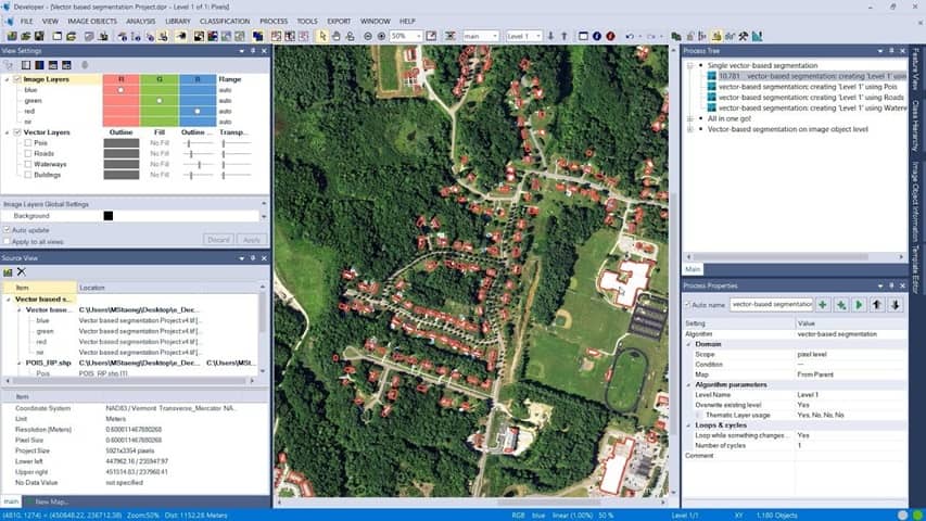
9. eCognition
Trimble eCognition software is used by GIS professionals, Remote Sensing experts & data scientists to automate geospatial data analytics. It is designed to improve, accelerate and automate the interpretation of a variety of geospatial data and enables users to design feature extraction of change detection solutions to transform geo-data into to geo-information.
- Developer: Trimble Geospatial
- Platform: Windows
- Applications: Urban planning, civil engineering, public GIS
- Strengths: Automate data interpretation by designing your own feature extraction and change detection solutions
- Limitations: Expensive license, steep learning curve for advanced functions
Features:
- Integrated and modular GNSS systems for surveying and mapping
- Powerful, rugged and designed for the way you collect data
- Terrestrial 3D laser scanning and imaging systems
- Automated, continuous real-time monitoring and alerts
| Pros | Cons |
|---|---|
| ✅ Excellent for multiresolution segmentation and rule-based logic ✅ Supports multi-source data fusion (optical, LiDAR, SAR, etc.) ✅ Highly customizable rule sets for image classification ✅ Fast and scalable for large area and time-series analyses ✅ Integrates with remote sensing & GIS workflows (e.g., ArcGIS, ENVI) | ❎ Very high licensing cost, not suitable for small budgets ❎ Steep learning curve, requires training ❎ Primarily Windows-based; limited OS support ❎ Limited access for students and open-source communities |
10. SNAP
SNAP (Sentinel Application Platform) is an open-source software developed by the Brockmann Consult, Skywatch, Sensar and C-S. It is ideal for Earth observation processing and analysis remote sensing data, especially data from the Sentinel satellite missions under the Copernicus Programme.
- Developer: European Space Agency (ESA)
- Platform: Windows, Linux, macOS
- Applications:
- Climate monitoring, agriculture, hydrology
- Strengths: Free, actively developed by ESA
- Limitations: Interface may be slow on lower-end systems
Features:
- Common architecture for all Toolboxes:
- Sentinel-1 Toolbox (SAR data)
- Sentinel-2 Toolbox (MSI data)
- Sentinel-3 Toolbox (SLSTR, OLCI, SRAL)
- Very fast image display and navigation
- Accurate reprojection and ortho-rectification
- Automatic SRTM DEM download
| Pros | Cons |
|---|---|
| ✅ Free and open-source, Works on Windows, Linux, macOS ✅ Tailored for Sentinel (1, 2, 3) satellite data processing ✅ Supports SAR, optical, and atmospheric data ✅ Integrated toolboxes (S1TBX, S2TBX, S3TBX, etc.) ✅ Excellent radiometric, geometric, and atmospheric correction tools | ❎ Steep learning curve ❎ Performance can be slow on large datasets without strong hardware ❎ Limited tools for vector-based GIS tasks ❎ Not as user-friendly as QGIS or ArcGIS |
11. Google Earth Engine
Google Earth Engine (GEE) is a cloud-based platform developed by Google for scientific analysis and visualization of geospatial datasets, with planetary-scale analysis capabilities. It allows users to access and analyze of satellite imagery and geospatial datasets using powerful cloud computing resources. Now it’s available for commercial use and remains free for academic and research use.
- Developer: Google
- Platform: Web-based
- Applications:
- Deforestation, water resource monitoring, climate change
- Strengths: No local storage needed, extremely fast processing
- Limitations: Requires internet, limited customization offline
Features:
- Free access to petabytes of satellite imagery and geospatial datasets (e.g.- Landsat, Sentinel, MODIS, and more)
- Fast analysis using Google’s data centers
- No need for high-performance local machines
- Stores it in a public data archive that includes historical earth images going back over 40 years.
| Pros | Cons |
|---|---|
| ✅ Free for research, education, and non-commercial use ✅ Access to a massive archive of public satellite imagery (Landsat, Sentinel, MODIS, etc.) ✅ Ideal for large-scale environmental monitoring and change detection ✅ Strong support for time-series, classification, machine learning ✅ Automatic access to DEM, climate, and land use datasets | ❎ No native support for offline use or local processing ❎ Requires coding knowledge (JavaScript or Python APIs) ❎ Limited cartographic customization and map design ❎ Data upload and export options have quotas and limits |
Most commonly used extensions in integration with Remote Sensing Software:
a) QSWAT+
QSWAT+ (QGIS Interface for Soil and Water Assessment Tool) is a QGIS plugin that facilitates hydrologic modeling using the SWAT model (Soil and Water Assessment Tool). It enables watershed delineation, HRU (Hydrologic Response Unit) creation, and runoff, sediment, and nutrient transport simulation.
Key Features:
- Integration with the SWAT+ model for water and sediment simulation
- Automatic watershed and sub-basin delineation
- Land use, soil, and slope-based HRU definition
- Output visualization for streamflow and pollutant loads
- Support for BMP (Best Management Practices) evaluation
Use Cases:
- Watershed management
- Hydrologic impact of land-use change
- Water quality modeling
b) SAGA (System for Automated Geoscientific Analyses)
SAGA GIS tools, integrated into QGIS via the Processing Toolbox, offer advanced geospatial analysis capabilities for raster and terrain processing. SAGA is well-known for its hydrological, terrain, and statistical tools.
Key Features:
- Flow direction and accumulation analysis
- Stream network and watershed delineation
- Terrain classification and slope/aspect analysis
- Multivariate statistical tools for spatial data analysis
Applications:
- Hydrologic terrain modeling
- Geomorphology and landform classification
- Soil erosion and slope instability analysis
c) TauDEM (Terrain Analysis Using Digital Elevation Models)
TauDEM is a suite of hydrologic terrain analysis tools for extracting hydrologic information from digital elevation data. It is accessible in QGIS through the Processing Toolbox when correctly configured.
Key Features:
- Delineation of flow direction using the D-infinity method
- Stream and watershed extraction
- Slope-area analysis
- Identification of contributing areas and stream order
Applications:
- Watershed modeling
- Flood and runoff analysis
- Terrain-driven hydrologic simulations
d) Semi-Automatic Classification Plugin (SCP)
SCP is one of the most powerful plugins in QGIS for remote sensing and land cover classification. It supports supervised classification of satellite imagery, including Landsat, Sentinel, and MODIS.
Key Features:
- Preprocessing of satellite images (e.g., atmospheric correction)
- Training set and region of interest (ROI) management
- Supervised classification (Maximum Likelihood, Random Forest, etc.)
- Change detection and accuracy assessment
- NDVI and spectral index calculations
Applications:
- Land use/land cover mapping
- Vegetation and agricultural monitoring
- Time-series analysis using satellite imagery
e) MUSLEY (Multi-Scale Land Evaluation Tool)
MUSLEY is a QGIS plugin designed to support land suitability and capability analysis. It integrates various soil, climate, and topographic datasets to assess agricultural or development potential.
Key Features:
- Rule-based multi-criteria land evaluation
- Layer-weighting and scoring system
- Compatibility with FAO land evaluation guidelines Flexible for agricultural, urban, or conservation planning
Applications:
- Sustainable land-use planning
- Agricultural zoning
- Urban expansion suitability
Conclusion
Remote sensing software plays a crucial role in the acquisition, correction, analysis, and interpretation of satellite and aerial imagery. These software platforms are equipped with tools for pre-processing, atmospheric correction, classification, change detection, and more. Users can select software based on factors like type of imagery (optical, thermal, SAR), desired outputs, and technical expertise.
Commercial platforms like ENVI and ERDAS IMAGINE offer extensive processing capabilities and customer support, ideal for institutions and agencies. In contrast, open-source tools like SNAP and Orfeo Toolbox enable cost-effective analysis, especially for academic or research-based projects. The growing popularity of cloud platforms like GEE marks a shift toward scalable, collaborative remote sensing workflows.