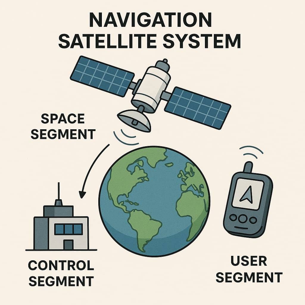
GISRSStudy » GNSS System

GNSS System

Global navigation satellite system (GNSS) is a general term describing any satellite constellation that provides positioning, navigation, and timing services on a global or regional basis.

Navigation Satellite System

Navigation Satellites Satellites navigation services to meet the emerging demands of the Civil Aviation requirements and to meet the user requirements of the positioning, navigation and timing based on the independent satellite navigation system. Satellite Navigation is based on a global network of satellites that transmit radio signals from medium earth orbit. Satellite Navigation with …

Navigation Satellite System Read More »

Best Garmn GPS

Best Buy Garmin GPS The Global Positioning System (GPS) is a satellite-based navigation system made up of at least 24 satellites. GPS works in any weather conditions, anywhere in the world, 24 hours/day. List of the Best Garmin GPS to Buy in 2023 Garmin Foretrex 701 Foretrex 701 Specification General Physical dimensions 7.3 x 4.3 …

Best Garmn GPS Read More »

GPS with GLONASS

GLONASS GLONASS stand for Global Navigation Satellite System, Russia, it is a space-based Global Navigation Satellite System (GNSS), operated by the Russian Federation. The GLONASS is a part of GPS System. The first GLONASS satellite was launched in 1982 and the system was declared fully operational in 1993. GLONASS System Orbital Constellation:24 Satellites(3 planes x …

GPS with GLONASS Read More »

GAGAN

GAGAN – GPS Aided GEO Augmented Navigation Introduction GAGAN GAGAN (GPS Aided GEO Augmented Navigation) is a Space Based Augmentation System (SBAS) developed by ISRO (Indian Space Research Organization) and AAI (Airports Authority of India). It is to provide the best possible navigational services over Indian Air Space. GAGAN is a system of satellites and ground stations that provide GPS signal corrections, giving …

GAGAN Read More »

DGPS

DGPS –Differential Global Positioning System What is DGPS? A DGPS stands for Differential Global Positioning System. It is an enhancement to the Global Positioning System (GPS) which provides improved location accuracy, in the range of operations of each system, from the 15-meter nominal GPS accuracy to about 1–3 centimeters. Each DGPS uses a network of …

DGPS Read More »

Scroll to Top