ERDAS IMAGINE Software
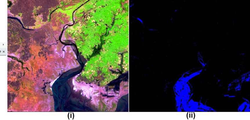
Introducing ERDAS IMAGINE Software Erdas Imagine performs advanced remote sensing analysis and spatial modeling to create new information. In Erdas Imagine Software, you can visualize your results in 2D, 3D, movies, and on cartographic-quality map compositions. The core of the Erdas Imagine product suite is engineered to scale with your Geo-spatial data production needs. Erdas […]