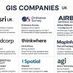
Skip to content
GIS

GIS & REMOTE SENSING

  • Home
  • GIS
  • Remote Sensing
  • Learn Software
    • Q-GIS
    • Arc-GIS
    • ArcGIS-Pro
    • Google Earth Pro
    • Erdas Imagine
  • GIS Course
    • GIS Courses in USA
    • GIS Courses in UK
    • GIS Courses in India
    • GIS Courses in Australia
  • GIS Job
    • GIS Companies in USA
    • GIS Companies in UK
    • GIS Companies in India
    • GIS Companies in Other Countries
  • Books
  • Search
  • Home
  • GIS
  • GIS Companies in Other Countries

GIS Companies in Top Countries

List of  Best GIS Companies in the world Countries

GIS Companies in Australia
  • Gruntify
  • Soar Pty Ltd
GIS Companies in Canada
  • Echosec
  • Jibestream
  • Geocode
  • Meemim Inc.(vGIS)
  • PCI Geomatics
  • SensorUp
  • Sparkgeo
  • Urthecast
GIS Companies in Finland
  • Indoor Atlas
  • Maptionnaire
  • Spatineo
GIS Companies in Germany
  • Awesome Maps
  • Beaconinside
  • FATMAP
  • Here
  • Navvis
GIS Companies in Spain
  • Avuxi
  • Carto
  • Geoblink
  • Geographica
  • Remot Technologies
  • SmartMonkey
  • Urban Data Analytics
GIS Companies in Sweden
  • Hexagon
  • Mapillary
facebook Share on Facebook
Twitter Tweet
Follow Follow me
custom Share
custom Share
custom Share
custom Share
custom Share

Post navigation

← Previous Post
Next Post →
  • Home
  • GIS
  • Remote Sensing
  • Learn Software
    • Q-GIS
    • Arc-GIS
    • ArcGIS-Pro
    • Google Earth Pro
    • Erdas Imagine
  • GIS Course
    • GIS Courses in USA
    • GIS Courses in UK
    • GIS Courses in India
    • GIS Courses in Australia
  • GIS Job
    • GIS Companies in USA
    • GIS Companies in UK
    • GIS Companies in India
    • GIS Companies in Other Countries
  • Books

Online GIS Training

About

Contect

Email- support@gisrsstudy.com

Connect

Follow by Email
Facebook
Facebook
fb-share-icon
Twitter
Follow Me
Tweet
YouTube
YouTube
Share

Recent Posts

  • Drainage Density – ArcGIS
  • Topology – ArcGIS
  • Layout – ArcGIS
  • Layout – QGIS
  • Create Shapefile
  • Georeferencing – QGIS
  • Georeferencing – ArcGIS
  • Interpolation
  • Flood Simulation Model
  • Spatial Analyst Tools
  • Unsupervised Classification – Erdas Imagine
  • Supervised Classification – Erdas Imagine
  • Stream Order – ArcGIS
  • Create DEM Map- ArcGIS
  • Heatmap – QGIS
Copyright © 2021 GIS RS Study | Powered by Utpal Santra
  • Terms and Conditions
  • Privacy Policy