How to Change Projection in QGIS
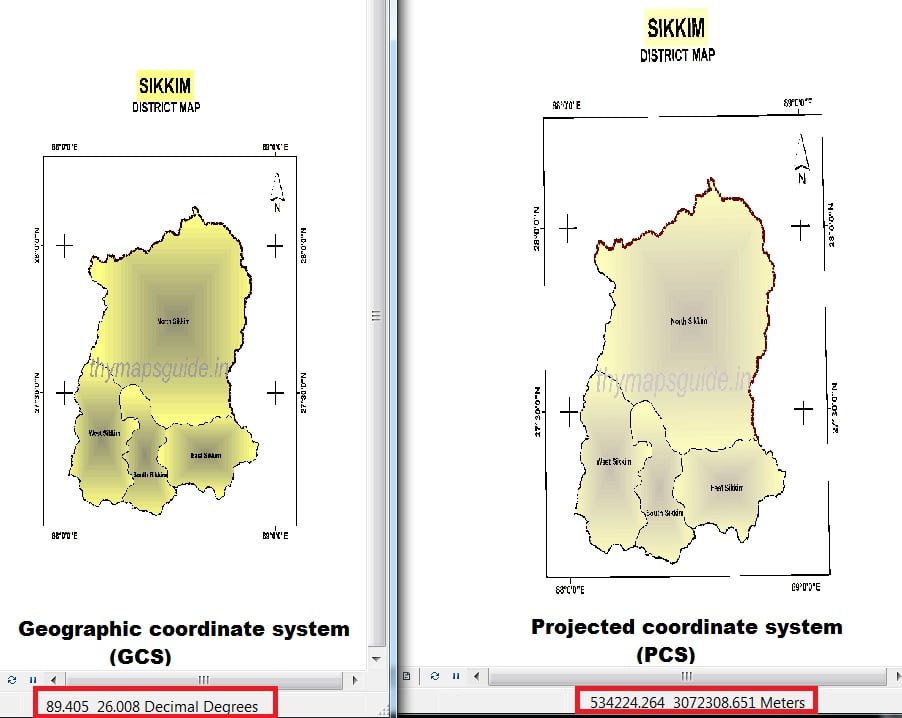
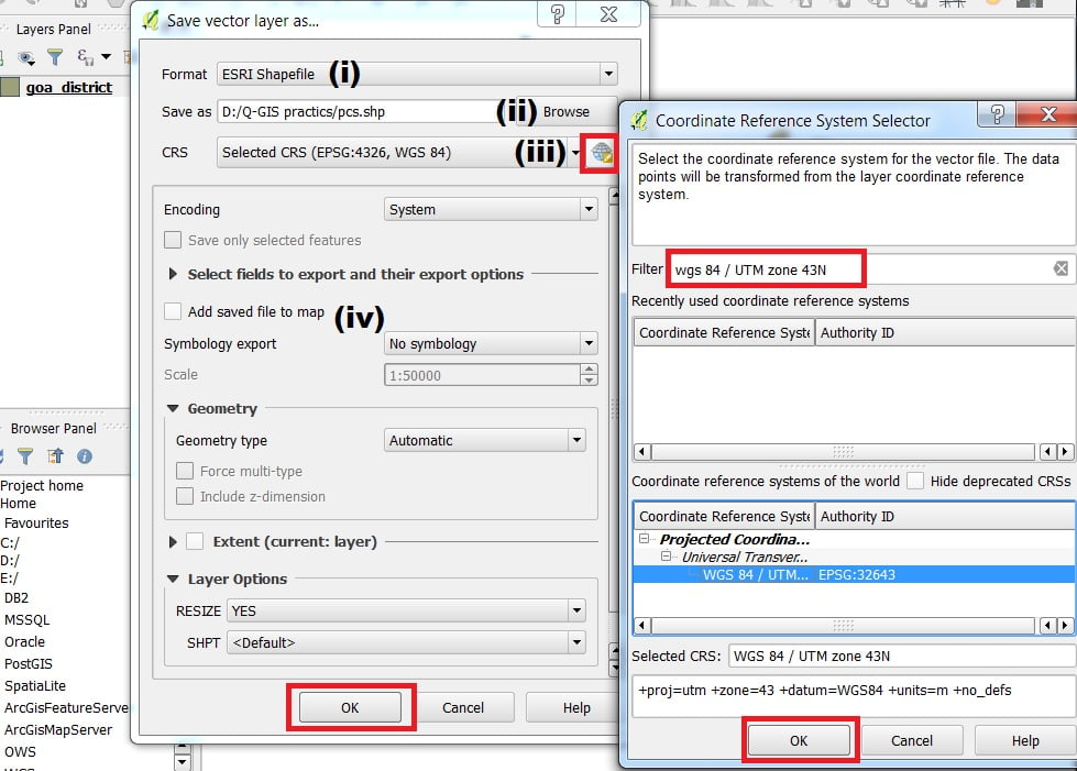
Summary: – How to Change Map Projection in QGIS, GCS to PCS. How to Change Map Projection in QGIS QGIS allows users to define a global and project-wide CRS (coordinate reference system) for layers without a pre-defined CRS. It also allows the user to define custom coordinate reference systems. Change Projection (GCS to PCS) Change […]