Downloading Shapefiles: A Complete Guide to GIS Data Access
In this tutorial discuss about, How to Download free Geographic (GIS) Shapefile Data in DIVA-GIS.
DIVA-GIS is a free web service for downloading mapping and geographic data analysis. Its provide free spatial data for the whole world.
It is developed by Robert J. Hijmans. Earlier versions were developed in collaboration with Edwin Rojas, Mariana Cruz, Rachel O’Brien, Israel Barrantes, Andy Jarvis and Luigi Guarino.
Download Country Level Shapefile Data
DIVA-GIS allow to download country level Shapefile Data absolutely free of cost.
Go to DIVA-GIS web portal, and select Free Spatial Data tab.
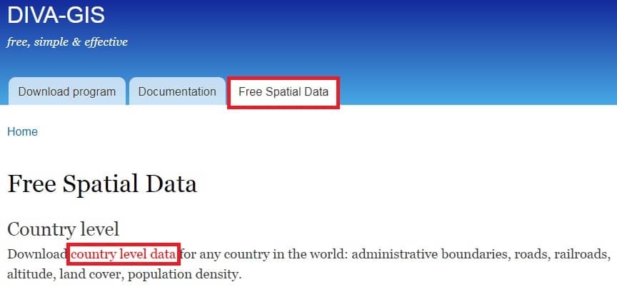
In the Country level section, click country level data.
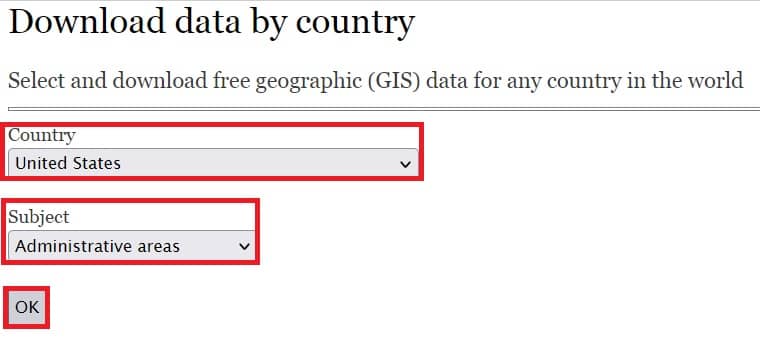
Now select and download free Shapefile data for any country in the world.
- Choose any country in the Country (eg.- United States) section.
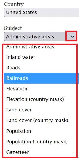
- In the Subject section choose Administrative areas.
- Click OK button.
Open next page, Finally click Download.
Your data download in ZIP archive format (eg.- USA_adm), Now Extract the .zip file.
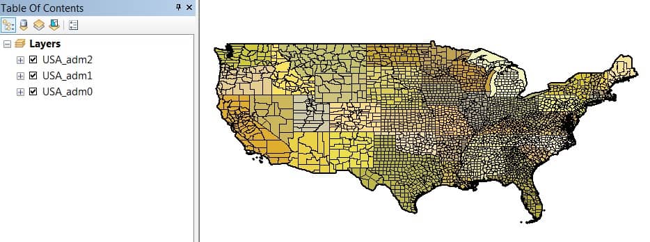
Once you have extract the USA_adm zip file, show all the USA Shapefiles dataset.
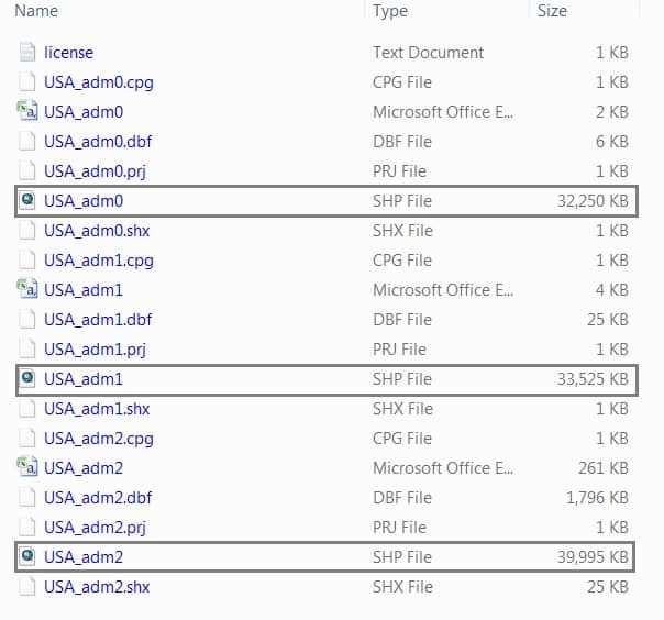
Three segment data are available;
- USA_adm0– represent the United States Country Boundary.
- USA_adm1– represent the United States State Boundary.
- USA_adm2– represent the United States Block Boundary.
Now you can Add data in ArcGIS.
Similarly, you can also download others Spatial Vector Data, such as; Rail, Roads, Elevation, Land cover, Population, and many more.
Follow the same process in DIVA-GIS, just need to one change. In the Subject section, click drop-down arrow, and choose your require data.
Esri Shapefile Download
It is possible to download shapefiles data in from Esri, as well as ArcGIS Online.
Creates a compressed file (.zip file) containing a shapefile for each layer.
You can download the file and save it to your computer.
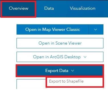
Follow the Steps, Export the data from ArcGIS Online:
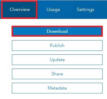
1. Log in to ArcGIS Online.
2. On the Overview tab, click Export Data > Export to Shapefile.
3. The Export to Shapefile window appears, specify the Tags and Summary sections, and click Export.
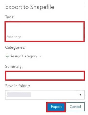
4. Now finally click Download button. The shapefile is downloaded in a zip folder.
Other Sources to Download Shapefiles Data
- USGS- TNM Download
- Learn more about, how to Download Data & Maps from The National Map Viewer.
- Open Street Map (Geofabrik’s)
- Learn more about, how to Download Spatial (Shapefiles/Vector) GIS data.