ArcGIS Open Data: Download Data From ESRI Open Data Hub
Introduction
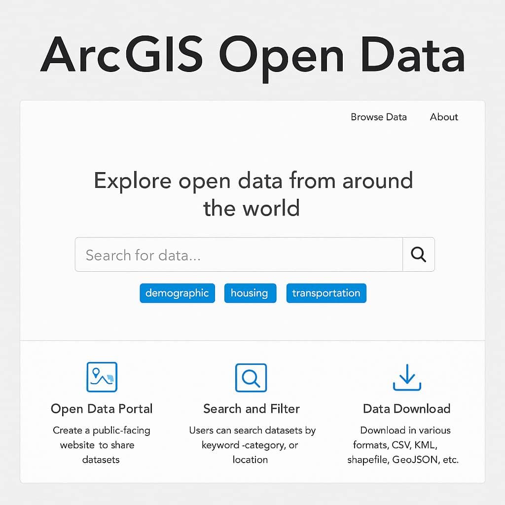
ArcGIS Open Data is a free capability of ArcGIS Hub that allows governments, organizations, and communities to share authoritative geospatial data with the public via customizable websites.
The Open Data enables all types of GIS data formats, its Vector and Raster data.
Open data capabilities come included in ArcGIS Online, no additional purchases or training are needed. You’ll be able to successfully share the data that you’re already collecting, maintaining, and curating using workflows and best practices.
Supporting Data Formats
You can access and store GIS data types in the formats you already use.
Geospatial Data Formats
- Geodatabases Spatial databases
- Shapefiles
- GeoPackage
- GeoJSON
- KML
- JSON
- XML
- SDTS
- OGC Web Services
Tabular Data Formats
- Databases
- dBase
- CSV/Text/ASCII
- Microsoft Excel
- Microsoft Access
- Anything connected via OLE DB API
Web and Real Time Data Formats
- RSS
- WebSocket
- Website (Poll)
- Kafka Event Messenger
- Azure Event Hub
- NMEA
- GTFS
- Waze
- Sierra Wireless RAP
- Trimble TAIP
- Common Alerting Protocol (CAP)
Imagery, EO, and 3D Data Formats
- Commercial Satellite
- Public Satellite (Landsat/Sentinel)
- Aerial photography
- UAS/UAV
- Lidar (LAS, LAZ)
- JPEG
- TIFF/GeoTIFF/COG
- GRIB
- HDF
- netCDF
- CAD/Revit
ESRI Open Data
ESRI provides different types of Data Categories, Download raw data and share your insights with your community or build new applications that serve specific users.
ArcGIS Data Hub
Open data capabilities of ArcGIS Hub make it possible to share and discover authoritative data.