Attribute Table in ArcGIS
In ArcGIS Database (dBASE ) Table represent the Data table or Attribute table. Dataset in ArcGIS insights based on the type of data in the field.
When you create Feature classes or tables, you select a data type for each field. Fields are the components that provide structure for a table. You can’t have a table without fields.
Create a Database Table in ArcMap
Follow these steps to create a table in a database:
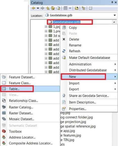
1. Open ArcCatalog or ArcMap and also open the Catalog window.
2. Create a connection to your database.
3. In the Catalog window, right-click the Geodatabase connection, select New > Table.
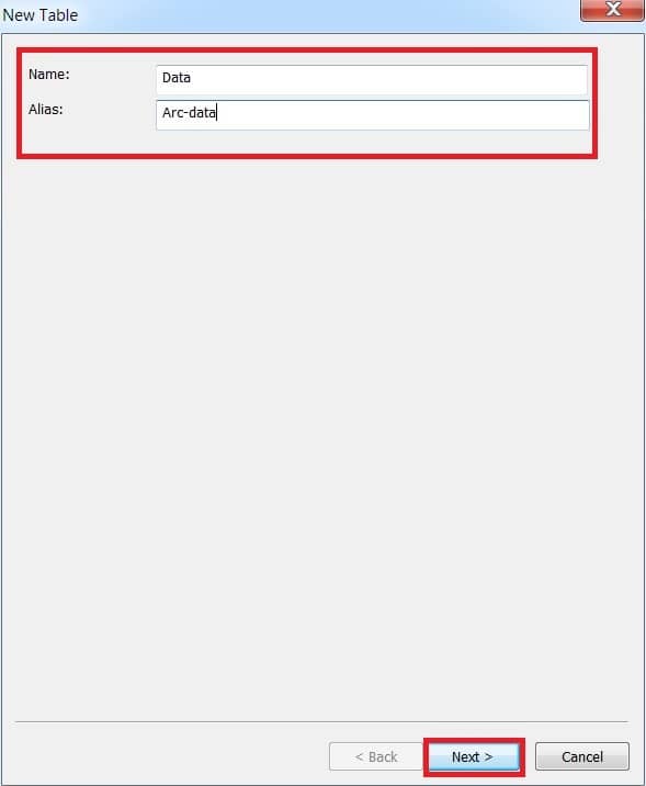
4. Type a Name and optionally type an Alias of the table, then click Next.
5. Skip this step, Specify the database storage configuration, just click next.
[ArcGIS automatically adds an to the table. The ObjectID value is populated automatically when you load data into the table.]
6. To add a field to the table, click the next blank row of the ObjectID field in the Field Name column and type a Name.
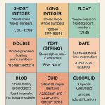
7. Click the Data Type column, and choose a data type from the drop-down list.
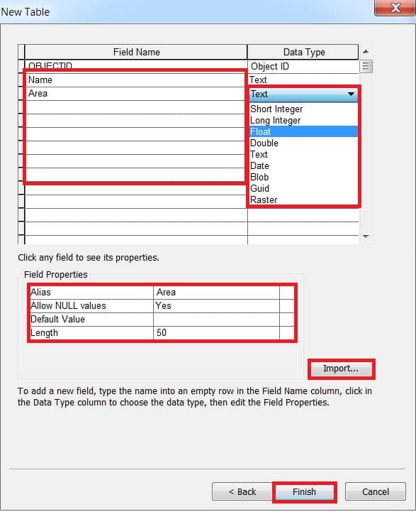
8. Optionally you can create an alias for this field by clicking in the Alias field under Field Properties and typing an alias.
(You can also Import your data).
9. If you don’t want any null values stored in the field, click the field next to Allow NULL values and choose No from the drop-down list.
10. Finally click Finish button to create the table.
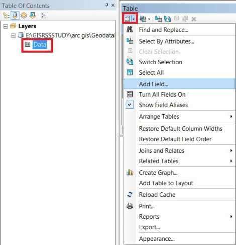
You can also customize or manually change or modify your Table, on the Table of Contents window. Right-click the table, and click Open.
To add a field to the table,or customize, click the Table options button. and select Add Field.
Add Field window appear, write the Name, and choose Data type, so on.
Defining Fields in the Tables
Fields are also used to maintain relationships between tables and their attribute indexes.
Certain field names appear in ArcGIS with their fully qualified names for tables stored in an enterprise Geodatabase.
- FID
- AREA
- LEN
- POINTS
- NUMOFPTS
- ENTITY
- EMINX
- EMINY
- EMAXX
- EMAXY
- EMINZ
- EMAXZ
- MIN_MEASURE
- MAX_MEASURE