Web GIS

WebGIS is a web services, that deliver data and capabilities, and connect components. It’s implementing a modern GIS. Web GIS is a cloud based web server on the Internet.

GIS Cloud

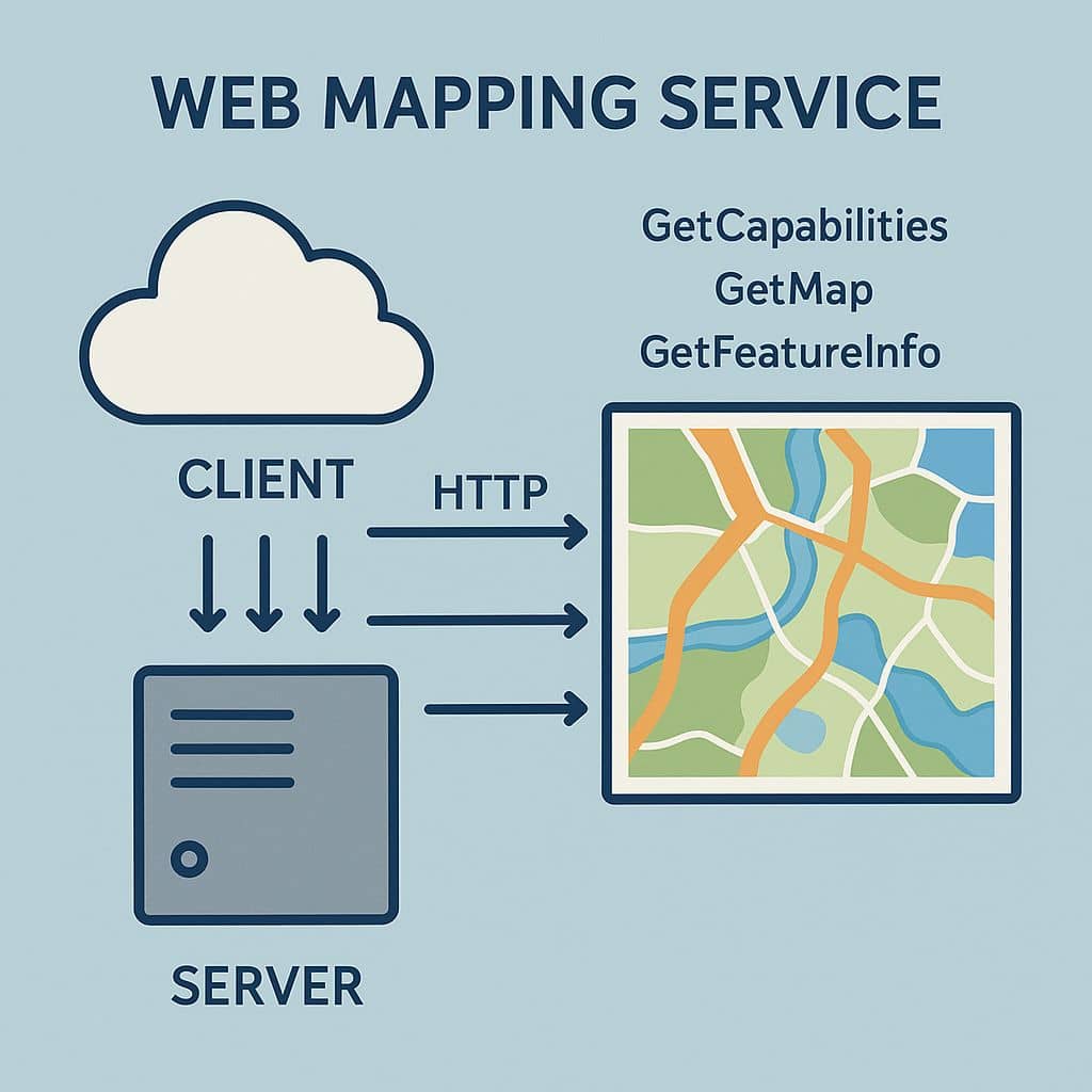
Cloud GIS In today’s interconnected world, understanding spatial relationships is as critical as interpreting facts or statistics. Geographic Information Systems (GIS) have long served as a cornerstone for spatial analysis, enabling users to collect, manage, analyze, and visualize geospatial data. Traditionally, GIS demanded robust local infrastructure, including high-powered desktops, expensive proprietary software, and intricate databases. […]

GIS Cloud Read More »

Web Mapping Service

Web Mapping Service What is Web Mapping Service? The Web Mapping Service (WMS) provides access to a georeferenced representation of the data for basic mapping and data visualization applications. A Geographic Information System (GIS) software application or online mapping tool that supports WMS is required for viewing the georeferenced data from the WMS server. The

Web Mapping Service Read More »

POLARIS GIS

POLARIS GIS What is POLARIS GIS? POLARIS is a specialist consultancy offering a diverse range of geospatial services to private and public sector clients in the UK and internationally. It is to utilize a variety of geospatial technologies to provide cost effective and industry leading solutions. Features : POLARIS is focused on projects in the

POLARIS GIS Read More »

RRC GIS

RRC GIS RRC GIS stands for RailRoad Commission of Texas Geographic Information System. The RRC GIS Viewer allows you to view information about wells, pipelines, surveys, LPG/CNG/LNG, Operator Cleanup Program, Voluntary Cleanup Program, Brownfield Response Program, Commercial Waste Disposal sites, Discharge Permits and related features in a map view The default view when you open

RRC GIS Read More »

MyGeodata Cloud

MyGeodata Cloud Tutorial MyGeodata Cloud allows, share or uploads your own GIS data, converts them on-line to various GIS/CAD formats and coordinates systems, shows your GIS data on a map, share or publishes your data, and many more. What is MyGeodata Cloud? MyGeodata Cloud is a complex portal for Geographic Information Systems (GIS) and CAD

MyGeodata Cloud Read More »

Scroll to Top