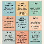
Geospatial Database
What is Geospatial Data?
Geospatial data is information that has a geographic aspect to it. This type of information contains things such as an address with a city, state, and zip code.
Geo-spatial data, also called spatial data, is data that correlates to a geographic location and contains a geographic components. It also can contain latitude and longitude (coordinates) to identify a place on the map.
Geospatial Data examples:
Maps are the most logical example of geospatial data. Maps contain a lot of information about geospatial data, usually in the form of points, lines, polygons, and imagery.
Geospatial Data represents:
- Complex raster data such as imagery and grid data.
- Simple 2D and 3D vector geometric objects such as points, lines, and polygons;
- Points are location coordinates with attached attribute tables, and can for example represent residences, store locations, or mobile phone locations.
- Lines have starting points, end points, and in the case of curves, several midpoints, and an attribute table.
- Polygons are area units, with borders set as lines that have attribute tables.
Geospatial Database?
A geospatial database is defined in a geometric space, such as vector data and raster data. It’s provides the best manageability and security to analyze large, complex, heterogeneous spatial data.
Geographical Information System (GIS) is a tool on top of a geospatial database to edit and maintain geospatial data. GIS support geospatial objects, which are organized in layers that can be overlaid both visually and logically.
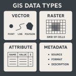
Types of Geospatial Data
There are two basic types of geo-spatial data:
- Raster Data
- Vector Data
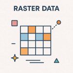
Raster Data
Raster Data also known as grid data, for e.g.- elevation, slope, population, etc. Raster data uses cells to represent spatial data, such as imagery of cities, roads, and waterways.
Vector Data
Vector Data is simply XY coordinates. Generally, they are a Latitude and Longitude value. Vector data uses points, lines, and polygons to represent spatial data that is displayed on the map.
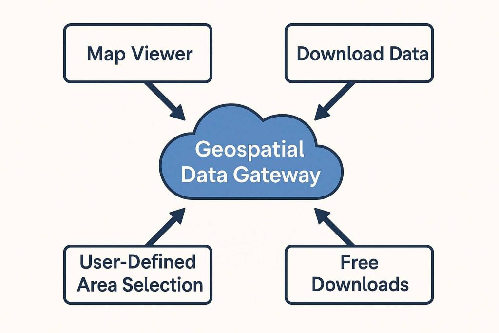
Geospatial Data Gateway
The Geospatial Data Gateway (GDG) of the United States Department of Agriculture (USDA)- National Resources Conservation Service.
Geospatial Data Gateway provides access to a map library of over 100 high resolution vector and raster layers in the Geospatial Data Warehouse.
It allows you to choose your area of interest, browse and select data, customize the format, then review and download.
This GDG service is made available through a close partnership between the three Service Center Agencies (SCA); Natural Resources Conservation Service (NRCS), Farm Service Agency (FSA) and Rural Development (RD).
Available Data:
- Aerial ortho imagery
- Land Use/Land Cove
- DRGs
- Elevation data
- Hydrologic and soil data
List of Data Sources:
Thanks for sharing the content was very helpful