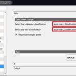
Summary: –
The Five basic components of all GIS systems. These components work together to create an integrated system that allows users to make informed decisions based on geographic data.
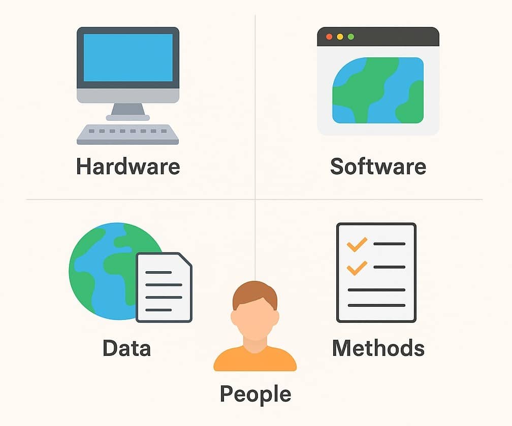
Components of GIS
GIS Components are the primary function to perform Geo-spatial analysis. A Geographic information integrates hardware, software, data capturing, managing, analyzing, and displaying all forms of geographically referenced information.
The main 5 key components of Geographic Information Systems (GIS) are:
- Hardware
- Software
- Data
- User
- Procedure
All these five components organized to automate, manage, and deliver information through geographic presentation.
Hardware
Hardware is the computer system on which a operate GIS Software. They attached it to a disk drive storage unit, used for storing data and runs a program.
The GIS hardware consists of four major components, such as:
- Processing
- Storage
- Display
- Input and Output
The Main Hardware components are:
Software
GIS software is a major function of research, analysis, and display geographic information. GIS Tools help to query, edit, run and display GIS data. The important software functional are:
- Data entry editing, and maintenance
- Analysis/ transformation/ manipulation
- Data display and output
Some GIS Softwares are:
The Software components are:
- GIS Tools
- DBMS (Database Management System)
- GUI (Graphical User Interface)
- Query Tools
- Layout
Data
The most important component of GIS is the Data. Spatial data and related tabular data are the backbone of GIS. The digital map forms the basic data input for GIS. Tabular data related to the map objects can also be attached to the digital data.
A GIS will integrate spatial data with other data resources and can even use a DBMS. GIS data is a combination of spatial and tabular data or Attribute Data. Spatial can be Vector and Raster.
User (People)
People are user of Geographic Information System, they can be handle all the tasks in GIS software. Users can maintain to design and technical specification. It has limited value without the people who manage the system and develop plans for applying it to real-world problems. GIS user is called GIS Analyst or Engineer.
Procedure (Methods)
Procedure is more related to the management aspect of GIS. It’s referred to lines of reporting, control points, and other mechanism for ensuring the high quality of GIS. A successful GIS operates, which are the models and operating practices unique, well-designed and business rules to each organization. The procedures used to input, analyze, and query data determine the quality and validity of the final product.
GIS Procedures include:
- How to data will be retrieved
- Input to the system
- Stored, managed, transformed, analyzed, and finally presented output.