Image Post Processing
In this Tutorial perform Post Image Processing/ Image Classification Vectorization in Erdas Imagine Software.
For many specialized applications, classifying data that have been merged, spectrally merged or enhanced with principal components, image algebra, or other transformations can produce very specific and meaningful results. However, without understanding the data and the enhancements used, it is recommended that only the original, remotely-sensed data be classified.
Post Image Classification Vectorization
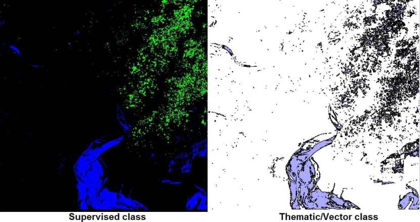
Vectorization over the classified image is done after the classified image has been filtered all the unwented noice has been removed from the thematic dataset. Converting the thematic raster data into vectors retains the class information with each polygon.
Perform Post Classification Vectorization using Erdas Imagine Software
Before you start Post Classification Vectorization, make sure you have already created supervised classification. If you don’t done this, you can’t perform Vectorization process.
Following the steps below:
1. Open your supervised classification image.
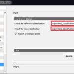
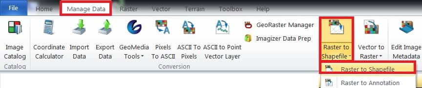
2. Select Manage data tab > Vectorization group > Raster to Shapefile.
3. The Raster to Shapefile dialog box opens, under the Input Thematic Raster, automatically selected your supervised data file.
4. Under Output Shapefile provide the output file name.
5. Select eight-Neighborhood mode options.
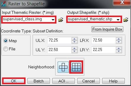
6. Finally click OK button to complete this process.
7. Now open the Vector or Thematic file. Select File > Open > Vector Layer
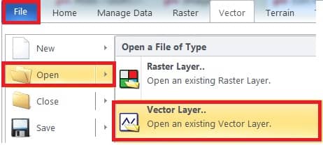
8. Select your Output Shapefile, and click OK.