Image Analysis ArcGIS
What is Image Analysis?
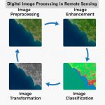
Image analysis is the extraction of meaningful information from images. Mainly from digital images by means of Digital image processing techniques.
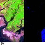
This is used as a fundamental tool for recognizing, differentiating, and quantifying diverse types of images, including grayscale and color images, Multispectral images for a few discrete spectral channels or wavebands, and Hyperspectral images.
ArcGIS Image Analysis
ArcGIS Image Analyst expands your arsenal of advanced imagery tools and user experiences to improve and simplify workflows.
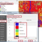
Image Analysis window
The Image Analysis window supports the analysis and exploitation of image and raster data in ArcMap.
To open the Image Analysis window, click Windows > Image Analysis.
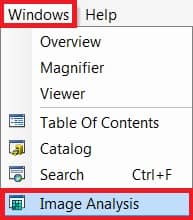
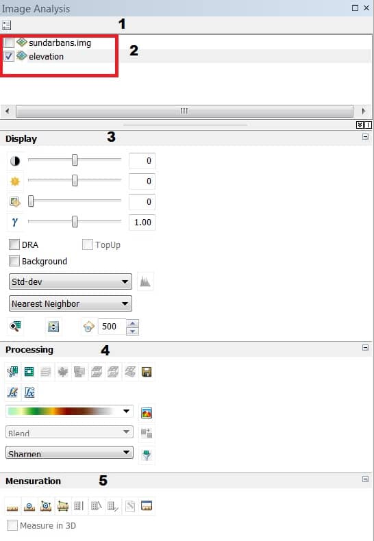
Image Analysis Layers
There are five components to the interface—
- Layer list
- Options
- Display
- Processing
- Mensuration
Layer list
The layer list is a reflection of all the raster layers in the active data frame. A raster catalog layer is not visible nor can it be used within the Image Analysis window.
Options
The Image Analysis Options offer where you can set the defaults for some of the tools in the window, such as defining the red and near-infrared bands to be used with the NDVI tool, the azimuth and altitude values to be used with the Shaded Relief tool, and the standard deviation value to use with the standard deviation stretch method.
Display
This Display panel contains tools used to enhance the appearance of data, include contrast, brightness, gamma, and transparency sliders, etc.
Following are some more details on the individual Display extensions and their function.
| Button | Name/Option |
|---|---|
| Contrast slider | |
| Brightness slider | |
| Transparency slider | |
| Gamma slider | |
| DRA (Dynamic Range Adjustment) | |
| Background | |
| TopUp | |
| Stretch | |
| Interactive Stretch | |
| Resample | |
| One-to-one | |
| Swipe layer | |
| Flicker layer |
Processing
The Processing panel features easy, one-click access to several commonly used image processing techniques. These include clipping, masking, orthorectification, convolution filters, and mosaicking.
Following are some more details on the individual processing extensions and their function.
| Extension Button | Name |
|---|---|
| Clip | |
| Mask | |
| Composite Bands | |
| NDVI | |
| Colormap To RGB | |
| Difference | |
| Pan-sharpening | |
| Orthorectify | |
| Export | |
| Function Editor | |
| Apply Function Template | |
| Shaded Relief | |
| Mosaic | |
| Filter |
Mensuration
The Mensuration panel contains tools to measure point, distance, angle, height, perimeter, and area from an image with sensor information.
ArcGIS Image Analyst for ArcGIS Pro
Image Analyst for ArcGIS Pro provides tools for advanced image interpretation, exploitation, and Geo-spatial analysis on an array of imagery modalities.
ArcGIS Pro Image Analyst Extension
The ArcGIS Image Analyst extension provides functions, tools, and capabilities for image and Geo-spatial analysts. For more details click here.