Remote Sensing Techniques to Access Water Quality
Remote sensing techniques are powerful tools for assessing water quality over large spatial and temporal scales. These methods use sensors mounted on satellites, aircraft, or drones to collect data on the optical properties of water bodies, which can be used to estimate various water quality parameters.
Water Remote Sensing studies the color, temperature, and quality of water through the observation of the spectrum of water leaving radiance.
Satellite Remote Sensing or Earth Observation can be crucial in understanding the spatio-temporal dynamics of water quantity and quality, which can be used to simulate water resources management
Data collected remotely from sensors aboard satellites and aircraft or deployed in and under water are an important tool for addressing the need to better understand factors impacting water quality.
Techniques:
- Atmospheric correction (e.g., Sen2Cor, ACOLITE)
- Spectral indices (e.g., NDVI, NDWI, FAI)
- Machine learning models for parameter estimation
Factors affecting water quality:
- Pollution
- Water temperature
- Food web changes
- Introduced species
- The amount of nutrients in the water
- Changes in water flow, such as after events like hurricanes, drought, or floods
Water Quality Parameters Assessed via Remote Sensing
| Parameter | Remote Sensing Indicator | Notes |
|---|---|---|
| Chlorophyll-a | Reflectance in green and red bands | Proxy for algae concentration |
| Turbidity/TSS | Reflectance in red/NIR | High values = high sediment load |
| CDOM | Absorption in blue wavelengths | Influences water color |
| Surface Temperature | Thermal infrared bands | Affects aquatic life |
| Dissolved Oxygen (DO) | Indirectly inferred via temperature + algae | Not directly measurable |
| Harmful Algal Blooms (HABs) | High chlorophyll + fluorescence index | Detected with hyperspectral sensors |
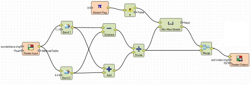
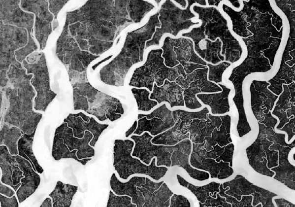
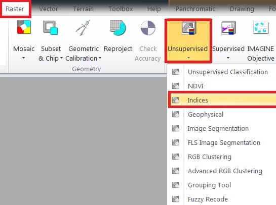
Water Index- Erdas Imagine
In this tutorial perform Water Index; Sundarbans Landsat TM Satellite image, using Erdas Imagine Software.
At first open Indices window; on the main menu, select Raster > dropdown Unsupervised section > click Indices.
1. Now indices window is appeared, select Input file (ex.- sundarbans), then go to destination folder and enter Output file name.
2. Choose your satellite data Sensor (ex.- Landsat 4 TM).
3. In the Index section, choose your query- WorldView Water Index.
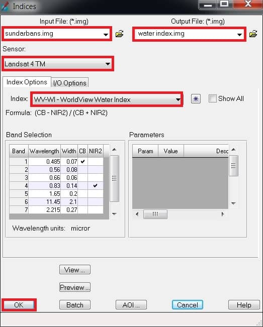
4. Finally click OK button.