GIS Specialist
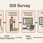
A GIS specialist is an all-rounder in all areas of Geoinformatics. They are specialize all the geographic fields, in geospatial analysis, cartography, data management, and develops.
Specialist Job Description
Knowledge and Experience
- Operations, services, and activities of a GIS program.
- Principles and practices of land-based mapping application theory.
- Methods and techniques of implementing and deploying GIS applications and solutions using a variety of technologies.
- Principles of supervision, training, and performance evaluation.
- Principles and procedures of record keeping.
- Principles of business letter writing, business arithmetic, and basic report
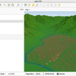
- GIS hardware, software, server-based applications, and web-based applications.
- A range of software tools for GIS map creation and maintenance, data analysis, and Internet-enabled GIS, City standard software, database and operating systems.
- Global Positioning System (GPS) hardware and software.
- Office procedures, methods, and equipment including computers and applicable software applications such as word processing, spreadsheets, and databases.
- Pertinent federal, state, and local laws, codes, and regulations.
How to apply for a Specialist Job
- Advertising your profile– There are many widely used job sites out there that draw visits from qualified candidates. Submit your profile in the job sites
- LinkedIn– LinkedIn is a social network for job seekers, professionals, and businesses. Create a account in linkedin, and post your jobs.
- CareerBuilder– CareerBuilder is a amazing platform to start your career in USA. It has reach 80+ million unique, diverse U.S. job seekers annually by posting your jobs through their talent acquisition channels.
- Freelanceing– Submit your profile in Freelanceing websites, like Freelancer, Upwork, Toptal, etc.
Salary
GIS specialist salaries vary by experience, industry, organization, and location. The average U.S. salary for a specialist is: $56,000– $68,000 per annum.
Representative Duties
- Make equipment recommendations; troubleshoot hardware, software and peripheral
problems. - Interpret base maps; monitor and maintain parcel/land use maps and databases; assign,
verify and coordinate boundaries. - Develops reporting data from existing GIS/CMMS databases.
- Performs manipulation of developed GIS data into Public Works Computerized
Maintenance and Management Systems (CMMS). - Interpret engineering plans, future developments, annexations, Capital Improvements
projects, and model interpretations for GIS layer and database development.