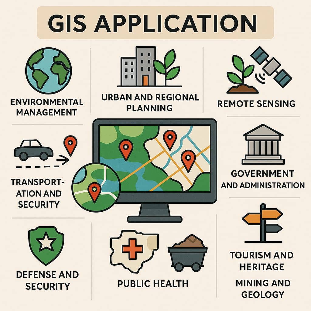
Applications of GIS
Geographic Information Systems (GIS) are applied in various sector. The count of GIS application is growing day by day. In the below some of the well-known applications concerning GIS.
GIS Applications
GIS is a Field to Attached Everything, Agriculture, Industry, Business, Automobile, Environment, and many other sectors.
GIS Application in Agriculture
- Agricultural Mapping
Vegetation and soil index imagery can be reviewed in Google Earth Pro. Agricultural Mapping is the best practices to properly management Cultivation.
- Farming
The ability of GIS to analyze and visualize agricultural environments and workflows has proven to be very beneficial to those involved in the farming industry.
- Future Food Demand
The power of GIS is future prediction, so in that case, It helps predict future food conditions and management.
- Crop Productivity
Satellite Image data to deliver crop health. Crop productivity using indices like Normalized Difference Vegetation Index (NDVI)
- Irrigation
For regional farmers to identify areas in the fields, requiring a closer analysis and deciding if additional crop irrigation or fertilization is required.
GIS Application in Industry
- Supply Chain Management
Finding which supply chains are vulnerable to a more suitable plan for interruptions.
- Urban Planning
Developers, Architects, and Engineers are now using GIS technology to used spatial database and as analysis and modeling tool for urban growth. It’s helps for urban planner to identify, zoning criteria, and expansion of urban development.
- Banking
New ATM Machine zone identifies, understanding service gaps area, capturing locations where existing mobile transaction occur and assisting in mobile security infrastructure.
- Space Utilization
Identify vacent space and Utilization for best suitable Industry to growth.
- Development Planning
GIS helps us to better understand new capabilities and innovations in planning.
GIS Application in IT Industry
- API Development
ArcGIS APIs, access location services, and tools to develop your mapping and Spatial analysis applications. It also accesses a full suite of location services to provide Basemap layers, Geocoding and routing capabilities, and other Geo-spatial functionalities.
- Machine Learning
Machine Learning (ML) has been a core component of spatial analysis in GIS. ML refers to a set of data-driven algorithms and techniques that automate the prediction, classification, and clustering of data.
- CAD Interoperability
Integrating CAD data, like- DWG, DXF, and use into GIS.
- EEZ
Exclusive Economic Zone (EEZ) recognise boundaries for sovereign rights regarding the exploration of marine resources below the surface of the sea.
- 3D Modeling
GIS Technology creates a 3D view or model to measure height, and surface-level using ArcScene.
GIS Application in Automobile
- Self-Driving Vehicles
Sitting back in the car and relaxing while Google’s self-sustaining car does all the work rigged with LIDAR, GPS, an inertial unit, and sophisticated software.
- GPS Receivers
In GIS Technology GPS Receiver helps you to collect field data and monitor all the maps.
- Estimated Travel Time
For your destination, getting live updates for estimated travel time, only for GIS.
- GeoFencing
This is perfect for car sharing and rental programs.
- Real-Time Driving
The GIS Technology helps to save time and money on your commute as drivers share real-time traffic information and road alerts.
GIS Application in Business
- Market Share Analysis
GIS is also used for managing business information. Optimizing the locations, where the customers are located, target marketing campaigns, and optimize sales territories.
- Direct Marketing
GIS technology is used for reaching out to customers directly with locational intelligence.
- Nearest Location
Find the nearest location analysis to use ‘Closest Facility‘ and ‘Calculating Service Areas‘ in GIS.
- Geocoding Businesses
Mapping and analyzing Geocoded data to pointing anything from restaurants, banks, schools, shops, etc with a list of addresses.
- Store Proximity
In this case, GIS uses Gravity Models, determining the likelihood of customers patronizing a particular store-based competition, and other factors.
GIS Application in Environment
- Climate Change Skeptics
Maps make climate change findings easier for skeptics to understand and obtain.
- Sea Level Rise
Collecting data to study climate change and predict sea-level rise.
- Land Surface Temperature Change
Day by day land temperature is increasing, so in this situation, using GIS map algebra to see how land surface temperature changes.
- Pollution Modelling
Create a GIS Mapping for air pollution sources and impacts on the environment and people.
- Vegetation Indices
Create NDVI (Normalized Difference Vegetation Index) map to describe the vegetation density and assess changes in plant health, then observe vegetation change throughout time.