Components of Remote Sensing
Remote Sensing Components is a major function to perform Geospatial analysis.
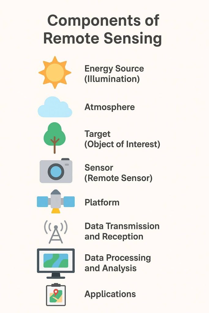
There are three major segments/components of Remote Sensing:
- Platforms
- Sensors
- Orbits
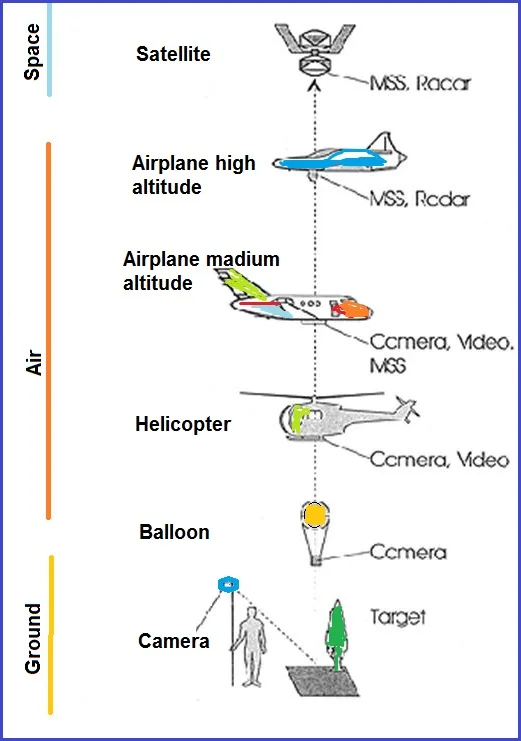
Platforms
Remote Sensing platforms can be classified as follows, based on the elevation from the Earth’s surface at which these platforms are placed.
There are three types of platform in Remote Sensing-
- Ground borne platform
- Airborne platform
- Space-borne platform
Ground borne platform
Ground borne remote sensors are very close to the ground. This platform used to record detail information about the Earth’s surface closely. The height of the ground-based platform is up to 50 meter from the Earth surface.
Some example of ground-based platform is:
- Ground vehicle
- Tower
- Air balloon
- Kite, and others
Airborne platform
Airborne remote sensors are a low altitude or high altitude aerial remote sensing. This is used to collect very detailed images and facilities the collection of data over any portion of Earth’s surface. The height of the airborne platform is above 50 km from earth’s surface. It is a very expensive platform as compared to a ground-based platform.
There are some examples of airborne platform:
- Aeroplane
- High-altitude aircraft
- Drone
- Helicopters, and others
Space-borne platform
The space-borne remote sensors are orbiting spacecraft or space-shuttle on the earth. It is used to collect information on both the earth’s surface and atmosphere. Also, it coverage large area and gather more information. Space borne imaging ranges from altitude 250 km to 36000 km.
There are some examples of Space-borne platform:
- Rocket satellite (height is 250 to 300 km above from the Earth’s surface)
- Satellites
- low-level satellite (height is 700 to 1500 km)
- high-level satellites (height is 36000 km)
Sensor
There are two types of sensors available in Remote Sensing:
- Active Sensor
- Passive Sensor
Active Sensor
Active Sensor is a source of light or illumination and its sensor measures reflected energy. The energy is generated and sent from the Remote Sensing platform towards the targets.
Radar is an example of Active Sensor.
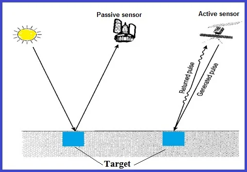
Passive Sensor
Passive Sensor is a source of energy is that naturally available of the Sun. Most of the Remote Sensing systems work in passive mode, using solar energy as the source of EMR.
The MSS is an example of Passive Sensor.
Orbits
There are three types of satellite Orbits:
- Geostationary
- Sun-synchronous
- Polar-Orbiting
Geostationary Orbit
A Geostationary Satellite Orbit is a very high altitude (approximately 36,000 km), which views the same portion of the Earth’s surface.
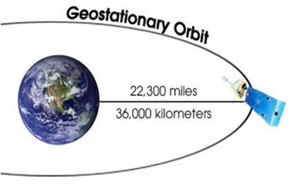
This allows the satellites to observe and collect information continuously over specific areas. Weather and communications satellites commonly have these types of orbits.
Sun-synchronous Orbit
Geo-synchronous Satellite is placed in the geosynchronous orbit, and Earth-centered orbit with an orbital period that matches Earth’s rotation on its axis, 23 hours, 56 minutes, and 4 seconds.
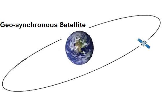
Since there are 365 days in a year and 360 degrees in a circle, it means the satellites have to shift its orbit by approximately 1 degree per day. These satellites orbit at an altitude between 700 to 800 km.
Polar Orbit
A Polar orbit satellite travels north-south over the poles and takes approximately an hour and a half for a full rotation. Almost all the satellites that are in a polar orbit are at lower altitudes.
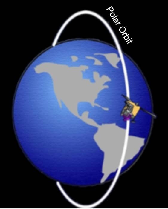
This satellite mostly used for Earth-mapping, observation, capturing the Earth as time passes from one point.