Union in QGIS
QGIS only allows two layers for using the Union Tool. The Union operation with a single input layer of three overlapping features.
How Union works
This algorithm checks overlaps between features within the Input layer and creates separate features for overlapping and non-overlapping parts. The area of overlap will create as many identical overlapping features as there are features that participate in that overlap.
An Overlay layer can also be used, in which case features from each layer are split at their overlap with features from the other one, creating a layer containing all the portions from both Input and Overlay layers. The attribute table of the Union layer is filled with attribute values from the respective original layer for non-overlapping features, and attribute values from both layers for overlapping features.
Create Union in QGIS
In this tutorial, create Union feature in QGIS.
Steps:
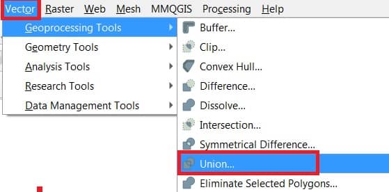
1. In the Toolbar menu, click on Vector, select Geoprocessing Tools, and click Union.
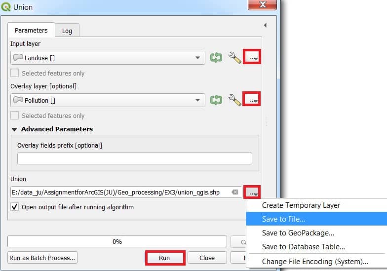
The Union analysis tool window appear, fill all the parameters.
2. In the Input layer section, browse and select data (ex.- landuse).
3. Select Overlay layer (ex.- pollution).
4. Optionally you can choose Overlay fields prifix.
5. Choose destination you went to save your output file.
6. Finally click Run button to complete this task.
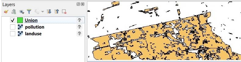
Now show your Union result in the Layers panel, and also map canvas in QGIS.