Union in ArcGIS
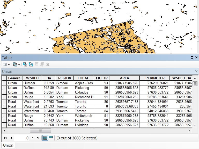
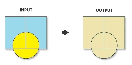
Computes a geometric union of the input features. All features and their attributes will be written to the output Feature class.
Usage
- Union tool may generate multipart features in the output even if all inputs were single part.
- This tool will use a tiling process to handle very large datasets for better performance and scalability.
- All input feature classes and feature layers must have polygon geometry.
- Attribute values from the input feature classes will be copied to the output feature class.
Union Tool in ArcGIS
Union can run with a single input feature class or layer. In this case, instead of discovering overlap between the polygon features from the different feature classes or layers, it will discover the overlap between features within the single input. The areas where features overlap will be separated into new features with all the attribute information of the input feature.
Perform Union in ArcMap
Open ArcToolbox, Arc toolbox window appears to expand Analysis Tools, then expend the Overlay subgroup, select Union and double click it.
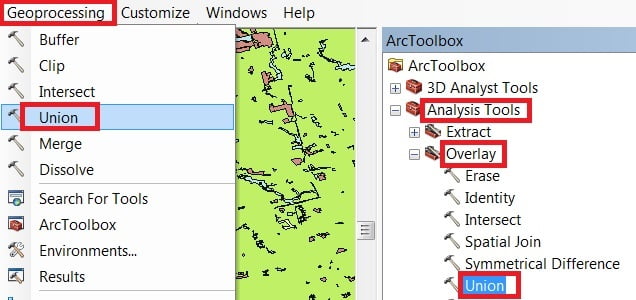
You can also use the shortcut method to open the Dissolve tool. Select Geoprocessing Tab, dropdown, and choose to Union
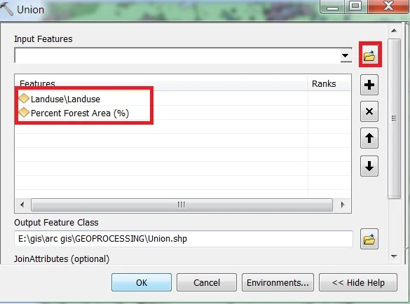
1. Now Union window is appears, browse Input files.
2. Output files are automatically selected on your Folder because you have already set up the Environments.
3. Now just click OK button for complete this task.