Merge in ArcGIS
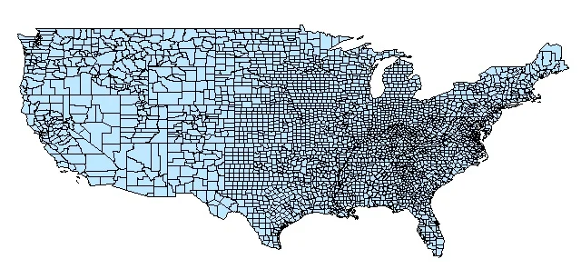
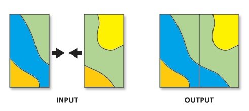
Combines multiple input datasets into a single, new output dataset. This tool can combine point, line, or polygon Feature class or tables.
Usage
- Use Merge tool to combine datasets from multiple sources into a new, single output dataset.
- All features from the input datasets will remain intact in the output dataset, even if the features overlap.
- All fields in the output dataset and the contents of those fields can be controlled using the Field Map control.
- This tool does not support annotation feature classes.
- Use the Mosaic to new Raster tool to merge multiple rasters into a new output raster.
Merge Tool in ArcGIS
In ArcGIS Marge tool to combine datasets from multiple sources into a new, single output dataset. All input datasets must be of the same type.
Perform Dissolve in ArcMap
Open ArcToolbox, Arc toolbox window appears to expand Data Management Tools, then expend the General subgroup, select Marge and double click it.
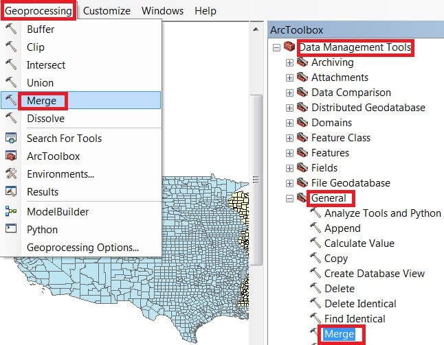
You can also use the shortcut method to open the Intersect tool. Select Geoprocessing Tab, dropdown, and choose Marge.
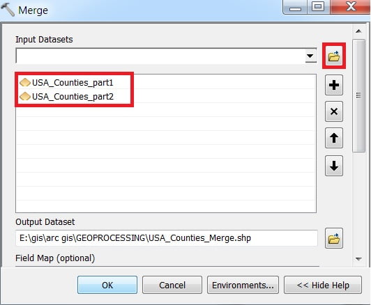
1. Now Marge window appears, browse Input files.
2. Output files are automatically selected on your Folder because you have already set up the Environments.
3. Finally click OK button.