Clip in ArcGIS
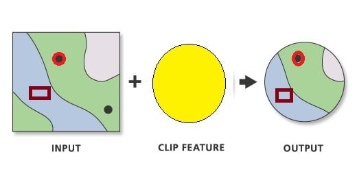
Clip is a tool to cuts out a portion of a raster dataset, mosaic dataset, or image service layer.
Usage
- Clip polygon features that touch or are within a buffered distance of a selected feature using the Clip command.
- The Clip Features can be points, lines, and polygons, depending on the Input Features type.
- This tool allows you to extract a portion of a raster dataset based on a template extent.
- An existing raster or vector layer can be used as the clip extent.
- The extent values must be in the same spatial coordinates and units as the raster dataset.
Clip Tool in ArcGIS
In ArcGIS Use this tool to cut out a piece of one Feature class. This is particularly useful for creating a new feature class—also referred to as a study area or Area of Interest (AOI). That contains a Geographic subset of the features in another, larger feature class.

Perform Clip in ArcMap
Open ArcToolbox, Arc toolbox window appears to expand Analysis Tools, then expend the Extract subgroup, select Clip, and double click it.

You can also use the shortcut method to open the Clip tool. select Geoprocessing Tab, dropdown, and choose Clip.
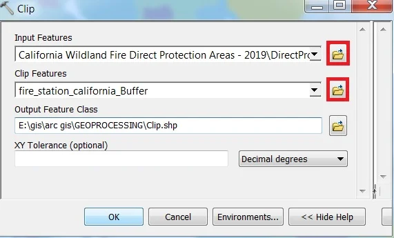
1. Now Clip window appears, browse Input file.
2. Output files are automatically selected on your Folder because you have already set up the Environments.
3. Finally click OK button.


