Dissolve in ArcGIS
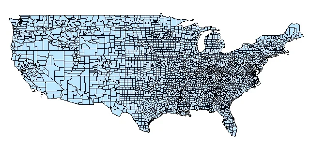
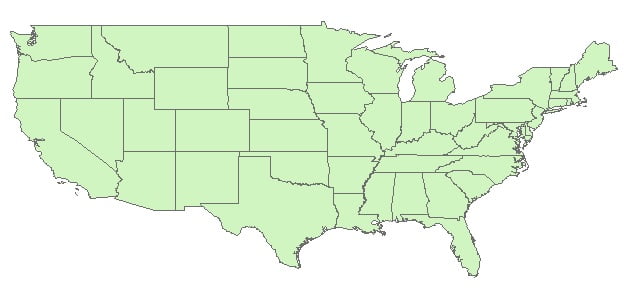
Dissolve creates the regions by removing the boundaries between counties. It can be create very large features in the output Feature class.
Usage
- Dissolve maintains linear data belonging to different planar graphs in the same coverage.
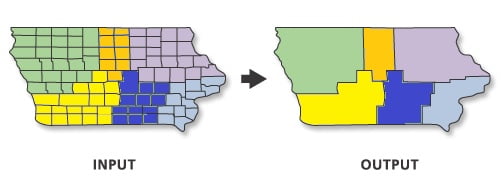
- This tool is used to create a simplified coverage from one that is more complex.
- The merging of polygons with this tool is the counter part of intersecting polygons in overlays.
- The dissolve item may be a redefined item.
Dissolve Tool in ArcGIS
In ArcGIS Use the Dissolve tool when you want to aggregate features based on a specified attribute or attributes. For example, you could take a feature class data collected on a county-by-county basis. Use Dissolve to create a feature class containing based on the name of each county.
Perform Dissolve in ArcMap
Open ArcToolbox, Arc toolbox window appears to expand Data Management Tools, then expend the Generalization subgroup, select Dissolve and double click it.
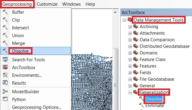
You can also use the shortcut method to open the Dissolve tool. Select Geoprocessing Tab, dropdown, and choose to Dissolve.
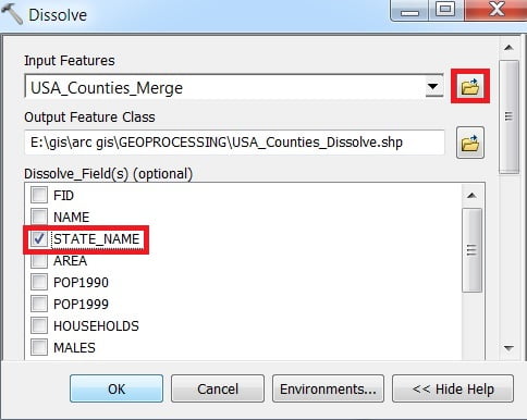
1. Now Dissolve window is appears, browse Input files.
2. Output files are automatically selected on your Folder because you have already set up the Environments.
3. The most important, select your Dissolve Field and click OK.