Buffer in ArcGIS Pro
In ArcGIS Pro, a buffer is a zone of a specified distance around a feature — points, lines, or polygons. Buffers are commonly used in proximity analysis, such as finding features within a certain distance of a road, river, or facility.
Buffers are typically used to create areas that can be further analyzed using a tool such as Overlay Layers.
Proximity Analysis
A Geoprocessing Tool operates on a dataset. In ArcGIS Pro, there are hundreds of Geoprocessing tools, encompassing a wide variety of operations.
1. On the ribbon, click the Analysis tab. In the Geoprocessing group, click Tools.
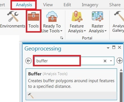
2. The Geoprocessing pane open, in the search bar, type Buffer, because I can perform Buffer Analysis. In the list of results, select buffer > buffer pane appears > fill all the required box and Run.
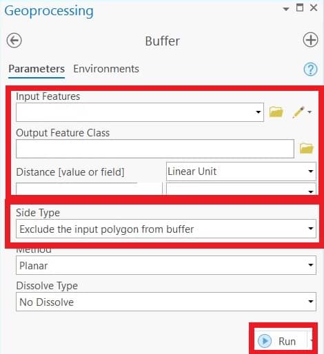
Create Buffer Polygon
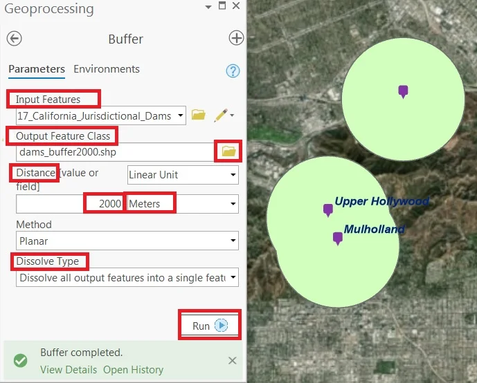
1. Open the Buffer (Analysis) tool from ArcGIS Pro.
2. Set the standard parameters such as Input Features, Distance values and Output Feature Class name.
3. The Side Type parameter must be set to Exclude the input polygon from buffer.
5. Finally click Run button.
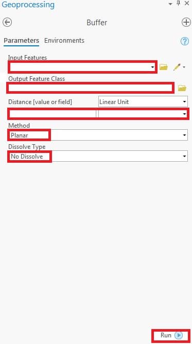
Create Buffer around a Point feature
Create a circular buffer around the point feature.
1. In the Geoprocessing pane, navigate to Toolboxes > Analysis Tools > Proximity, and click the Buffer tool.
2. Now open the Geoprocessing dialog box, fill the parameters; Input Features, Output Feature Class, and Distance [value or field]
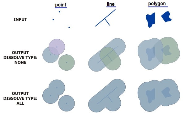
3. In Method section, choose Planar, and Dissolve Type– No Dissolve.
4. Click Run button.