Intersect in ArcGIS
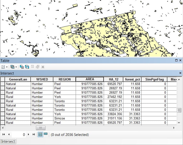
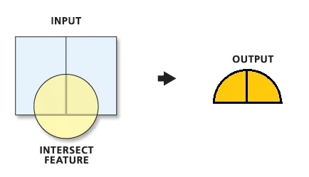
Computes a geometric intersection of the input features. Features or portions of features which overlap in all layers and/or feature classes will be written to the output Feature class.
Usage
- The Intersect tool calculates the geometric intersection of any number of feature classes and feature layers.
- This tool will use a tiling process to handle very large datasets for better performance and scalability.
- All input feature classes and feature layers must have polygon geometry.
- Attribute values from the input feature classes will be copied to the output feature class.
Intersect Tool in ArcGIS
A list of the input feature classes or layers. When the distance between features is less than the cluster tolerance, the features with the lower rank will snap to the feature with the higher rank. The highest rank is one.
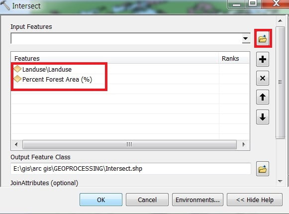
Perform Intersect in ArcMap
Open ArcToolbox, Arc toolbox window appears to expand Analysis Tools, then expend the Overlay subgroup, select Intersect and double click it.
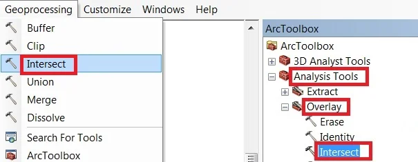
You can also use the shortcut method to open the Dissolve tool. Select Geoprocessing Tab, dropdown, and choose to Intersect.
1. Now Intersect window appears, browse Input file
2. Output files are automatically selected on your Folder because you have already set up the Environments.
Now just click OK button for complete this task.