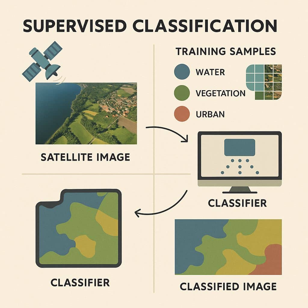
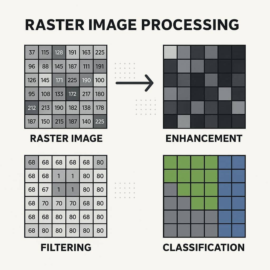
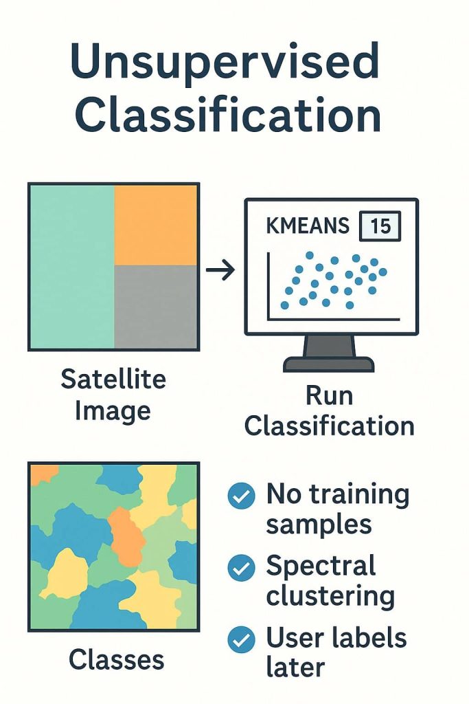
Erdas Imagine

Erdas Imagine Software is world-class Remote Sensing as well as Satellite image processing software. The ERDAS IMAGINE provides true value, consolidating remote sensing, photogrammetry, LIDAR analysis, basic vector analysis, and radar processing into a single product.

Supervised Classification

Supervised Classification in Erdas Imagine Supervised classification uses image pixels representing regions of known, homogenous surface composition ‘training areas’ to classify unknown pixels. A Supervised Classification describes information about the data of land use as well as land cover for any region. Soil type, Vegetation, Water bodies, Cultivation, etc. Supervised Training Supervised training is closely […]

Supervised Classification Read More »

NDVI, NDBI, NDSI, SAVI

NDVI, NDBI, NDSI, SAVI- Erdas Imagine NDVI The NDVI stand for Normalized Difference Vegetation Index, its describes the vegetation density and assessing changes in plant health. NDVI is calculated as a ratio between the red (R) and near-infrared (NIR). In this tutorial, learn how to apply the NDVI Formula and calculate vegetation patterns. Process of NDVI NDVI Formula (NIR – R) /

NDVI, NDBI, NDSI, SAVI Read More »

Scroll to Top