Pwrform NDVI, NDBI, NDSI, SAVI- Erdas Imagine
NDVI
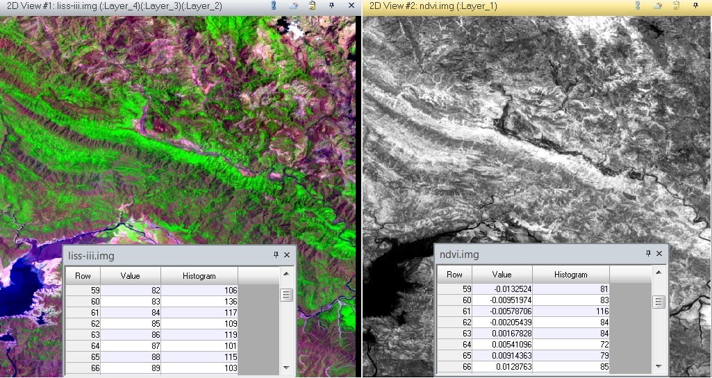
The NDVI stand for Normalized Difference Vegetation Index, its describes the vegetation density and assessing changes in plant health. NDVI is calculated as a ratio between the red (R) and near-infrared (NIR). In this tutorial, learn how to apply the NDVI Formula and calculate vegetation patterns.
Process of NDVI

NDVI Formula
(NIR – R) / (NIR + R)
In Landsat 4-7, NDVI = (Band 4 – Band 3) / (Band 4 + Band 3).
The Landsat 8, NDVI = (Band 5 – Band 4) / (Band 5 + Band 4).
IRS Liss-III, NDVI = (Band 3 – Band 2) / (Band 3 + Band 2).
NDVI always ranges from -1 to +1.
How to apply NDVI Formula
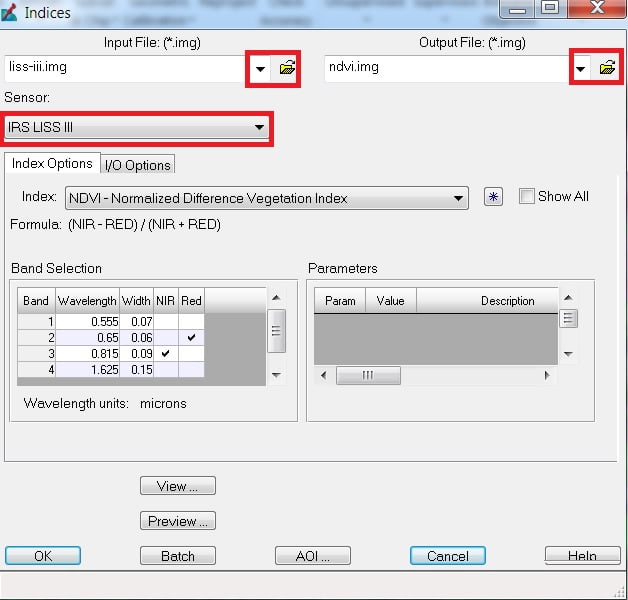
1.On the Raster tab, the Classification group expend Unsupervised, and selects NDVI.
2. The Indices dialog is open, select Input file and Output file, and most important, choose Sensor (ex. IRS LISS-III) for your Satellite image.
3. Band selection box is automatically selected. Now click OK.
NDBI
Normalized Difference Built-up Index (NDBI) describes the Built-up density of any Geographic area. NDBI is calculated as a ratio between the shortwave infrared (SWIR) and near-infrared (NIR).
Process of NDBI
NDBI Formula
(SWIR – NIR)/(SWIR + NIR)
NDBI ranges from -1 to +1.
How to apply NDBI Formula
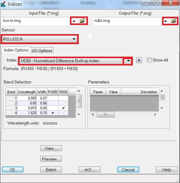
1.On the Raster tab, the Classification group expend Unsupervised and select Indices.
2. The Indices dialog is open, select Input file and Output file, and most important choose Sensor (ex. IRS LISS-III) for your Satellite image. Now select NDBI in the Index box.
3. Band selection box is automatically selected. Now click OK.
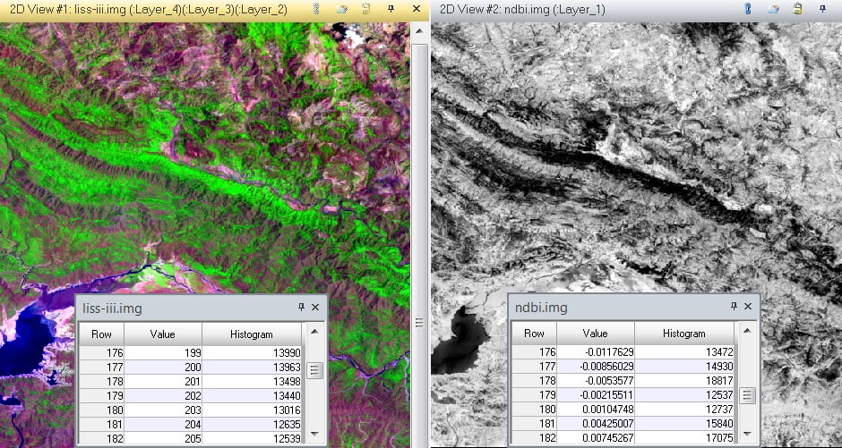
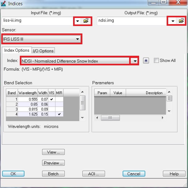
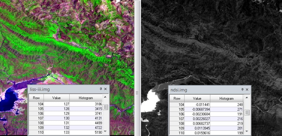
NDSI
Normalized Difference Snow Index (NDSI) describes the Snow cover for any area. NDSI is calculated as a ratio between the visible (VIS) and mid-infrared (MIR).
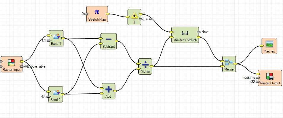
Process of NDSI
NDSI Formula
(VIS– MIR)/(VIS+ MIR)
NDSI ranges from -1 to +1.
How to apply NDSI Formula
1. On the Raster tab, the Classification group expend Unsupervised and select Indices.
2. The Indices dialog is open, select Input file and Output file, and most important, choose Sensor (ex. IRS LISS-III) for your Satellite image. Choose NDSI in the Index box.
3. Band selection box is automatically selected. Now click OK.
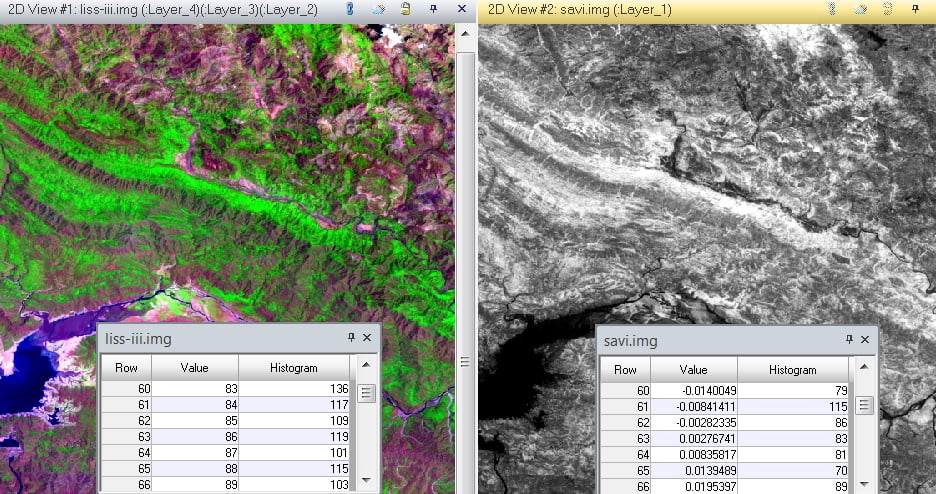
SAVI
Soil Adjusted Vegetation Index (SAVI) is similar to NDVI, these enhancements are useful, because SAVI accounts for variations in soils. SAVI is calculated as a ratio between the near-infrared (NIR), red (RED), and L (Vegetation cover current factor).
Process of SAVI
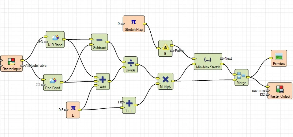
SAVI Formula
(NIR– RED)*(1+L) / (NIR+ RED+L)
SDVI ranges from -1 to +1.
How to apply SAVI Formula
1.On the Raster tab, the Classification group expend Unsupervised and select Indices.
2. The Indices dialog is open, select Input file and Output file, and most important, choose Sensor (ex. IRS LISS-III) for your Satellite image. Choose SAVI in the Index box.
3. Band selection box is automatically selected. Now.

I just like the helpful information you supply to your articles. I will bookmark your blog and check once more here frequently. I’m moderately sure I’ll be told plenty of new stuff right right here! Good luck for the following!
Thank you, please follow my website for better content in future
Highly descriptive article, I loved that bit. Will there be a part 2?
Yes definitely, Thank you.
Hello to every one, it’s truly a good for me to visit this web page, it includes precious Information.|
Thank you,
It’s amazing to visit this web page and reading the views of all friends on the topic of this piece of writing, while I am also keen of getting know-how.|
Thanks
Hi there all, here every one is sharing such knowledge, thus it’s pleasant to read this website, and I used to visit this blog everyday.|
Thanks,,.please follow my website for better content in future.
The information shared is of top quality which has to get appreciated at all levels. Well done…
A great post without any doubt.
You actually make it seem so easy together with your presentation however
I to find this topic to be really one thing that I believe
I might by no means understand. It seems too complicated and extremely broad for me.
I am having a look ahead to your next publish, I will try to get
the hang of it!
Generally I don’t learn article on blogs, however I wish to say that
this write-up very forced me to try and do it! Your writing
taste has been amazed me. Thank you, very great article.
Appreciate you sharing, great blog. Awesome.
A big thank you for your article post.Really looking forward to read more. Fantastic.