Convert KML File to Shapefile in ArcGIS
Keyhole Markup Language (KML) is an Geographic Data , basically it is a Google Earth Data structure. In this Tutorial Learn how to convert KML file to Shapefile.
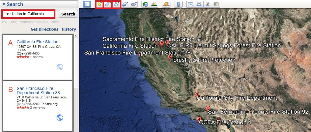
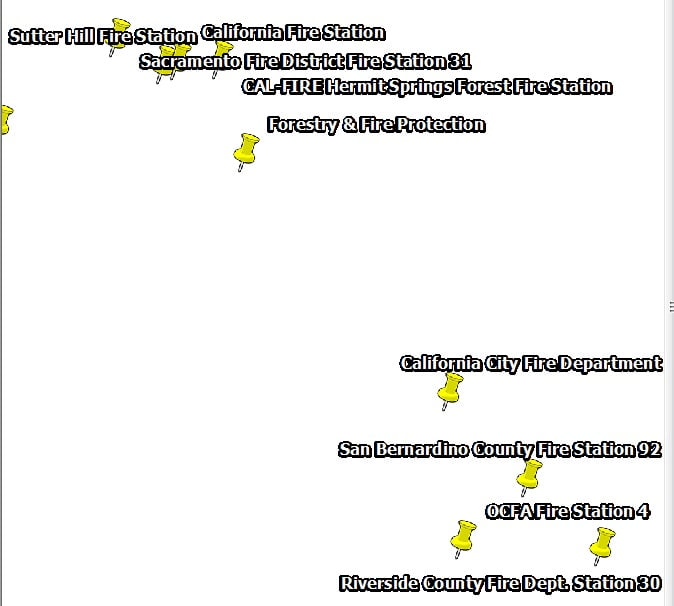
Save or Export KML file, first open Google Earth. now you can search any places or create polygon, path or point. i can search Fire Station in California and show all the result.
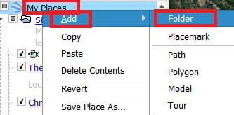
The next step is save to KML. At first create a Foldel (fire station california). Now select your search places one by one, right click and select copy as kml. your place is copy just past it on your new folder(fire station california).
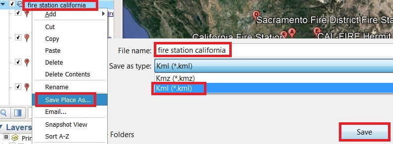
Now right click your folder (fire station california) and click save place as. defalt name is fire station california (you also change this name) and select file type .kml.
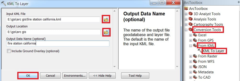
Launch ArcMap Application and open ArcToolbox. Arc toolbox window is appears expend Conversion tools, then expend From KML sub group and select KML to Layer
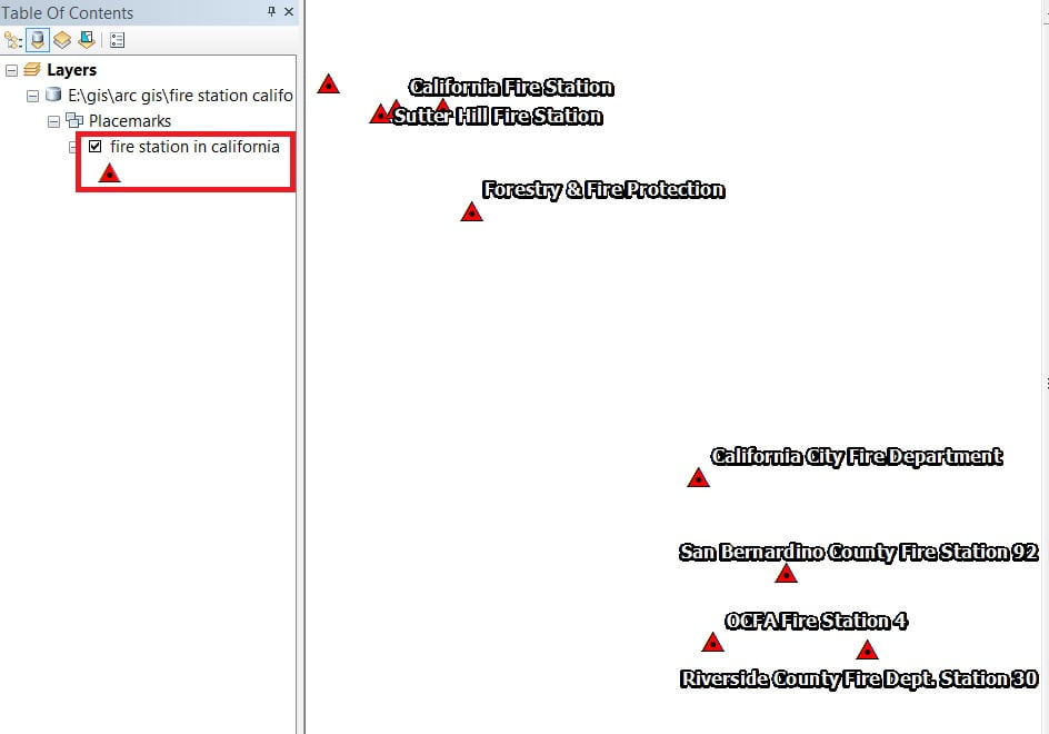
KML to Layer window are appears Browse Input file (fire station california) and select your Output destination, then click OK.
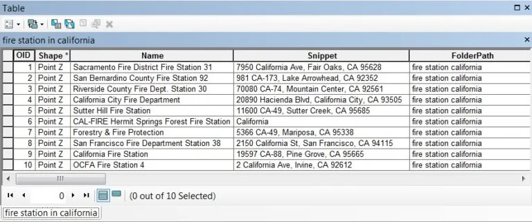
Data is added, you can customize the data (change symbology, color, name label etc. Also view the Attribute Data.


you’re really a good webmaster. The site loading speed is amazing. It seems that you are doing any unique trick. Also, The contents are masterpiece. you have done a great job on this topic!