ArcGIS Collector
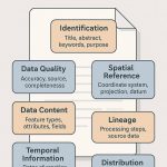
Introduction
ArcGIS Collector offer to collect and update information in the field, use your smartphone or tablet. Try Collector, you took a sample map to the field and captured information about your local area.
Key Features:
- Real-time data collection using GPS-enabled devices
- Offline data access and syncing when connected
- Smart forms with drop-downs, conditional logic, and validation
- Photo attachments to features or forms
- Map-centric workflow with intuitive interface
- High-accuracy GPS integration with external receivers (e.g., Trimble, EOS)
ArcGIS Collector Online
The ArcGIS Collector Field Maps is an all-in-one app that uses data-driven maps to help mobile workers perform data collection and editing, find assets and information, and report their real-time locations.
ArcGIS Collector App
Arc GIS Collector App helps you to create a map for your local region.
Download ArcGIS Collector
- Download and Install the app on your device if you don’t have it yet. It’s available on Google Play for Android devices and the App Store for iPad and iPhone.
- Open the app, On the initial screen, select Try it.
- Tap the Parks map to open it. he map opens and, if you allow Collector access to your location, the map centers on where you are.
Tutorial
Before being abal to use the collector ArcGIS app, first need to create feature layers and maps. So the application is ready to go so upon logging into ArcGIS online.
Steps :
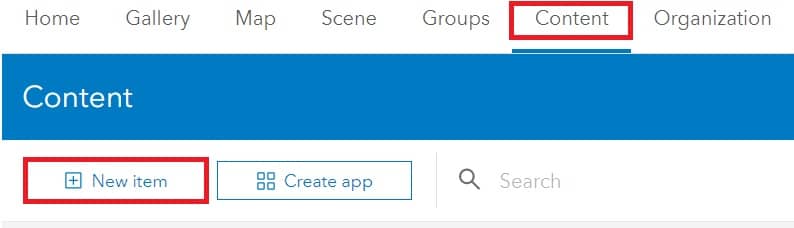
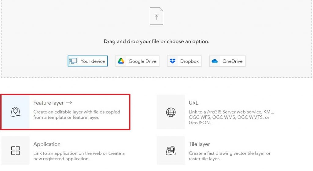
1. On the ArcGIS online dashboard, go to Content tab, and click New item, in the top left corner.
2. New item window open choose Feature layer.
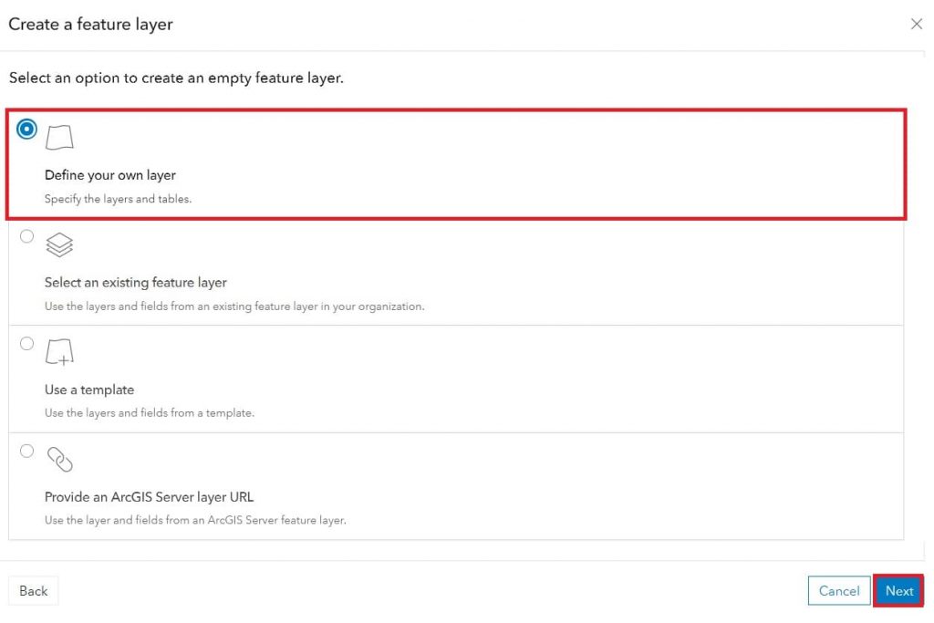
3. Now Select an option to create an feature layer. We’re choose Define your own layer, and click next.
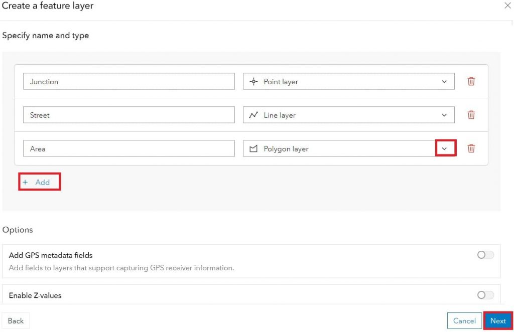
4. Select layer type, point, line, and polygon, and click next button. (You can the layer name, as your choice).
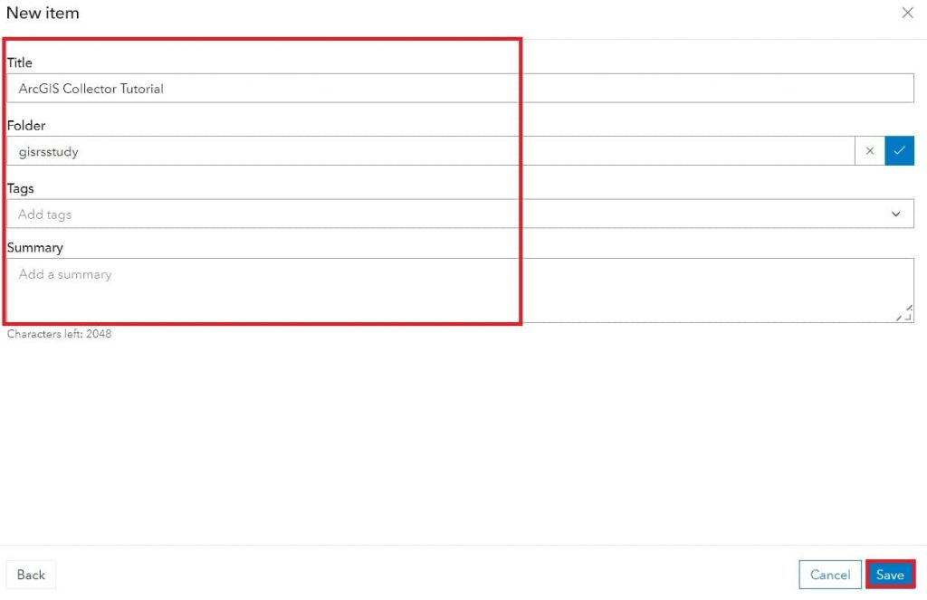
5. Now write the Title, select folder, and optionally tags, and summary, then click Save.
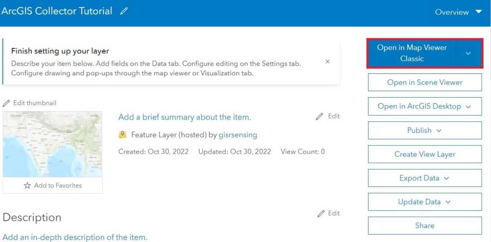
6. Open your map in map viewer classic.
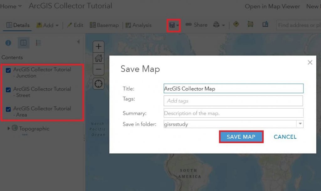
7. Saw the all layers you created, in the Contents window.
8. The most important save your map. Click the Save Map, Save your map, with title, tags, summary, and folder destination.
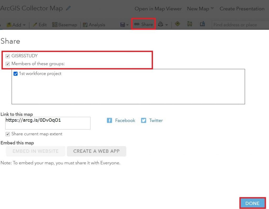
9. Click the Share button, and choose who can view this map. Once you have select this, Update sharing pop-up window appear. Click Update Sharing to adjust the settings of the items you can update so they can be viewed in the web map.
Now we’re ready to use Collector app into your personal device (mobile).
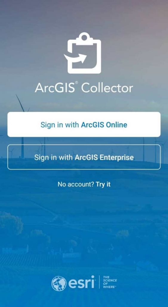
Open Collector App
Once you have installed Collector app, you will need to Sign in with ArcGIS Online or ArcGIS Enterprise.

After logging, presented the maps available you are created.
Now working with the map in public parks, and it will bring up your map thap the GPS accuracy.