Ground Control Points (GCPs)
What is Ground Control Point?
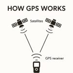
The Ground Control Points (GCPs) are defined as points on the surface of the earth of a known location used to Georeference data.
The GCPs are specific pixels in an image for which the output map coordinates are known. GCP consists of two X,Y pairs of coordinates:
- Source coordinates—usually data file coordinates in the image being rectified
- Reference coordinates—the coordinates of the map or reference image to which the source image is being registered
GCPs are identifiable features on the Earth’s surface that have known ground coordinates in X, Y, and Z. A full GCP has X (Longitude), Y (Latitude), and Z (elevation) coordinates associated with it. Horizontal control only specifies the X,Y, while vertical control only specifies the Z.
Features:
The following features on the Earth’s surface are commonly used as GCPs:
- Intersection of roads
- Utility infrastructure
- Intersection of agricultural plots of land
- Survey benchmarks
In the type of mapping project, GCPs can be collected from the following sources:
- Ground GPS
- Total station survey
- Theodolite survey
- Planimetrics and topographic maps
- Digital ortho rectified images
- Digital elevation model
Why would you Use GCPs?
GCPs is important when precision mapping and true global accuracy are needed. Its increase the absolute or global accuracy of a map. They help ensure that the Latitude and Longitude of any point on your map correspond accurately with actual GPS coordinates.
The images below shown from left to right illustrate a ground control point. A photo collected with that GCP identified the location.
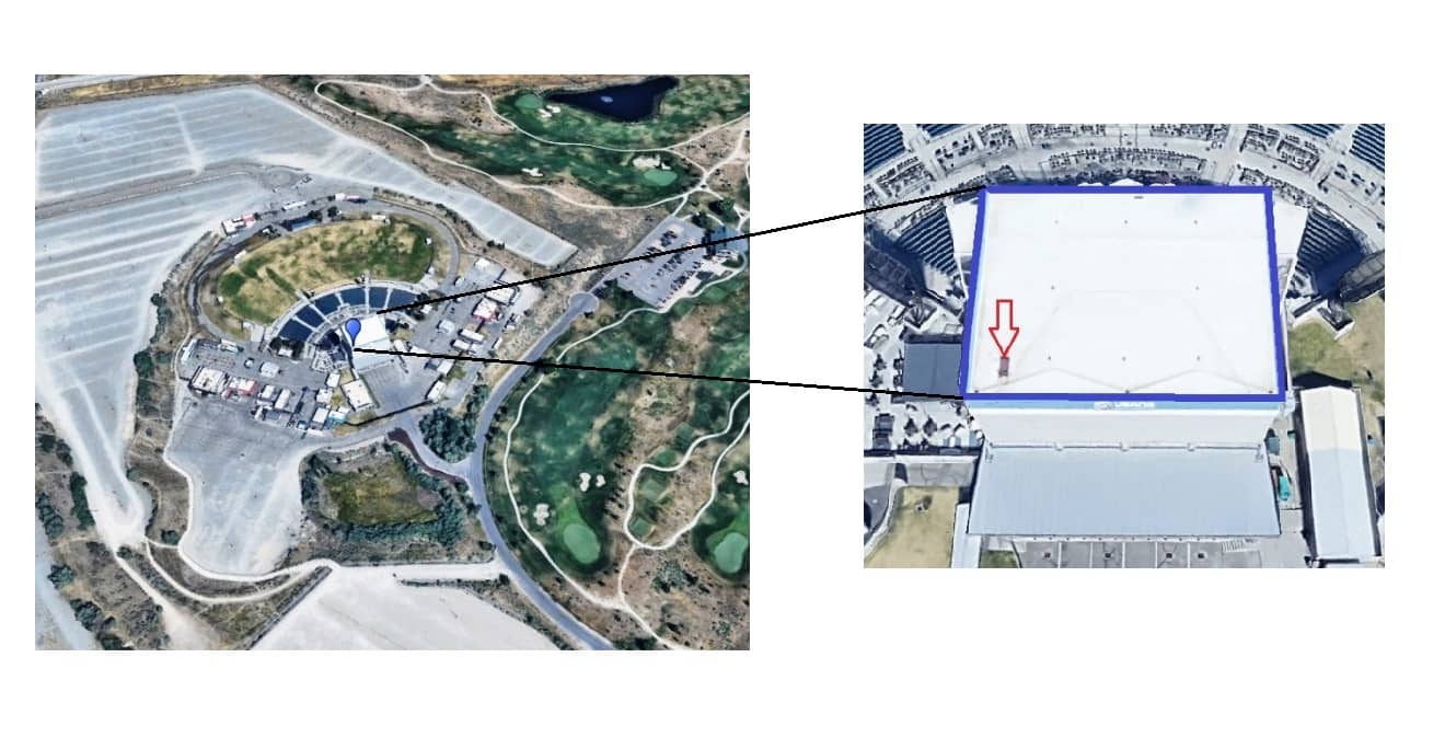
The zoomed image shows a red arrow at the Building, where the GPS receiver was positioned to obtain the absolute coordinates of that point. In this manner multiple ground control targets can be placed within the area of interest, surveyed and then imaged during flyover. The resulting absolute accuracy of the Geo-referenced and DEM will be dependent on the precision of the equipment used for the ground survey. Depending on the planned ground resolution or GSD of the photos care should be taken in sizing the targets so that the surveyed point can be resolved in the photos, i.e. target should be 5-15 X the anticipated GSD.
Why GCPs are Important?
- Ground control is essential when you need High Global Accuracy.
- GCPs are needed when you need products to certain range of accuracy
- They are required to Verify the Accuracy.
Applications of GCPs
- Land survey
- Mapping the terrain – Contour Map / DTM / DSM
- Civil Engineering Construction Project design
- Property boundary survey
- Large volume measurements
GCP Requirements
Requirements for minimum GCPs for an accurate mapping project vary with respect to the size of the project. With respect to establishing a relationship between image space and ground space, the theoretical minimum number of GCPs is two GCPs having X, Y, and Z coordinates and one GCP having a Z coordinate associated with it.
In order to compute a unique solution, at least seven known parameters must be available. In using the two X, Y, Z GCPs and one vertical (Z) GCP, the relationship can be defined. However, to increase the accuracy of a mapping project, using more GCPs is highly recommended.
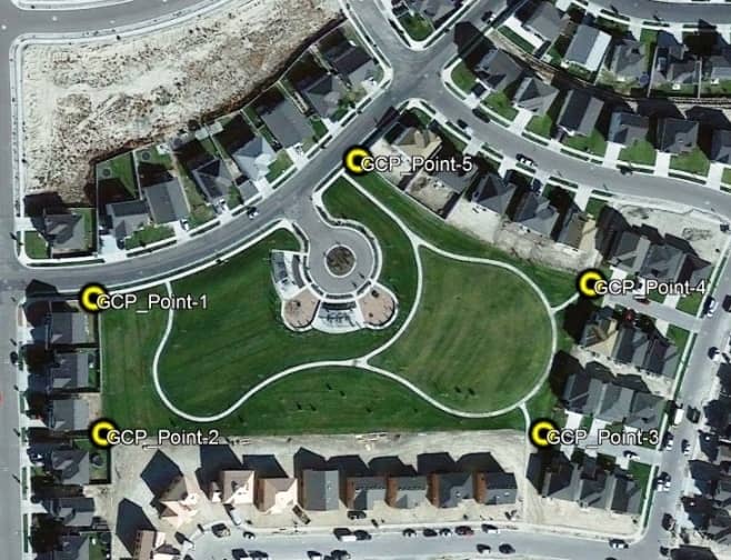
Coordinates of Ground Control Points at the Area of Interest
| Ground Control Points (GCP) | Coordinate- X (Latitude) | Coordinate- Y (Longitude) |
|---|---|---|
| 1 | 40°21’8.48″N | 111°57’24.36″W |
| 2 | 40°21’6.77″N | 111°57’24.24″W |
| 3 | 40°21’6.63″N | 111°57’16.98″W |
| 4 | 40°21’8.50″N | 111°57’16.13″W |
| 5 | 40°21’10.14″N | 111°57’19.93″W |
Ground Control Point in GIS
Collect GCPs in QGIS
This is a Geo-referencing process to Marks GCP.
Collect GCPs in ArcGIS
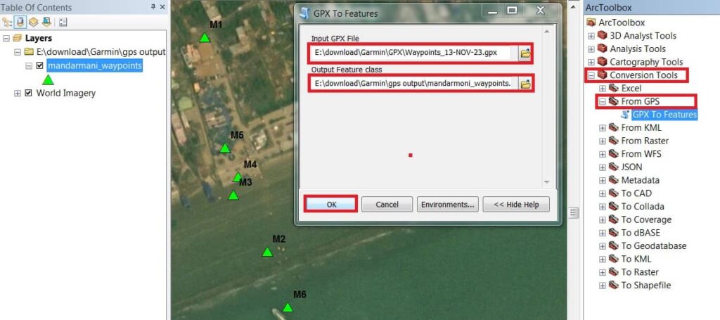
Learn, How to import GPS data (GPX) in ArcGIS.
Open ArcMap, go to Arc–Toolbox, drop-down Conversion tools, choose From GPS, and double click GPX To Features.
GCPs in Erdas Imagine
The GCP set is stored in the image file along with the raster layers. If a GCP set exists for the top layer that is displayed in the Viewer, then those GCPs can be displayed when the Multi-point Geometric Correction tool.
In the Cell-array of GCP data that displays in the Multi-point Geometric Correction tool or GCP Tool. One column shows the point ID of each GCP. The point ID is a name given to GCPs in separate files that represent the same geographic location.
GCPs in Google Earth
Learn, How to import GPS data in Google Earth pro.
Open Google Earth, in the menu bar select Tools and click to GPS checkbox.
Now GPS Import window is appear, you can choose Device (Garmin, Magellan), or Import from file.
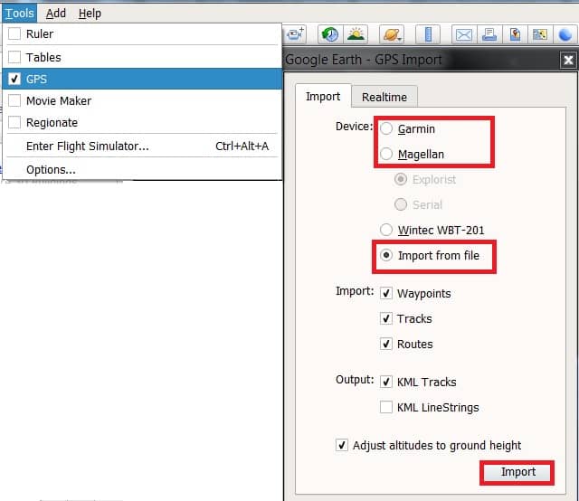
Once you have select the data, click Import button.
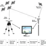
GCP Survey
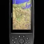
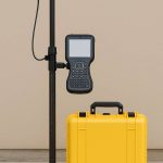
Collect GCPs in GPS
The GPS device helps you to collect accurate Ground Control Points, then it’s used in GIS or Remote Sensing Software.
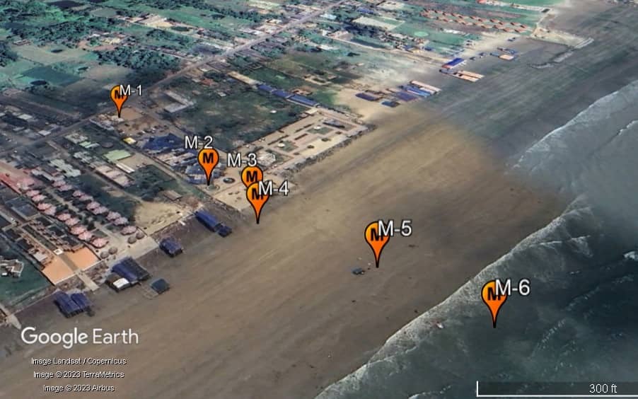
In the example of Mandarmani sea beach GPS Survey using Garmin eTrex 10. AOI below the entire area mapped was 1.3 square km. The 6 GCPs that were available are shown tagged in the ortho and did not represent the best spatial distribution for an area of that size.
| Sl No. | Waypoints | Latitude (N) | Longitude (E) | Distance from preceding waypoint (m) | Elevation (m) |
|---|---|---|---|---|---|
| 1 | M-1 | 21°39’47.74″ | 87°42’2.90″ | 0 | 5.524956 |
| 2 | M-2 | 21°39’44.21″ | 87°42’3.60″ | 112 | 4.594986 |
| 3 | M-3 | 21°39’43.28″ | 87°42’4.05″ | 32.7 | 0.689224 |
| 4 | M-4 | 21°39’42.70″ | 87°42’3.89″ | 19.4 | 0.686930 |
| 5 | M-5 | 21°39’40.89″ | 87°42’5.05″ | 65.7 | -0.282074 |
| 6 | M-6 | 21°39’39.11″ | 87°42’5.76″ | 58.5 | -0.690216 |
Example of GPS Survey to collect GCPs or Waypoint.