Remote Sensing Applications
Remote Sensing in Environment
Remote Sensing is play to major role in natural resource management including.
- Forestry: biodiversity, forest, deforestation
- Water source management
- Habitat analysis
- Environmental assessment
- Pest/disease outbreaks
- Impervious surface mapping
- Hydrology
- Mineral province
- Geomorphology
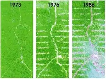
Forestry
Remote Sensing mapping helps to, forest cover updating, depletion monitoring, and measuring biophysical properties of forest stands. These include collecting harvest information, updating inventory information for timber supply, broad forest type, vegetation density, and biomass measurements. Also Environmental monitoring, the quantity, health, and diversity of the earth’s forests.
Hydrology
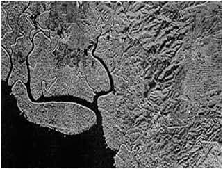
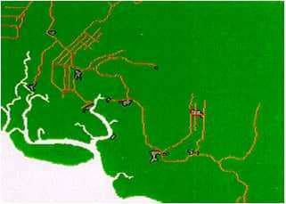
Hydrology is the study of water on the earth’s surface, whether flowing above ground, frozen in ice or snow, or retained by soil. The hydrological applications include wetlands monitoring, measuring snow thickness, determining the snow-water equivalent, ice monitoring, flood monitoring, glacier dynamics monitoring, river/delta change detection, drainage basin mapping, watershed modelling, irrigation canal leakage detection, and many more.
Land Cover/ Mapping
Land mapping applications of remote sensing include natural resource management, wildlife habitat protection, baseline mapping for GIS input, urban expansion, logistics planning for seismic/exploration/resource extraction activities, damage delineation, like; tornadoes, flooding, volcanic, seismic, fire.
Generating different maps from remotely sensed data can be so effective ad valuable. A classification of sensing elements and methodologies to generate theses remotely sensed models are essential for mapping
Remote Sensing in Agriculture
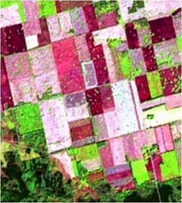
Agriculture plays a dominant role in the economies of both developed and undeveloped countries. Satellite and airborne images are used as mapping tools to classify crops, examine their health, examine their viability, and monitor farming practices.
The application of remote sensing in agriculture include:
- Farm classification
- Farm condition assessment
- Agriculture estimation
- Mapping of farm and agricultural land characteristics
- Mapping of land management practices
- soil characteristics
- Compliance monitoring
Remote Sensing in GIS
Remote Sensing (RS) and GIS are interconnected with each other. RS is one of the methods commonly used for collecting physical data to be integrated into a GIS. In the Remote Sensing process, capture the image to help of satellites, this image’s process and analysis in GIS Softwares.
Remote Sensing in Geography
Remote sensing images have specific uses within various fields of geographical study. The Remote sensing data possess advantages over conventional data and can provide multispectral, multidata, and multisensor information. This data is very useful in the agricultural fields for the crop type classification, crop condition assessment, crop yield estimation, and soil mapping.
Remote Sensing in Geology
In geology, remote sensing can be applied to analyse large, remote areas. Remote sensing interpretation also makes it easy for geologists to identify an area’s rock types, geomorphology, and changes from natural events such as a flood, erosion, or landslide.
Geological applications of remote sensing include the following:
- Bedrock mapping
- Lithological mapping
- Structural mapping
- Sand and gravel exploration/ exploitation
- Mineral exploration, hydrocarbon exploration
- Sedimentation monitoring
- Geo-hazard mapping, and more
Remote Sensing in Archaeology
Archaeology is an important component of Remote Sensing. Satellite imagery and Global Positioning Systems (GPS), to drones and LiDAR (Light Detection and Ranging) have revolutionized how we do archaeology. These new technologies help archaeologists in identifying and investigating archaeological sites both on land and underwater.
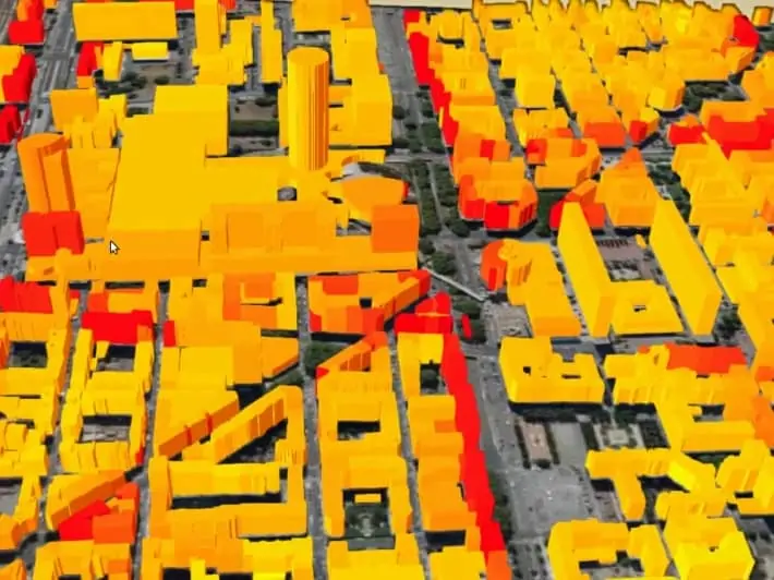
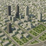
Remote Sensing in Urbanization & Transportation
The application of remote sensing in urbanization and transportation include:
- Urban planning
- Roads network and transportation planning
- City boundaries by time
- City expansion
- Land use planning