SAGA GIS- System for Automated Geoscientific Analyses
The SAGA development started with the beginning of the 3rd millennium and has been initiated by a small team of researchers from the Dept. of Physical Geography, Göttingen. In 2007 the center of the SAGA development moved towards Hamburg, where a few of us are employed now at the Dept. of Physical Geography, Hamburg.

What is SAGA GIS?
SAGA GIS stands for System for Automated Geoscientific Analyses. It is a Free Open Source Geographic Information System (GIS) software with immense capabilities for geodata processing and analysis.
It has been designed for an easy and effective implementation of spatial algorithms. The SAGA is programmed in the object oriented C++ language and supports the implementation of new functions with a very effective Application Programming Interface (API).
SAGA GIS Download
SAGA runs Windows and Linux operating systems.
Tutorial
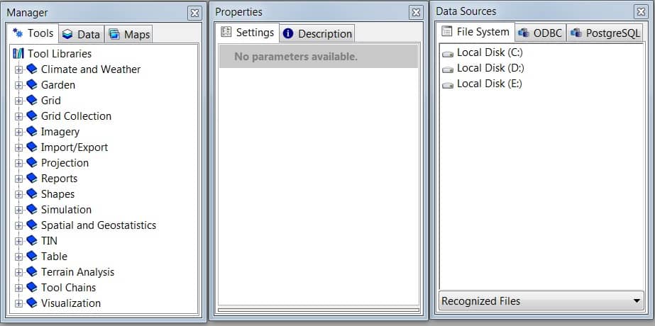
The SAGA GUI (Graphical User Interface) allows the user to manage and visualize data as well as to perform data analysis and manipulations by executing modules.
SAGA interfaces the user with three additional control elements. The workspace control has sub windows for the modules, Tools, Data and Maps workspaces.
Also, three main windows; Manager window, Properties window, Data sources window.