Create DEM & Contour from Google Earth in ArcGIS
In this Tutorial learn, how to Create Contour and DEM (Digital Elevation Models) from Google Earth with to help of ArcGIS Software.
Digital Elevation Model (DEM) is an Elevation data to represent Terrain.
Create DEM from Google Earth
DEMs are used often in Geographic Information Systems (GIS) and are the most common basis for digitally-produced relief maps as well as surface modeling.
You can creating a DEM data using both, Google Earth Pro and Google Earth Web.
Create DEM Using Google Earth Pro
Open Google Earth pro application.
Google Earth is open to select any area or search for any particular region (choose hilly region).
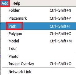
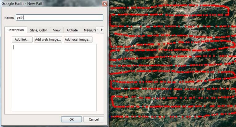
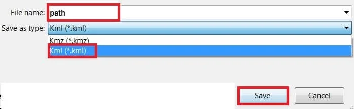
Now Add Path and create poly-line or path Data. Write the File Name (path) and click OK.
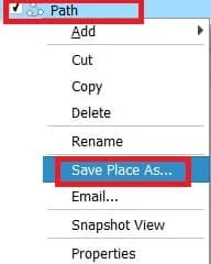
The next step is to save your data. Right-click Path and select Save Place As. Choose Data Format KML.
Create DEM Using Google Earth Web
Open Google Earth web.
In the Menu bar, click Add menu, and choose Polygon (the polygon tool also used to polyline).
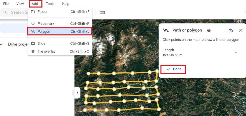
Now create a path in the map, same as Google Earth pro desktop.
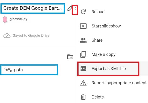
Once you have create a path, now Save your data into KML format.
Click three dot on your project name’s, and select Export as KML file.
Convert KML to GPX
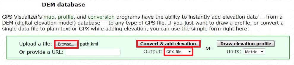
In the next part, KML Data convert to GPX Data to help from GPX Visualizer site.
Open GPS Visualizer Elevation, Browse KML File (path.klm), then convert & add elevation Output select GPX file.

Convert GPX to Feature using ArcGIS
Finally, open ArcGIS Software and add the GPX Data to Feature.
In the Search Box Search GPX to features, or you can also manually open this Tool. Open ArcTollbox, in the Conversion Tools group select From GPS subgroup and open GPX to Features Tool.

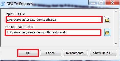
GPX to Features window appears, select Input GPX File (path.gpx) and also Output Feature Class then click OK button.
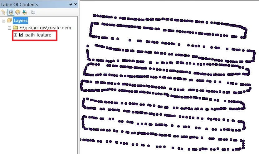
Now add GPX Feature Data (path_feature) in ArcMap.
Create IDW/ DEM
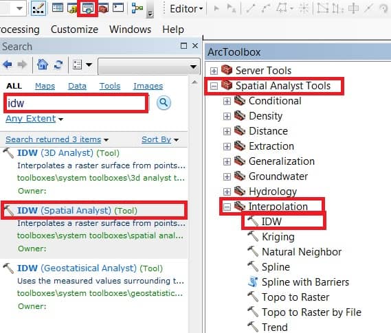
Create a DEM to open IDW Tool.
In the search box, search IDW. or you can also manually open this Tool. Open ArcTollbox, in the Spatial Analyst Tools group Select Interpolation subgroup and Open IDW Tool.
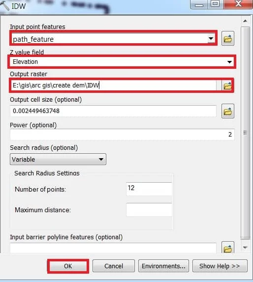
IDW Tool window appears, select Input point features (path_feature). The most Important Z value filed select Elevation, and choose output raster Destination. Finally, click the OK button.
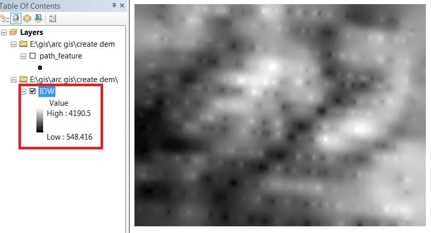
Add IDW in Table of Contents, and show the DEM result.
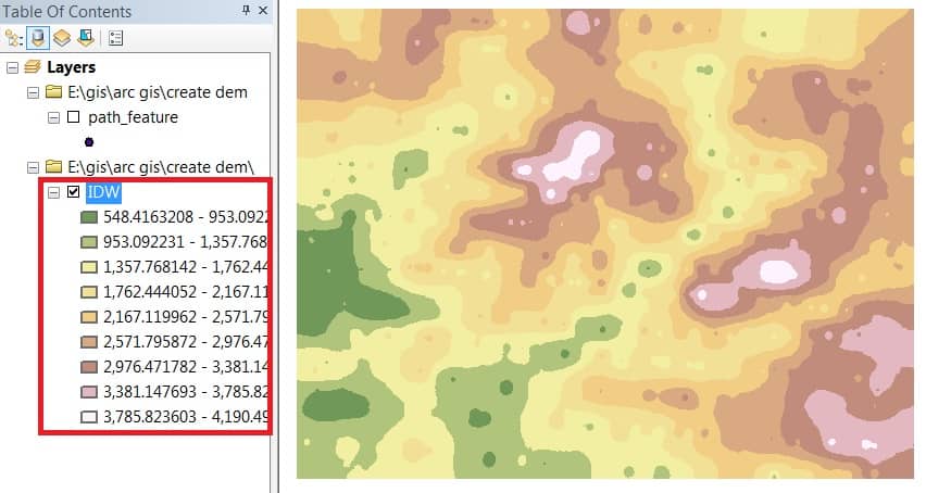
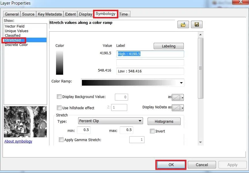
Right-click IDW, select Properties. Layer Properties window appears in the Symbology group, Choose Stretched and click OK.
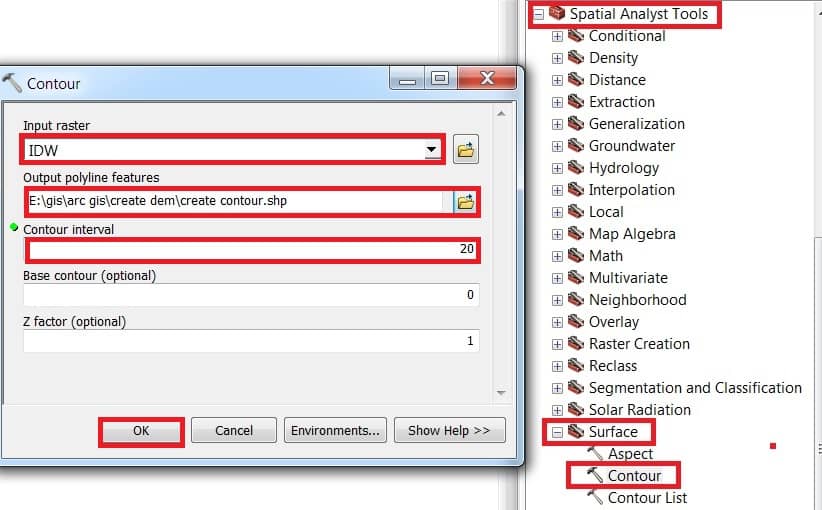
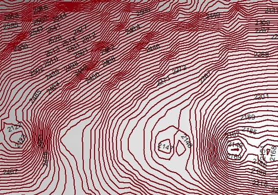
Create Contour from DEM Data
Now you can easily Create a Contour Map to from this DEM Data using IDW method.
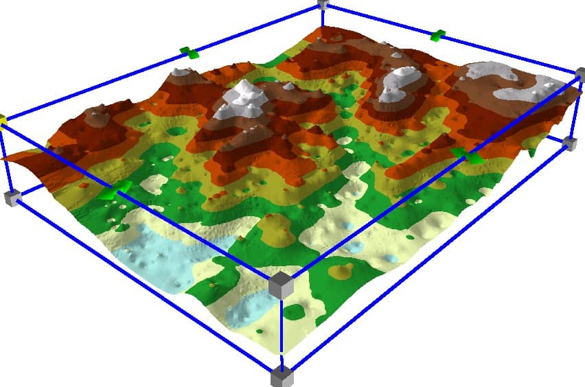
Create TIN (Triangulated Irregular Network) to proper 3D view.


I retired from Survey of India Department long back and like to learn DEM mapping.
Thank you
I got what you mean , appreciate it for posting.Woh I am pleased to find this website through google. “The test and use of a man’s education is that he finds pleasure in the exercise of his mind.” by Carl Barzun.