Raster Data Analysis
What is Raster Data Analysis?
Raster data analysis is the process of analyzing geospatial data, such as; Geoprocessing, Surface analysis and Terrain mapping.
Raster data are especially suited to continuous data. Continuous data change smoothly across a landscape or surface.

Examples of Raster Data
Raster Data is classified into various types; they are:
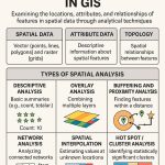
Raster Data Analysis Techniques
| Method | Description |
|---|---|
| Map Algebra | Perform cell-by-cell calculations between rasters |
| Reclassification | Change cell values based on rules (e.g., land use codes to categories) |
| Overlay Analysis | Combine multiple rasters (e.g., slope + soil) for suitability analysis |
| Zonal Statistics | Summarize raster values within zones (e.g., mean rainfall by district) |
| Interpolation | Create raster from point data (e.g., rainfall stations) |
| Raster Clipping | Extract a subset of raster using a polygon or shape |
| Change Detection | Compare two rasters (e.g., vegetation loss over time) |
| NDVI / Indices | Analyze vegetation or water using band math (e.g., NDVI = (NIR – Red)/(NIR + Red)) |
| Terrain Analysis | Derive slope, aspect, hillshade from DEMs |
| Hydrological Modeling | Flow direction, accumulation, stream networks |
Perform Raster Analysis in ArcGIS
The Raster Analysis toolbox contains a set of tools for performing raster analysis using ArcGIS software.
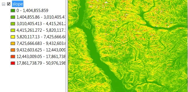
Slope Analysis
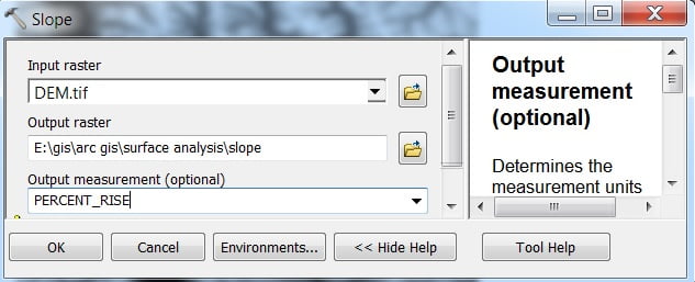
Open ArcMap, then open the Toolbox, ArcToolbox window is appears to expend Spatial Analyst Tools, then expend the Surface subgroup, and select Slope.
Slope window appears select Input Raster and Output Raster (you can choose output measurement- Degree or Percent), and click Ok.
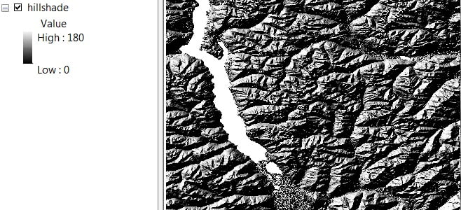
Hillshade Analysis
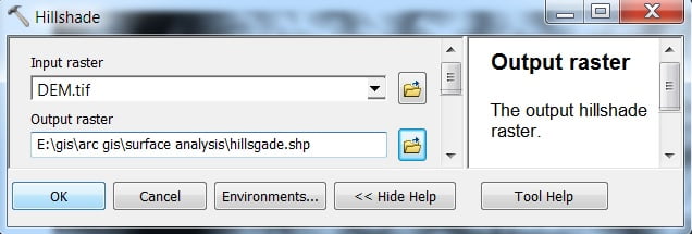
In ArcMap, open the Toolbox, ArcToolbox window is appears to expend Spatial Analyst Tools, then expend the Surface subgroup, and select Hillshade.
Hillshade window appears select Input Raster and Output Raster, and click Ok.
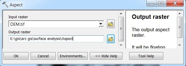
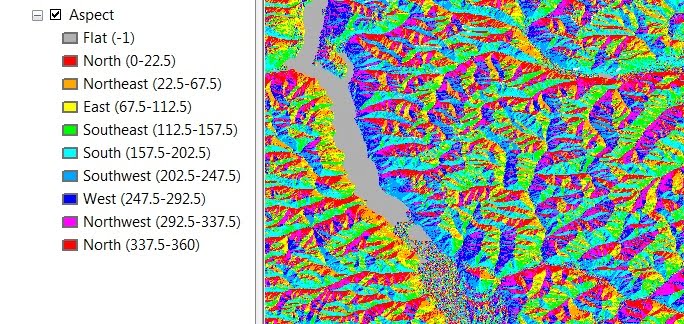
Aspect Analysis
In ArcMap, open the Toolbox, ArcToolbox window is appears to expend Spatial Analyst Tools, then expend the Surface subgroup, and select Aspect.
Aspect window appears select Input Raster and Output Raster, and click OK.