Stream Order or River Network using DEM Map in ArcGIS
Stream order is a method for identifying and classifying types of streams based on their numbers of Tributaries.
Stream Order in ArcGIS refers to a method used to classify the hierarchy of streams in a hydrologic network, typically as part of watershed analysis or terrain modeling. ArcGIS uses stream order tools in conjunction with a Digital Elevation Model (DEM) to derive this information
Create Stream Order in ArcMap
In this Tutorial, Learn How to create a Stream order or River Network in DEM Map using ArcMap.
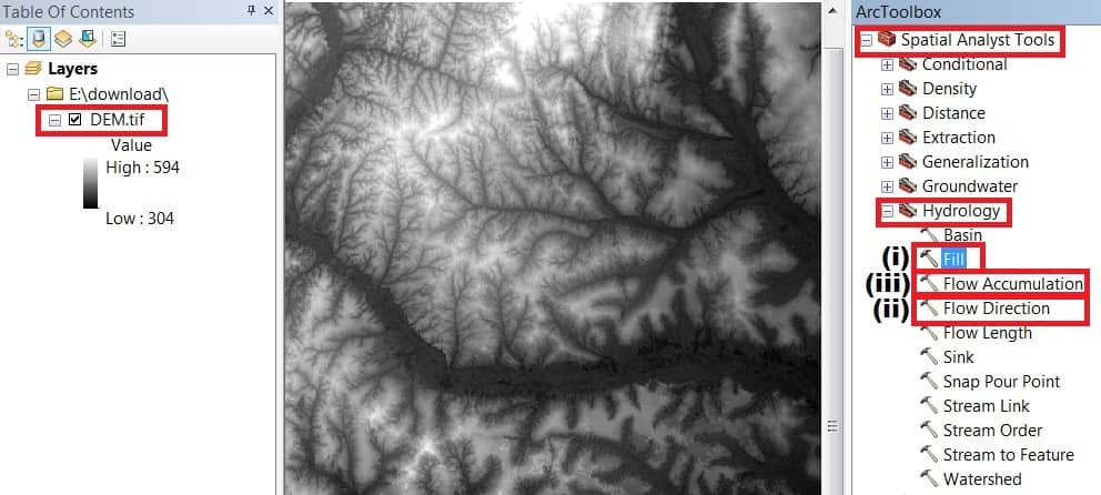
Add DEM Map in ArcMap Software, then open ArcToolbox.
Already open ArcToolbox, select Spatial Analyst Tool > Hydrology, and perform 3 tasks one by one – (i) Fill, (ii) Flow Direction, and (iii) Flow Accumulation.
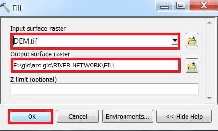
Fill
Open Fill, select Input file- Dem Map, choose Output Destination and write the name, then click OK.

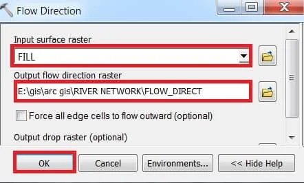
Flow Direction
Open Flow Direction, select Input file- Fill, choose Output Destination and write the name, then click OK.
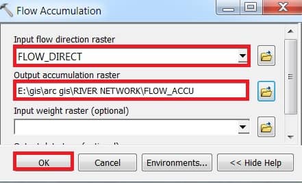
Flow Accumulation
Open Flow Accumulation, select Input file- Flow Direction, choose Output Destination and write the name, then click OK.
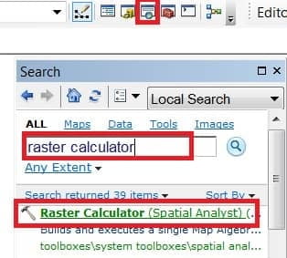
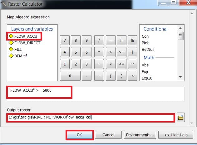
Complete all 3 processes, Now open Raster calculator to calculate Flow Accumulation.
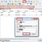
Open Search Box and search Raster Calculator. Raster Calculator window appears, double click Flow Accumulation Data (FLOW_ACCU) >=5000 (this value calculate for River Accumulation). Write-Output name and choose a destination and then click OK Button.
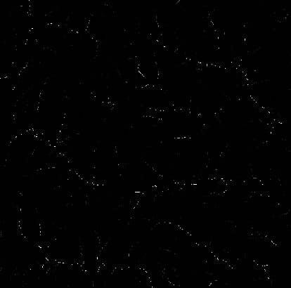
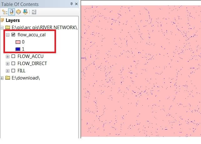
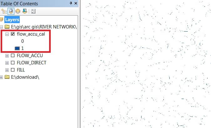
You can see the calculated Flow Accumulation Result (flow_accu_cal) ‘0’ and ‘1’. Value 1 mention to River Network.
Customize this Data to better understand River Network. Select flow_accu_cal data, Right-click, and choose Properties. Properties window appears value ‘0’ choose to blank color and click OK.
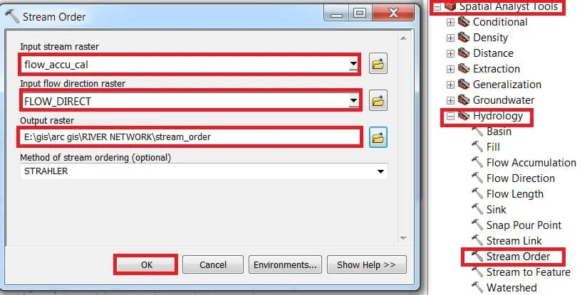
Stream Ordering Process
The next step is to perform the Stream Order. Open ArcTollbox > select Spatial Analyst Tool > Hydrology > Stream Order.
Stream Order window appears, Input stream raster – Flow Accumulation Calculate Data (flow_accu_cal). Input flow direction raster – Flow Direction Data and then choose Output and click OK.
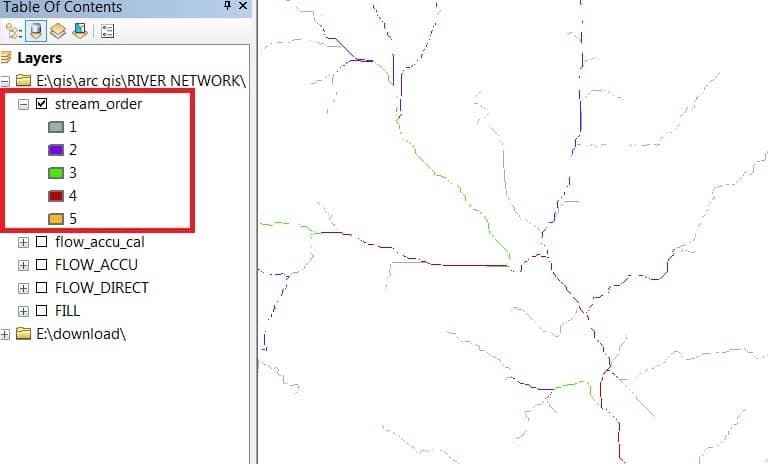
Now see the result of the Stream order.
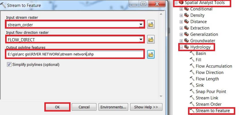
The next Important part converts Stream ordering into Feature as well as Polyline Shapefile.
In the ArcTollbox > select Spatial Analyst Tool > Hydrology > select Stream to Feature.
Stream to Feature window appears, Input stream raster (stream_order), then Input flow direction raster (FLOW_DIRECT) and choose Output and click OK.
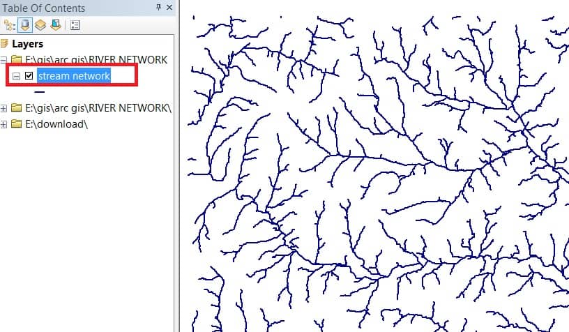
Now see the result of the Stream order Feature (Stream Network).
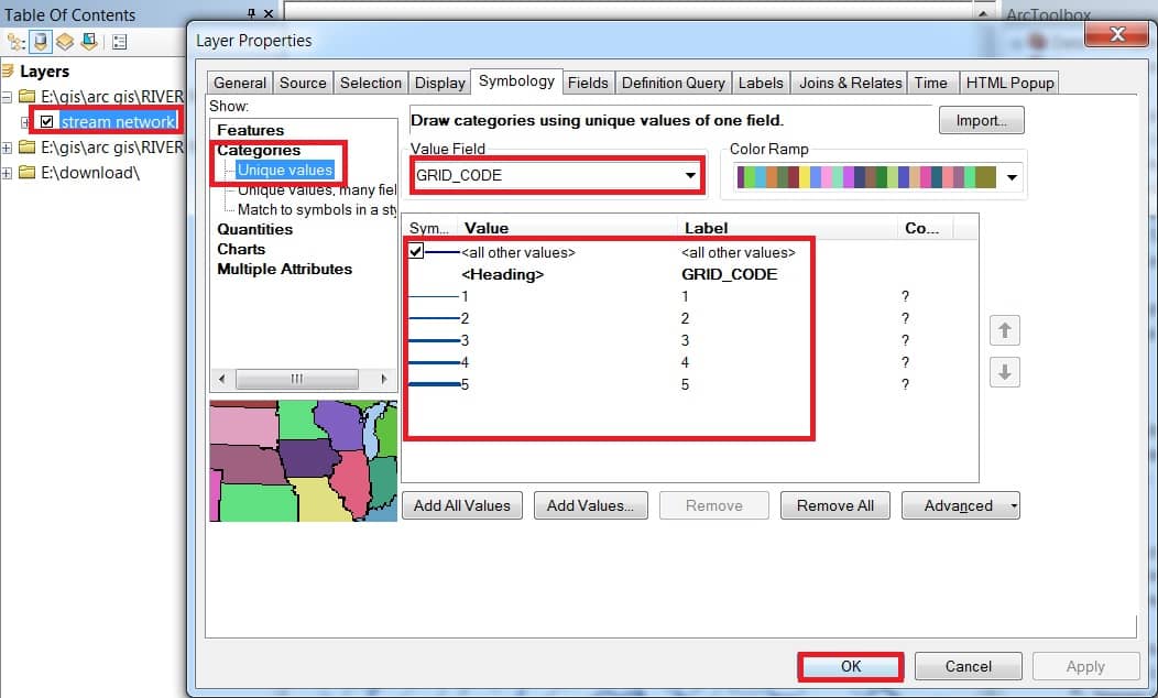
Customize Stream Network Feature Data, Right-click, and select Properties.
Stream Network Properties window appears, in the symbology group select Categories and choose GRID_CODE in Value field option, and click Add all values.
You can also change color, width and Label, to Better Understand Stream Ordering. Complete all of the Processes click OK button.
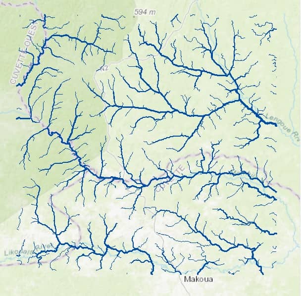
Now see the result of the Stream ordering or River Network.
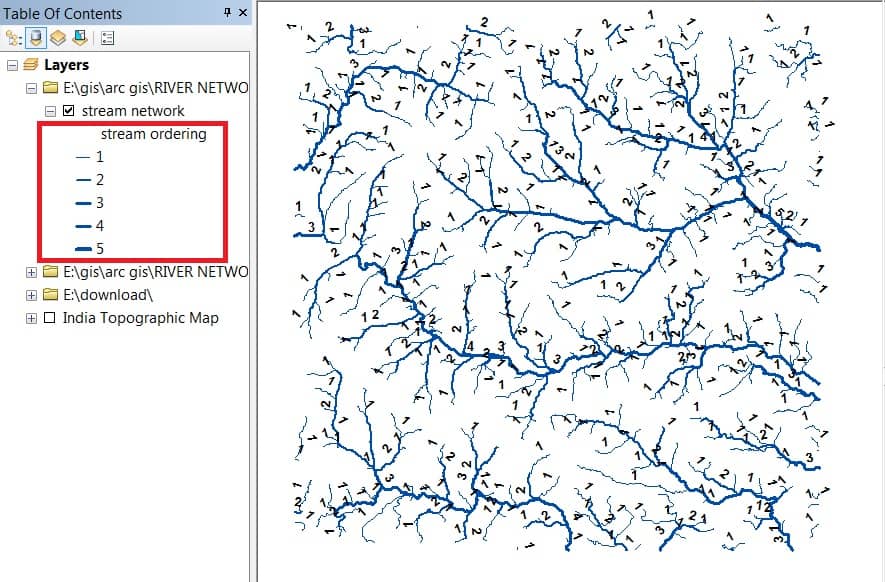
Add Base-map and view to Amazing River Network, and check Better Accuracy level.


Hi!
Dear Sir/Madam,
I would like to thank you for sharing such an important tutorial. I have been using fill, flow direction, flow accumulation, Reclassifying, stream order, stream to feature and grid code to do the same process. It works, but I have a problem. I will not get a stream bigger than 7. Any ideas?
Best regards,
Fryad