Machine Learning with ArcGIS
Introduction
Machine Learning (ML) tools have been a core component of spatial analysis in GIS.
ML refers to a set of data-driven algorithms and techniques that automate the prediction, classification, and clustering of data. It can play a important role in spatial problem solving in a wide range of application areas, from image classification to spatial pattern detection to multivariate prediction.
Esri has developed tools and workflows to utilize the latest innovations in deep learning to answer some of the challenging questions in GIS and Remote Sensing applications.
Core Areas of ML in GIS
| Task | Application Example |
|---|---|
| Classification | Land cover (urban, forest, water) |
| Regression | Predicting temperature or air pollution |
| Clustering | Crime hotspot analysis |
| Dimensionality Reduction | Satellite image compression |
| Anomaly Detection | Detect illegal land use |
Algorithms Used
| Type | Algorithm |
|---|---|
| Supervised | Random Forest, Decision Trees, SVM, Logistic Regression |
| Unsupervised | K-Means, DBSCAN, Hierarchical Clustering |
| Deep Learning | CNNs (for images), LSTMs (for spatio-temporal) |
ML Libraries (Python)
scikit-learn: Traditional MLxgboost,lightgbm: Gradient boosting for tabular spatial dataTensorFlow,PyTorch: Deep learning for satellite images
ML Supporting GIS Platforms
- ArcGIS Pro: Built-in ML tools for classification, prediction, clustering
- QGIS: Python-based ML using external scripts
- Google Earth Engine: ML on remote sensing imagery at scale
Machine Learning in ArcGIS
Machine learning in ArcGIS to perform image classification, enrich data with clustering, or model spatial relationships.
The Machine learning can be computationally intensive and often involves large and complex data.
Esri’s continued advancements in data storage and both parallel and distributed computing make solving problems at the intersection of ML and GIS increasingly possible.
In addition to ML methods and techniques in ArcGIS tools, ML is used throughout the ArcGIS platform for enabling smart, data-driven defaults, automating workflows, and optimizing results.
There are many key initiatives within Esri to advance machine learning methods, such as random forests, neural networks, logistic regression, and time-series forecasting are on the roadmap, as well as simplified user experiences for integrating with popular machine learning libraries and packages.
Examples of Machine Learning in ArcGIS
- Prediction-is about using the known to estimate the unknown. ArcGIS includes a number of regression and interpolation techniques that can be used to perform prediction.
- Classification-is the process of deciding to which category an object should be assigned based on a training dataset. rcGIS includes many classification methods focused on remotely sensed data.
- Clustering-is the grouping of observations based on similarities of values or locations. ArcGIS includes a broad range of algorithms that find clusters based on one or many attributes, location, or a combination of both.
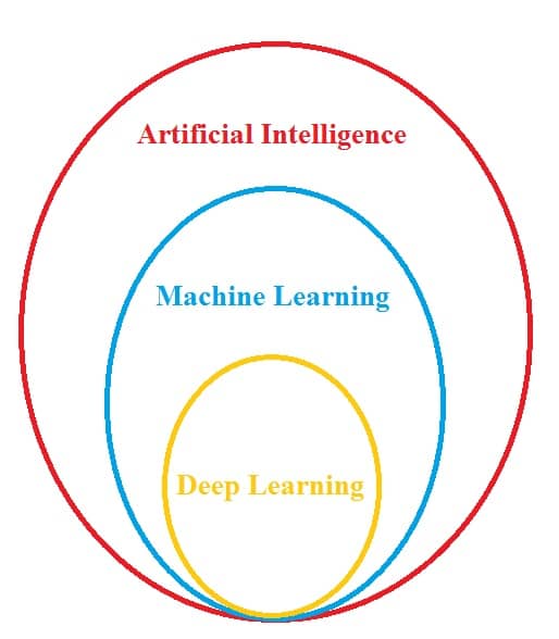
Machine Learning and Artificial Intelligence- Spatial Analysis
Use machine learning and artificial intelligence (AI) to train and inference using tools designed to solve the complex spatial problems you face.
Where the algorithms and approaches incorporate space into their computation, will continue to empower ArcGIS users to take advantage of the latest advances in technology and computing, while still focusing on solving problems in a fundamentally spatial way.