ArcGIS SharePoint
What is ArcGIS SharePoint?
ArcGIS for SharePoint is an app that allows you to map and search content in Microsoft SharePoint. You can create maps that combine your Microsoft SharePoint data with published geographic content from ArcGIS. You can also share the maps you create with others, both within and outside of your organization, using ArcGIS.

ArcGIS SharePoint is a mapping and spatial analytics add-in that helps users:
- Visualize SharePoint lists and libraries on maps.
- Link SharePoint data with ArcGIS layers.
- Use spatial tools to gain location-based insights.
Uses
- SharePoint provides GIS and interactive mapping functionality.
- It helps GIS departments sell the value of GIS to an organization.
- It’s easily configurable to meet business-specific reason.
- It’s available at no extra cost.
Download SharePoint
ArcGIS SharePoint will continue to grow and evolve to support the latest releases of SharePoint, including 2013, 2016, 2019, and SharePoint Online.
Complete the form to download SharePoint.
SharePoint 2021.1 is a major update that includes a new, fully redesigned app for modern SharePoint pages. This app, called ArcGIS Maps, is available alongside the previous app (ArcGIS Maps Classic). ArcGIS Maps include the following new features:
- New styles are available for styling layers.
- Use Buffer/Drive time analysis to find driving, walking, and trucking routes.
- If your data has time fields, you can now enable time animation on the map.
- Add infographic cards to the map to get demographic information.
- Multiple bug fixes and improvements have been made.
Components
Once you have SharePoint is installed and configured, you have access to the following three components to help you map and organize your SharePoint and ArcGIS data:
- ArcGIS Map Search app part– allows you to quickly locate documents stored in your SharePoint site collection using location attributes.
- ArcGIS Maps web part– the JavaScript-based web part for SharePoint. It allows you to display SharePoint lists, ArcGIS-hosted feature services, and ArcGIS web maps on an interactive map.
- ArcGIS Maps Locate workflow– reads specified information from your Share Point list and generates a new list column containing location information that can be used to plot features on a map. SharePoint lists containing address data must be geocoded or spatially enabled before you can add the data to the map.
How It Works
- Install ArcGIS for SharePoint (from Microsoft AppSource).
- Connect to ArcGIS Online or ArcGIS Enterprise.
- Configure web maps and layers to show SharePoint data on a map.
- Use map tools to analyze, filter, and visualize business and spatial data together.
Tutorial
In this tutorial we using ArcGIS Maps web.
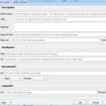
Steps:
1. Sign in to ArcGIS account.
2. Create a new page on SharePoint.
3. Browse to the page on which you want to insert the ArcGIS Maps web part.
4. Add data from either of these sources: Share-Point or ArcGIS.