Mapbox Geocoding
Mapbox Geocoding is the process of taking an address or name of a place and converting it into coordinates (latitude and longitude) values. This process is called geocoding (forward) and reverse geocoding.
Features:
- 🔎 Autocomplete place names
- 🌐 Supports many languages and countries
- 📍 Suggests points of interest (POI)
- 🔄 Works with Mapbox Vector Tiles
- 🧭 Can use proximity biasing (e.g., bias toward user’s location)
Mapbox Geocoding API
The Mapbox Geocoding API allows you to perform two types of geocoding:
1. Forward Geocoding– converts text (place names) into geographic coordinates. For example, forward geocoding turns the address greenfield park into coordinate values of 45.4847° N, 73.4662° W.
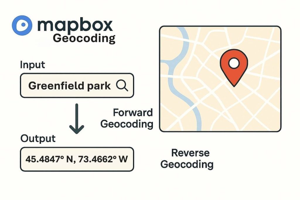
2. Reverse Geocoding-converts geographic coordinates into place names (text). For example, 45.4847° N, 73.4662° W. latitude and longitude values turn into the address greenfield park.
How Geocoding Works in Map
The API has two parts:
- Source data-used to define locations.
- Tools-used to search and return those locations.
To generate a reverse geocode with the Geocoding API, click anywhere on the Map.
Make sure you have an account in Mapbox, otherwise you can’t create a geocoding in the map.
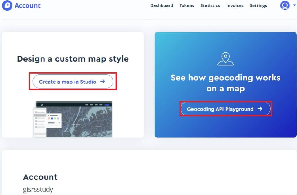
Example: Add Geocoder to Map
mapboxgl.accessToken = 'YOUR_MAPBOX_ACCESS_TOKEN';

const map = new mapboxgl.Map({
  container: 'map',
  style: 'mapbox://styles/mapbox/streets-v12',
  center: [73.4662, 45.4847],
  zoom: 10
});

const geocoder = new MapboxGeocoder({
  accessToken: mapboxgl.accessToken,
  mapboxgl: mapboxgl
});

map.addControl(geocoder);
Geocoding in Mapbox Studio
Mapbox Studio uses geocoding in the dataset editor. You’re using the Mapbox Geocoding API to find data to add to your custom dataset.
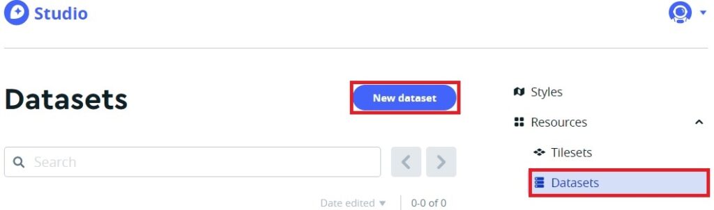
Within the dataset editor, you can search for and add countries, regions, districts, postcodes, places, localities, neighborhoods, and addresses.
Follow the tutorial How to add data in Mapbox Studio Datasets.
If you add a search tool to your application to find addresses, mapbox offers several wrapper libraries that allow you to integrate the Mapbox Geocoding API into your existing application seamlessly:
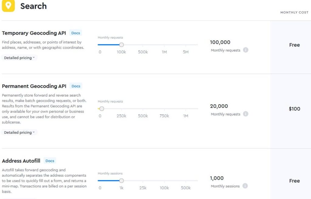
Geocoding API pricing
The default Geocoding API rate limit is 600 requests per minute, but can be adjusted on a per-account basis.
Details about the number of requests included in the free tier and the cost per request beyond what is included in the free tier are available on the pricing page.