Greene County GIS Mapping
The Greene County Geographic Information Systems (GIS) Department provides a comprehensive GIS to support the needs of government agencies and the residents of Greene County. Greene County GIS Map creates, manages, analyzes, and maps all different kinds of data used to support a wide range of functions.
Greene County GIS Data Download
Download the Greene County GIS data for free.
1. Visit the ArcGIS open data official page, select green countries data tag, and Data type (feature or raster layer).
2. Next choose your data, and click the data name (Wetlands).
3. Finally click the Download button.
4. Enable the Toggle Filters, and download the data in four different format; CSV, KML, Shapefile, and GeoJSON.
Greene County Ohio GIS Map
Open the Greene County Ohio GIMS (Geographic Information Management System) web portal, and start mapping.
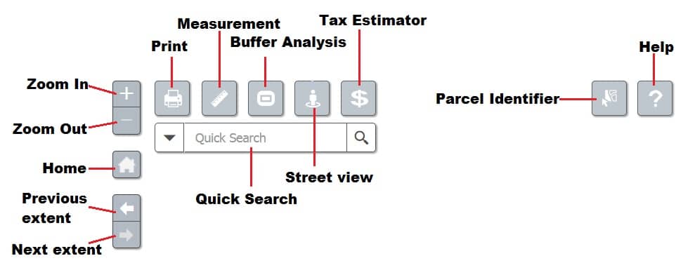
Quick Buttons
Greene County Ohio’s quick button helps you to quick response in you map.
Toolbar
Five important Toolbars available in the Greene County Ohio:
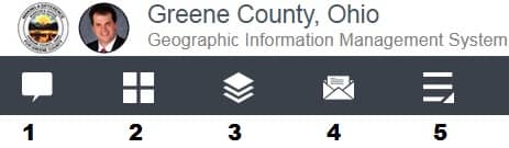
- Feature Information
- Basemap Gallery
- Layer List
- Public Notification
- Additional Tools
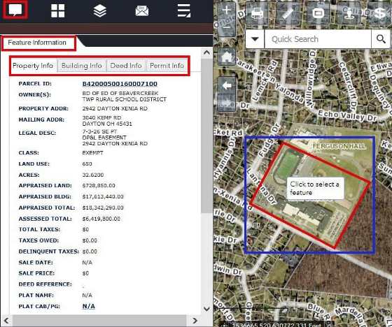
Feature Information
The Feature Information Tool provide all information about the selected feature and is updated nightly.
Click any feature on the map, and all the information will be listed under four tabs:
Property Info, Building Info, Deed Info, and Permit Info.
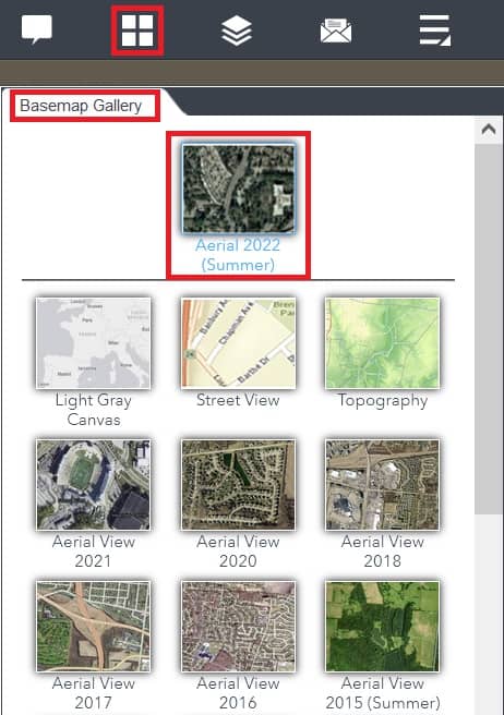
Basemap Gallery
The Basemap Gallery Widget allows you to select the basemap you would like to use for mapping.
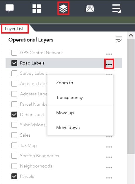
Layer List
The Layer List tool shows all the Operational Layers available on the map. Clicking the boxes will turn them on or off.
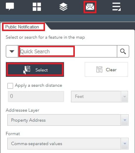
Public Notification
The Public Notification Tool identifies a collection of properties and creates mailing labels, or a structured text file, of owners and occupants.
Locate an address with the Quick search, click the Select button to create a new selection, and Add to the current selection.
Additional Tools
The Additional Tools provide five features:
- Parcel Report
- Data Extract
- Draw
- Location
- Bookmark
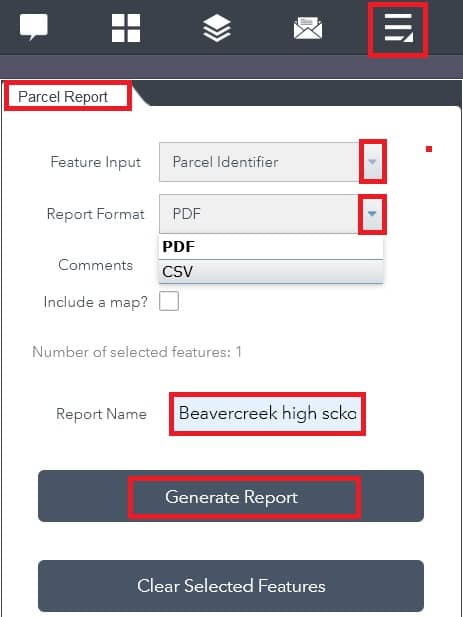
Parcel Report
The Parcel Report tool creates a report based on selected features.
Enter the Report Name, and click Generate Report button. The report can generate either a PDF or CSV format.
Data Extract
The Data Extract Widget allows you to select and download data for a specific Area of Interest (AOI).
Specify the Layers you would like to Clip, and use the Area of Interest graphic tools to define the area.
Select a Feature Format for the type of data desired, and click Execute.

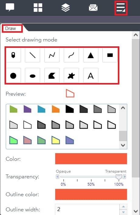
Draw
The Draw Tool allows you to create graphics on the map. Right Click on a graphic to Edit,
Move, Rotate/Scale, or Delete.
Location
The Location tool allows you to find locations on the map based on your inputs.

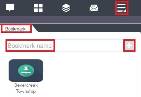
Bookmark
The Bookmark tool stores a collection of map view extents.
Create a new bookmark by typing the Bookmark Name and clicking the + sign. A thumbnail with the name will be added to the bookmark area.
Greene County NC GIS Map
Greene County, NC (North Carolina) GIS offers you to create a free hand mapping, powered by Esri.
Visit the Greene County NC web portal, and start mapping.
Toolbar
Eight important Toolbars available in the Greene County NC:
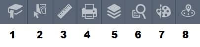
- Bookmark
- Select
- Measurement
- Layer list
- Quary
- Draw
- Near me
This all toolbars helps you to create geographical mapping and analysis.