ArcGIS Desktop: Comprehensive GIS Mapping and Analysis
ArcGIS Desktop software developed by Esri. It is widely used for GIS professionals to create, analyze, manage, and share Geographic Information so decision makers can make intelligent, informed decisions. It’s allowing to create maps, perform spatial analysis, and manage data.
ArcGIS was first released in 1999 and originally was released as ArcINFO, later it’s merge into ArcGIS Desktop.

Features:
- Interactive map creation
- Spatial and statistical analysis
- Visualize, analyze, and manage Data
- Combine 3D, CAD, imagery, and other data on a single map
- Connect people and data with ArcGIS Online and ArcGIS Living Atlas of the World
ArcGIS Desktop Download
The ArcGIS Released Version: 10.8 (February 2020). Download ArcGIS Desktop and create mapping and analysis.
As of 2025, ArcGIS Desktop pricing generally depends on license type, user level, and whether it’s for personal, educational, or commercial use.
ArcGIS Desktop version:
| Version | Released |
|---|---|
| 8.0 | 1999-12-27 |
| 8.0.1 | 2000-01-13 |
| 8.1 | 2001-05-01 |
| 8.2 | 2002-05-10 |
| 8.3 | 2003-02-10 |
| 9.0 | 2004-05-11 |
| 9.1 | 2005-05-25 |
| 9.2 | 2006-11-14 |
| 9.3 | 2008-06-25 |
| 9.3.1 | 2009-04-28 |
| 10.0 | 2010-06-29 |
| 10.1 | 2012-06-11 |
| 10.2 | 2013-07-30 |
| 10.2.1 | 2014-01-07 |
| 10.2.2 | 2014-04-15 |
| 10.3 | 2014-12-10 |
| 10.3.1 | 2015-05-13 |
| 10.4 | 2016-02-18 |
| 10.4.1 | 2016-05-31 |
| 10.5 | 2016-12-15 |
| 10.5.1 | 2017-06-29 |
| 10.6 | 2018-01-17 |
| 10.6.1 | 2018-07-16 |
| 10.7 | 2019-03-21 |
| 10.7.1 | 2019-06-27 |
| 10.8 | 2020-02-20 |
| 10.8.1 | 2020-07-28 |
| 10.8.2 | 2021-12-05 |
Core Products
ArcGIS Desktop provide 4 main applications:
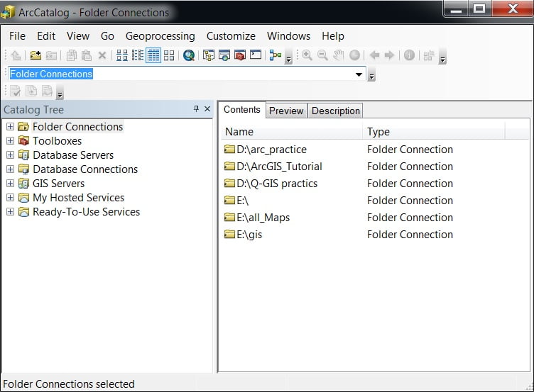
1. ArcCatalog:
Use for managing the spatial data holdings and database designs, and for recording and viewing metadata.
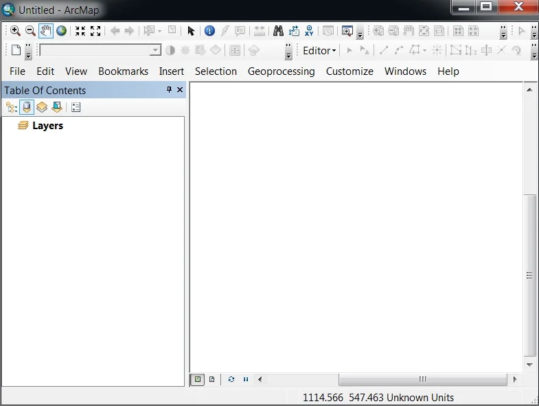
2. ArcMap:
Use for mapping and editing tasks, as well as for map-based analysis.
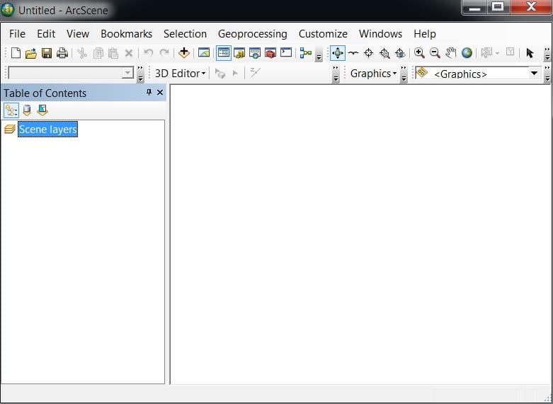
3. ArcScene:
Use in specialized 3D visualization and analysis (small datasets).
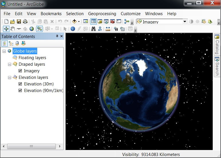
4. ArcGlobe:
Use for Global 3D visualization and analysis (large datasets).
ArcGIS Main Menu
- File
- Edit
- View
- Bookmarks
- Insert
- Selection
- Geoprocessing
- Customize
- Windows
- Help
File
On the File menu, Open, Save, Share, Add data, Basemap, Export, and Print your project. Also you sign into ArcGIS Online.
Edit
On the Edit menu, editing your current project. Edit features are; Undo, Redo, Cut, Copy, Paste, Delete, etc.
View
On the View tab, you can select Data view or Map view. Create and manage Graphs and Reports, Show/Hide Scroll and Status bar.
Some other features available in this section, like Data frame properties, Pause/Resume Drawing and Labeling
Bookmarks
Create and Manage Bookmarks your project file.
Insert
The Insert menu basically use for Map Layout, like Title, Legend, North line, Scale, etc.
Selection
The Selection menu helps you to select your project map/data Attributes, Locations, Graphics, and more.
Geoprocessing
The Geoprocessing menu provides Spatial Analysis tools, like Buffer, Clip, Intersect, Union, Marge, Dissolve.
Also in this section you can access, ArcToolbox, Environments settings, Result, ModelBuilder, and Python.
Customize
The Customize menu is the most importent part on Arc-GIS. In this section you can add/remove Toolbars, Extensions and manage ArcMap options.
Windows
The Windows menu also one of the most important part on Arc-GIS. Windows offers to Overview, Magnifier, Viewer features.
Add Table of Content, Catelog and Search, and also provide Image Analysis option.
Help
Help menu helps you to Arc-GIS Desktop help, Web help documentation, and more details about Arc-GIS.
ArcGIS Toolbars
- 3D Analyst
- Advanced Editing
- Animation
- ArcScan
- COGO
- Context Menus
- Data Driven Pages
- Data Frame Tools
- Distributed Geodatabase
- Draw
- Edit Vertices
- Editor
- Effects
- Feature Cache
- Feature Construction
- Geocoding
- Geodatabase History
- Geometric Network Editing
- Georefercing
- Geostatistical Analyst
- GPS
- Graphics
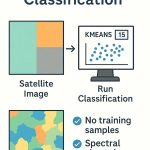
- Image Classification
- Labeling
- LAS Dataset
- Layout
- Main Main
- Network Analyst
- Parcel Editor
- Publisher
- Raster Painting
- Representation
- Route Editing
- Schematic
- Schematic Editor
- Schematic Network Analyst
- Snapping
- Spatial Adjustment
- Spatial Analyst
- Standard
- Tablet
- TIN Editing
- Tools
- Topology
- Tracking Analyst
- Transform Parcels
- Utility Network Analyst
- Versioning
ArcToolbox & Tools
- 3D Analyst Tools
- Analysis Tools
- Cartography Tools
- Conversion Tools
- Data Interoperability Tools
- Data Management Tools
- Editing Tools
- Geocoding Tools
- Geostatistical Tools
- Linear Referencing Tools
- Multidimention Tools
- Network Analyst Tools
- Parcel Fabric Tools
- Schematic Tools
- Server Tools
- Spatial Analyst Tools
- Spatial Statistics Tools
- Tracking Analyst Tools
ArcGIS Extensions
- ArcGIS 3D Analyst
- ArcGIS Aviation Airports
- ArcGIS Aviation Charting
- ArcGIS Bathymetry
- ArcGIS Business Analyst
- ArcGIS Data Interoperability
- ArcGIS Data Reviewer
- ArcGIS Geostatistical Analyst
- ArcGIS Image Analyst
- ArcGIS LocateXT
- ArcGIS Maritime
- ArcGIS Network Analyst
- ArcGIS Pipeline Referencing
- ArcGIS Publisher
- ArcGIS Roads and Highways
- ArcGIS Schematics
- ArcGIS Spatial Analyst
- ArcGIS Tracking Analyst
- ArcGIS Workflow Manager
- ArcGIS Defense Mapping
- ArcGIS Production Mapping
How to Use ArcGIS Desktop
Two main impotent Toolbar used: Standard and Tools toolbar.
- The Standard Toolbar is managed to full of work in ArcGIS.

- The Tools toolbar is is one of the primary ways that you interact with geographic information displayed in the data frame.

| Button | Name |
|---|---|
| Zoom In | |
| Zoom Out | |
| Pan | |
| Full Extent | |
| Fixed Zoom In | |
| Fixed Zoom Out | |
| Back | |
| Forward | |
| Select Features | |
| Clear Selection | |
| Select Elements | |
| Identify | |
| Hyperlink | |
| HTML Pop-up | |
| Measure | |
| Find | |
| Find Route | |
| Go To XY Location | |
| Open Time Slider Window | |
| Create Viewer Window |