Download QGIS Software: Step-by-Step Instructions
QGIS is a Free and open-source GIS Software to perform GIS application, and analysis of Geo-spatial data.
In this tutorial learn How to use QGIS Desktop Software.
Download QGIS Software
The current version is QGIS 3.44.0 ‘Solothurn’ and was released. Q-GIS is available on Windows, macOS, Linux and Android.
QGIS All Version:
| Version | Code name | Release Date |
|---|---|---|
| 0.0.1-alpha | 2002-07 | |
| 1.0 | Kore | 2009-01-05 |
| 2.0 | Dufour | 2013-09-08 |
| 3.0 | Girona | 2018-02-23 |
| 3.2 | Bonn | 2018-06-22 |
| 3.4 LTR | Madeira | 2018-10-26 |
| 3.6 | Noosa | 2019-02-22 |
| 3.8 | Zanzibar | 2019-06-21 |
| 3.10 LTR | A Coruña | 2019-10-25 |
| 3.12 | Bucureşti | 2020-02-21 |
| 3.14 | Pi | 2020-06-19 |
| 3.16 LTR | Hannover | 2020-10-23 |
| 3.18 | Zürich | 2021-02-19 |
| 3.20 | Odense | 2021-06-18 |
| 3.22 LTR | Białowieża | 2021-10-22 |
| 3.24 | Tisler | 2022-02-18 |
| 3.26 | Buenos Aires | 2022-06-17 |
| 3.28 LTR | Firenze | 2022-10-21 |
| 3.30 | ‘s-Hertogenbosch | 2023-03-03 |
| 3.32 | Lima | 2023-06-23 |
| 3.34 | Prizren | 2023-10-27 |
| 3.38 | Grenoble | 2024-07-19 |
How to Use QGIS Software
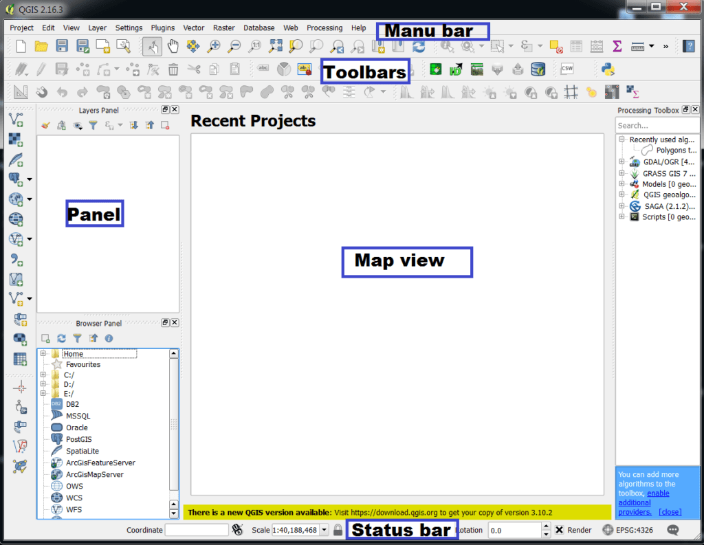
The QGIS GUI (Graphical User Interface) is divided into five components:
Menu Bar
The Menu bar provides access to QGIS functions using standard hierarchical menus. All the Menus options are described below.
Project
The Project menu provides access and exit points for project files. It provides tools are:
- Create New project
- Open, Close, and Save project
- Import/Export project
- Export the map canvas- Print Layout
- Set project properties and snapping options
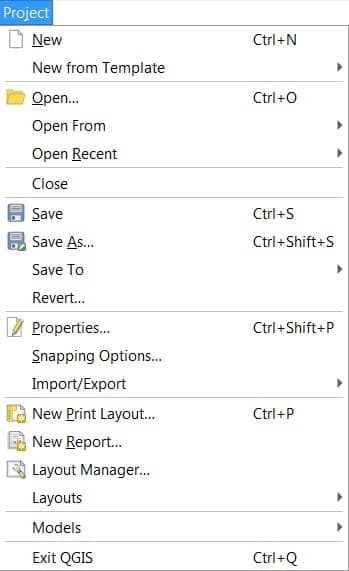
Learn more about Project menu.
Edit
The Edit menu provides most of the native tools needed to edit layer attributes or geometry. To enable Edit menu options you need to active editing mode by clicking on Toggle editing button.
It provides tools are:
- Cut, Copy, Paste Features
- Edit Attributes, Geometry
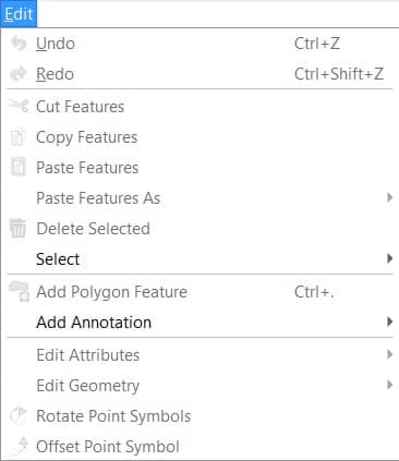
Learn more about Edit menu.
View
The View is the most impotent menu bar in QGIS for your project. Its provides tools:
- Create new 2D or 3D map views
- Zoom and Pan option
- Manage Bookmarks
- Manage all the Toolbars (Enable/ Disable option)
- Manage all the Panels (Enable/ Disable)
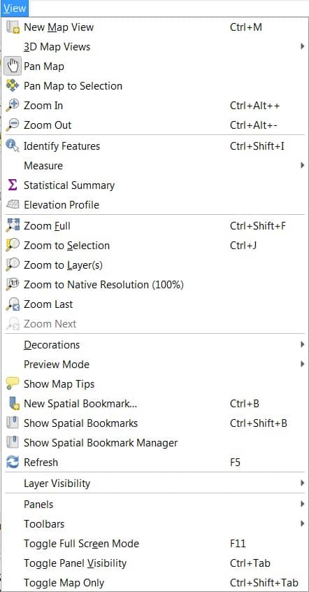
Learn more about View menu.
Layer
The Layer menu provides a large set of tools to create new data sources. The provides tools are:
- Create and Add layer (Shspefile)
- Open Attribute table
- Access Georeferencing

Learn more about Layer menu.
Settings
Settings menu provide quick access set-up options. You can Manage:
- User profile
- Manage Style
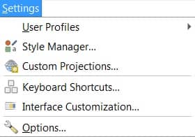
Learn more about Settings menu.
Plugins
The plugin menu helps to install a new plugin for access new operations. Some important plugins are:
- Processing
- QGIS Cloud
- Semi-Automatic classification
- QGIS2Web, and more
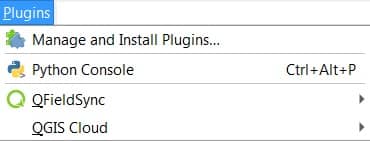
Learn more about Plugin menu.
Vector
Vector menu looks like if all core plugins are enabled, and also provide Geoprocessing and Analysis tools.
- Geoprocessing tools
- Buffer
- Clip
- Union
- Dissolve, and more
- Analysis tools
- Nearest Neighbour
- Basic Statistics, and more
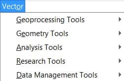
Learn more about Vector menu.
Raster
Raster menu allow to perform raster-based GIS tasks,and spatial analysis:
- Slope
- Aspect
- Hillshade
- Contour, etc
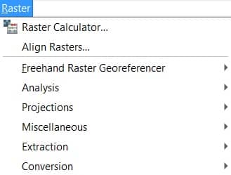
Learn more about Raster menu.
Database
To use Database menu, first you will need to enabled database plugins:
- DB Manager
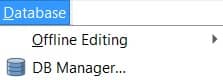
Learn more about Database menu.
Web
Web menu, similar to database menu, first enabled Web-based plugins:
- Qgis2threejs
- Qgis2web, and more
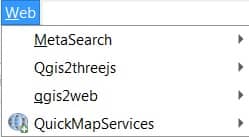
Learn more about Web menu.
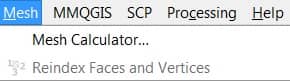
Mesh
The Mesh menu manipulate mesh layers.
- Mesh Calculator
Learn more about Mesh menu.
Processing
Processing menu allow to open processing Toolbox

Learn more about Processing menu.
Help
Help menu helps you to all the details about QGIS software and tutorial.

Learn more about Help menu.
QGIS
This menu is only available in macOS and contains some OS related commands.

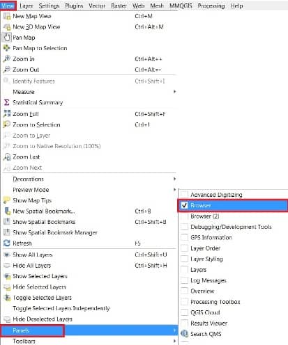
Panels
Panels are special widgets that you can interact with to perform more complex tasks. QGIS provides many panels.
To open panel, go to View menu then hover Panels. Selecting panel options, checking boxes.
Toolbar
The toolbars provide access to most of the functions in the menus.
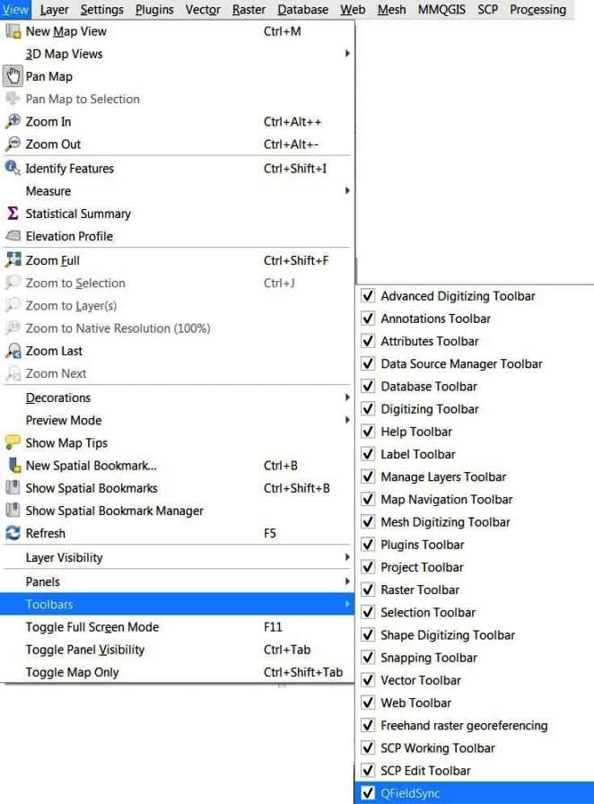
To open toolbar, go to View menu then hover Toolbars. Selecting toolbar options, checking boxes.
Map View
The QGIS Map view or Map canvas is the area to displayed maps in 2D.
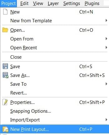
To Add a new map, go to View > New Print Layout.
Status Bar
The status bar provides you with general information about the map view and performing task. It resides Bottom position in the QGIS desktop application.

QGIS Tutorial
Georeferencing
The Georeferencer tool generating reference raster to geographic or projected coordinate systems by creating a new GeoTIff or by adding a world file to the existing image.
Perform Image to Image Georeferencing.
Perform Ground to Image Georeferencing.
Vector Data (Shapefile)
The Vector file or Shapefile is digital forms of maps to create symbology, labeling, diagrams. It also data storage format for storing the location, shape, and attributes of geographic features.
Create Vector Data or Shapefile.
Digitization
Digitization is a process of Raster 2 Vector Conversion.
Perform Raster 2 Vector Conversion (screen Digitization).
Uses of Attributes Toolbar
Attributes Toolbar use for editing Maps and manipulating Data.
Use Attributes Toolbar.
Layout (Print composer)
The Print Composer provides growing layout and printing capabilities. It allows you to add elements such as the Q-GIS map canvas.
Perform Layout in QGIS.