Map Layout- Print Composer – QGIS
In this Tutorial Learn How to Create Map Layout in QGIS.
The Print Composer provides growing layout and printing capabilities. It allows you to add elements such as the QGIS map canvas.
Layout Features
Text labels, images, legends, scale bars, basic shapes, arrows, attribute tables, and HTML frames. You can size, group, align, position, and rotate each element and adjust their properties to create your layout.
The layout can be printed or exported to image formats, Postscript, PDF, or SVG format. You can save the layout as a template and load it again in another session.
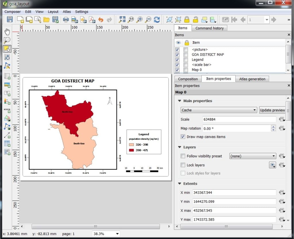
Now we can start to assemble our map. Go to Project > New Print Composer > composer title, then click OK.
In the Print Composer window open, click on Zoom full to display the full extent of the Layout. Now we would have to bring the map view that we see in the QGIS Canvas.
Uses all toolbars to – add Map, Images, Scale bar, Legend, North line, Table, Move, Position etc.
Start Map Layout
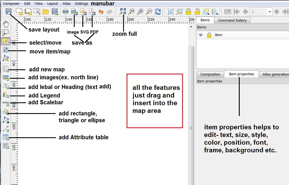
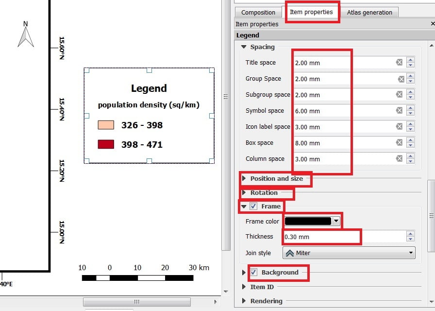
Uses Item properties to proper Text, Font, Size, Symbol, Color, Border, Background, Rotation, etc.
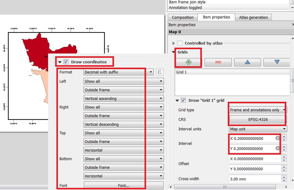
Add Coordinate value (Latitude & Longitude)- go to item properties > select Grids > + > choose Grid Type > change CRS (WGS 84 EPGS 4326) > select the Interval value X & Y (it is varies to map scale) > choose Grid frame style > select Draw Coordinate check box > settings Format, left, right, top, button, font etc.
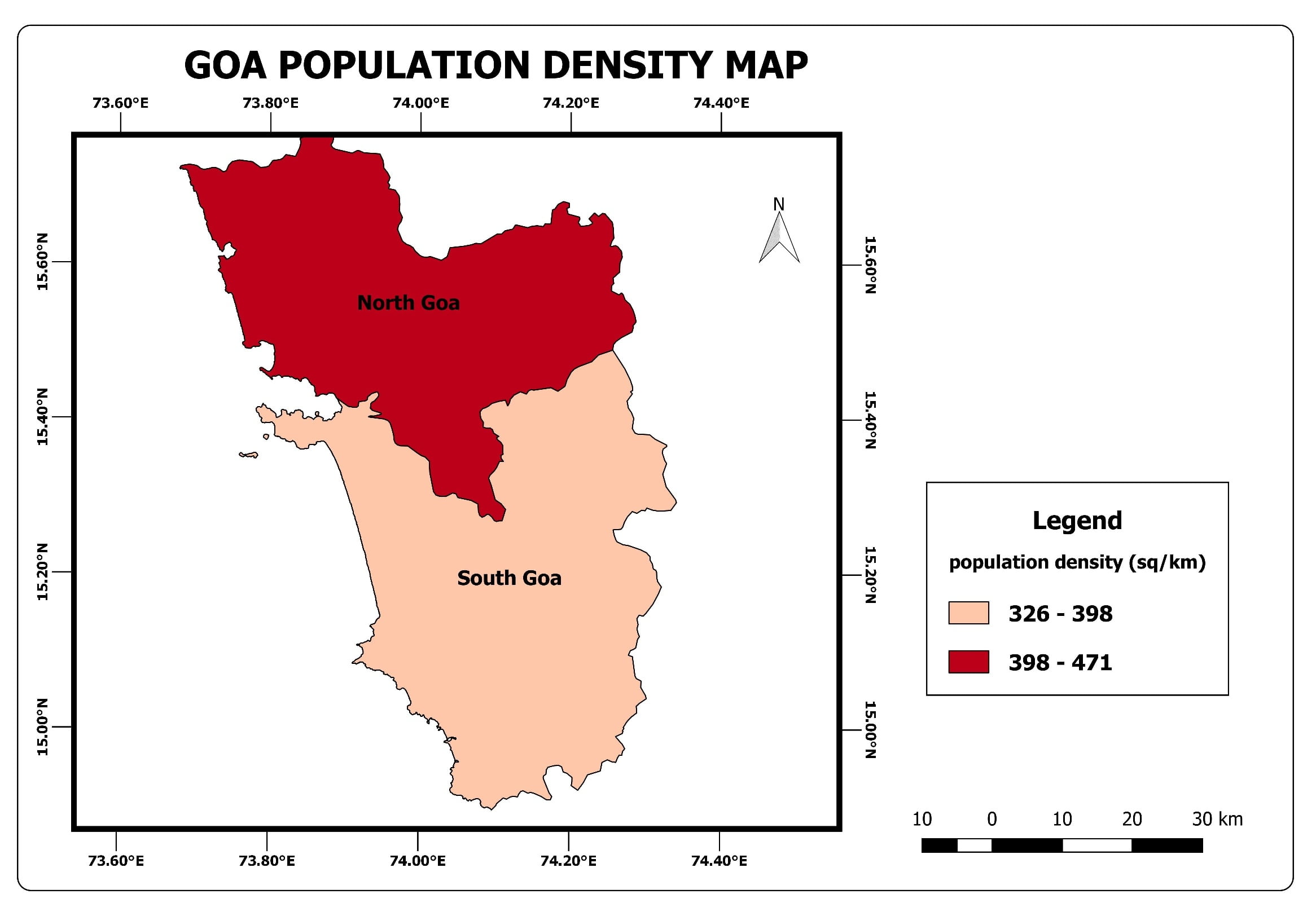
Once you have Completed the Layout, now its save as (export) Image, SVG or PDF Format.
Export Map