ArcGIS StoryMaps: Create Remarkable Stories
ArcGIS StoryMaps—a web-based application that integrates interactive maps with multimedia and narrative elements to create cohesive, engaging, and informative stories (Esri, 2013). Story Maps are now widely used in urban planning, disaster response, environmental advocacy, historical documentation, and classroom education—providing a user-friendly platform for spatial storytelling.
What is ArcGIS StoryMaps?
ArcGIS StoryMaps is a story authoring web-based application, create inspiring, immersive stories by combining text, interactive maps, and other multimedia content. Publish and share your story with your organization or everyone around the World.
A Story Map is a communication tool that allows users to guide their audience through geographic content step-by-step. It enhances understanding by combining spatial visualization with explanatory text, images, and video. Rather than presenting maps as static objects, ArcGIS Story Maps transforms them into dynamic experiences that serve educational, organizational, and public engagement purposes.
The increasing accessibility of Web GIS and digital storytelling has positioned Story Maps as a vital component in the evolving landscape of Geo-spatial technology (Mitchell, 2014).
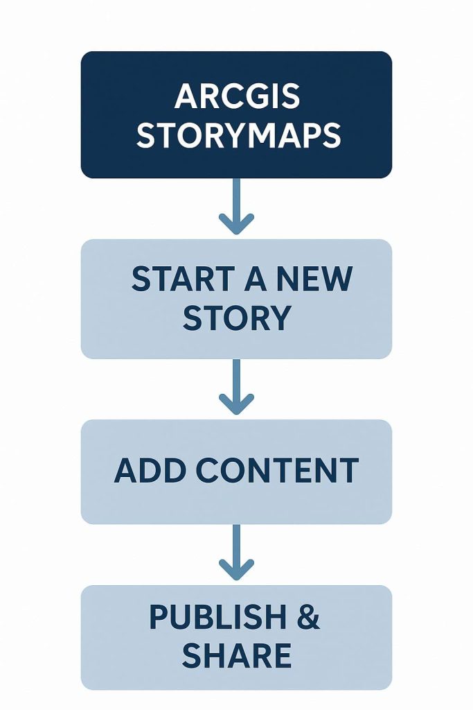
How Its Works–
Core Features
- User-friendly templates (e.g. Map Tour, Sidecar, Journal)
- Drag-and-drop editing interface with no coding required
- Integration of maps, videos, audio, charts, and images
- Scroll-based interactive storytelling design
- Hosted online for easy sharing and embedding
Benefits of User Story Mapping
- Create Stories– include maps, narrative text, lists, images, videos, embedded items, and other media.
- Publish and share your stories– within your organization, to specific groups, or with everyone.
- Create and publish your collections– it’s include stories and ArcGIS web apps bundled together.
- View and Edit your stories– from the Stories page, find stories authored by others in your organization, and add stories to your favorites list.
Advantages
- Simplified Communication: Complex spatial data is translated into engaging stories anyone can understand.
- Improved Accessibility: No technical expertise is required to interact with or even create a Story Map.
- High Customization: Users can tailor visual styles, content, and layout to match their brand or message.
- Multi-Platform Reach: Easily shared via links, embedded in websites, or viewed on mobile devices.
- Public Engagement: Great for community outreach, education, and raising awareness on local or global issues.
Applications
ArcGIS Story Maps are highly versatile and widely adopted across various sectors for public communication and professional analysis.
The table below outlines key sectors and examples of how Story Maps are applied in real-world scenarios:
| Sector | Use Case |
|---|---|
| Environmental Studies | Mapping climate change effects on ecosystems |
| Urban Planning | Visualizing infrastructure development and zoning |
| Education | Interactive geography and history lessons |
| Disaster Management | Real-time communication of disaster impact and response |
| Public Policy | Sharing demographic or census data with the public |
ArcGIS Online StoryMaps
Create your 1st Story
Create Account
1. Before start your story, first Create an ArcGIS public account, or Sign In.
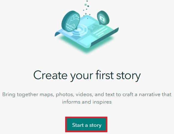
2. Successfully Log in, in ArcGIS Story Maps portal, create your first story. Click Start a Story (New story) button.
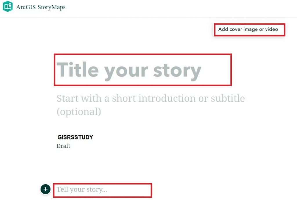
3. Customize your Story: Title, Description, Image/ Video, and more.
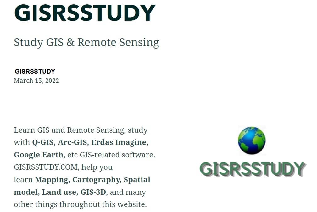
Story Maps Examples
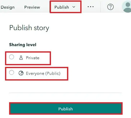
Publish Story
4. Click Publish button in the upper right corner, select your sharing level (i) private or (ii) public, then Publish your Story.
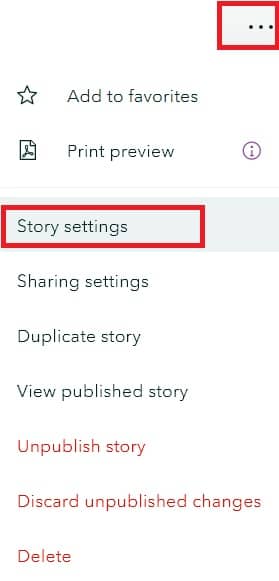
Configure Date settings
- In the story builder, click the menu button. Click Story settings to open the Story settings menu.
- Choose one of the options from the Date on cover drop-down menu. Original publication date, Date of last update, or None, and click Save.
Comparison of ArcGIS StoryMaps vs. Google Earth Stories
| Feature | ArcGIS StoryMaps | Google Earth Stories |
|---|---|---|
| 🌐 Platform | Web-based, part of the ArcGIS Online ecosystem | Web-based, part of Google Earth Web |
| 🗺️ Mapping Integration | Advanced GIS layers, symbology, real-time data, 2D & 3D support | 3D Earth-based flyover views with placemarks |
| 📚 Storytelling Format | Scrollable, media-rich stories with multiple layout options (sidecar, map tour) | Sequential, card-based stories with place-based fly-throughs |
| 🎨 Customization | Custom themes, branding, layout styling, multimedia embedding | Limited styling; mainly image, text, and place pins |
| 🧭 Interactivity | Interactive maps, charts, dashboards, survey integrations | Fly-to animations, place-based interaction |
| 🧩 Data Support | Supports live and static GIS data, CSVs, shapefiles, ArcGIS layers | Basic KML/KMZ or embedded media only |
| 🛠️ Design Tools | Includes blocks for text, media, maps, embeds, sliders, and guided tours | Uses slides with placemarks and captions |
| 📊 Analytical Features | Integrated with spatial analysis, dashboards, infographics | No spatial analytics |
| 💼 Use Cases | Government, education, journalism, NGOs, urban planning, storytelling | Travel, personal stories, educational exploration |
| 💲 Cost | Free tier available (limited credits), full features require ArcGIS license | Free |
Conclusion
ArcGIS Story Maps represent a significant evolution in how we communicate geographic information. By merging narrative storytelling with spatial analysis, they allow users to go beyond raw data and tell compelling, informative, and impactful stories. Whether used in government planning, classroom education, or public outreach, Story Maps make GIS content not only useful but meaningful.
In a world where data is abundant but attention is scarce, ArcGIS Story Maps stand out as a powerful tool that turns maps into messages—and viewers into participants in the story.