ArcGIS
ArcGIS was first released in 1999 and originally was released as ArcINFO. The ArcINFO was later merged into ArcGIS Desktop. After 15 years, Arc-GIS released ArcGIS Pro in 2015. ArcGIS Pro works in 2D and 3D for Cartography and Visualization and also works for Artificial Intelligence.
What is ArcGIS?
ArcGIS is a powerful Geographic Information System (GIS) platform developed by Esri that allows users to create, manage, analyze, and share spatial data and maps.
It is widely used for mapping, spatial analysis, and decision-making in various sectors like, urban planning, environment, transportation, and disaster management.
It’s offers location-based analytics to your Studies or Business practices. Gain greater insights using contextual tools to visualize and analyze your data. Collaborate and share via maps, apps, dashboards and reports.

It includes many products and services:
- ArcGIS Desktop (e.g., ArcMap, ArcCatalog)
- ArcGIS Pro
- ArcGIS Online
- ArcGIS Enterprise (Server)
- ArcGIS Apps (Field Maps, Survey123, etc.)
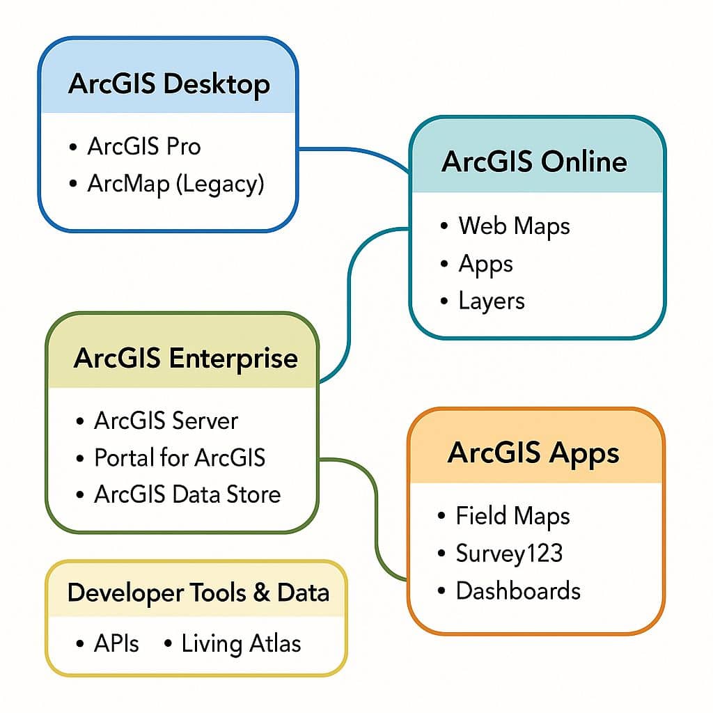
Breakdown the Components of ArcGIS:
1. ArcGIS Desktop
Desktop software for creating, editing, analyzing, and visualizing geospatial data.
- ArcGIS Pro
- Modern, 64-bit GIS application with 2D & 3D capabilities.
- Supports real-time analysis, Python scripting, and integration with ArcGIS Online.
- Example: Creating a land-use map and performing slope analysis.
- ArcMap (Legacy)
- Traditional ArcGIS Desktop application.
- Still used but gradually phased out in favor of ArcGIS Pro.
Other desktop tools:
- ArcCatalog – Data management and metadata.
- ArcScene & ArcGlobe – 3D visualization (legacy tools, replaced by ArcGIS Pro).
2. ArcGIS Online
ArcGIS Online is a cloud-based platform for web GIS:
- Create and share interactive maps and layers online.
- Access ready-to-use basemaps and data layers.
- Build Web Apps, StoryMaps, and Dashboards without coding.
Example:
Publish a crime heatmap and share it with your team via a web link.
3. ArcGIS Enterprise
An on-premises GIS platform for organizations needing private or secure deployment.
- ArcGIS Server – Publishes and hosts maps, geoprocessing, and spatial data services.
- Portal for ArcGIS (Enterprise)– Internal version of ArcGIS Online for private networks.
- ArcGIS Data Store – Stores hosted layers and analysis results.
- ArcGIS Web Adaptor – Integrates with an organization’s web server and security.
Example:
A city planning department manages all zoning and utility maps internally without using public cloud services.
4. ArcGIS Apps
Apps extend ArcGIS capabilities to field, desktop, and web use cases:
- Field Apps:
- ArcGIS Field Maps – Mobile data collection and map viewing.
- ArcGIS Survey123 – Smart form-based surveys.
- ArcGIS QuickCapture – Rapid field data collection.
- ArcGIS Navigator – Route navigation for field crews.
- Office & Web Apps:
- ArcGIS Dashboards – Real-time visualization of metrics and maps.
- ArcGIS StoryMaps – Combine maps with narrative text and multimedia.
- ArcGIS Experience Builder – Custom web app creation without coding.
- Imagery & 3D Apps:
- ArcGIS Earth – Lightweight 3D globe viewer (similar to Google Earth).
- Drone2Map for ArcGIS – Drone imagery processing to 2D/3D maps.
5. ArcGIS Developer Tools
For building custom GIS apps and automations:
- ArcGIS API for Python – Automate GIS workflows and spatial analysis.
- ArcGIS REST API – Access ArcGIS services for custom apps.
- ArcGIS Runtime SDKs – Develop mobile and desktop apps with GIS functions.
- ArcGIS JavaScript API – Build interactive web mapping applications.
6. ArcGIS Data & Content
Esri provides ready-to-use geospatial content:
- Basemaps: Streets, Satellite, Topographic, Imagery.
- Living Atlas: Curated collection of global datasets (climate, demographics, etc.).
- ArcGIS Hub & Open Data: Public data sharing platform.
Key Capabilities:
- Data visualization: Create 2D and 3D maps.
- Spatial analysis: Buffer, overlay, proximity, and terrain analysis.
- Remote sensing & imagery analysis: Process satellite and aerial imagery.
- Data management: Handle shapefiles, GeoDatabases, GeoPackages, and raster datasets.
- Web GIS integration: Share maps and analysis results online.
ArcGIS Extensions:
| Extension | Capabilities |
|---|---|
| ArcGIS 3D Analyst extension | Arc-GIS 3D Analyst extension to be a fully functioning of 3D GIS system. It allows you to view, manage, analyze, and share your 3D GIS data. View huge volumes of 3D GIS data in a global view using ArcGlobe, or view site-level data in a local coordinate system using ArcScene. Analyze GIS data in three dimensions using Geoprocessing tools, and use interactive tools in a 3D view. Share 3D views of GIS data by publishing Globe Services and share 3D analytic tools through Geoprocessing services. |
| ArcGIS Geostatistical Analyst | Geostatistical Analyst tools for surface generation and analyzing and mapping continuous datasets. Exploratory spatial data analysis tools provide insights about data distribution, global and local outliers, global trends. Level of spatial auto-correlation, and variation among multiple datasets. |
| ArcGIS Network Analyst extension | Perform advanced routing and network analysis supporting- Drive-time analysis, Point-to-point routing, Route directions, Service area define, Shortest path analysis, Closest facility analysis, Origin destination analysis, Gravity or Huff models, etc. |
| ArcGIS Schematics | Generate, visualize, and manipulate diagrams from network data coming from a geodatabase or any data that has explicit attributes showing connectivity. Use a number of schematic representations: Geographic, Geo-schematic, and schematic. Generate schematics from complex networks. Visualize both logical and physical connectivity. Evaluate network forecast and planning. Visualize non-spatial, connected data. Social networks Model .Generate flow-charts. |
| ArcGIS Spatial Analyst extension | Spatial Analyst extension of powerful raster modeling and analysis features allow to create, query, map, and analyze raster data. Arc GIS Spatial Analyst extension also allows integrated raster and vector analysis and adds more than 170 tools to the Arc-GIS Geoprocessing framework. |
| ArcGIS Tracking Analyst | Tracking Analyst supports network connections to Global Positioning System (GPS) units and other tracking and monitoring devices, so you can map your data in real time. Data can be played back at different speeds in forward and reverse. Analyze patterns in temporal data by creating data clocks. Create and apply actions on temporal data, and also create animations of your data using the Tracking Analyst Animation tool. View tracking data in 3D using ArcGlobe. |
| ArcGIS Data Interoperability | GIS data can be delivered in a variety of formats. For ex; data sources, such as advanced computer-aided design (CAD) datasets with extended entity attributes, MapInfo datasets, Intergraph GeoMedia datasets, and various GML files, can be accessed, displayed, and used directly in Arc GIS. Arc GIS Data Interoperability extension is a separate setup available on the Arc GIS Desktop media. |
| ArcGIS Data Reviewer | Analyze and validate data that allow to check for both spatial and attribution conditions. Additionally, also be sample data, validate metadata values against a schema, and check valency on network features. The results of the analysis or validation are stored in a table, where you can update the correction or verification status. |
| ArcScan for ArcGIS | Perform raster to vector conversion tasks on scanned documents, including raster editing, raster snapping, manual raster tracing, and vectorization. |
| ArcGIS Publisher | Publish data, maps, and globes authored using Arc GIS Desktop, with ArcMap and ArcGlobe. Author interactive maps and globes, publish them with Arc GIS Publisher, and share them via ArcReader. |
| ArcGIS Workflow Manager | Manage business process as workflows in a consistent manner and maintain accountability: Create standardized workflows, Simplify spatial data management and editing, Track work progress with reports, charts and historical job information, Communicate about important job and spatial data events automatically. |
| ArcGIS Aviation | Arc-GIS Aviation extension efficiently manage aeronautical information, products, and integrated workflows to generate navigational products compliant with aviation standards. Generate specialized surround elements for aeronautical charts. Create aeronautical features with the Feature Builder and other tools. |
| ArcGIS Bathymetry | Manage post-processed bathymetric data and metadata. Leverage the central geodatabase, referred to as the Bathymetric Information System (BIS), to interact with and manage large volumes of raster data and selected soundings on an Arc GIS Desktop platform. The extension provides: Externally stored raster data from a mosaic dataset, Managing survey, dataset, and any custom metadata. Extracting points from the BIS geodatabase that are linked to their original datasets Filtering and visualizing raster data within ArcMap. |
| ArcGIS Defense Mapping | Produce data and maps that comply with several standards using specialized editing and extraction tools. Data specifications that are supported include the following: Image City Map (ICM), Geobase GeoFidelis, Geonames, Multinational Geospatial Co-Production Program (MGCP), Stereo Airfield Collection (SAC), Topographic Data Store (TDS), Theatre Geospatial Database. |
| ArcGIS Maritime | Manage hydrographic information and products to generate electronic, hard copy, and raster navigational products. The following can be produced using the Nautical Solution: Electronic Navigational Charts (ENC), Additional Military Layers (AML), Marine Information Overlays (MIO), Inland Electronic Navigational Charts (IENC), Digital Nautical Charts (DNC), Paper charts and river books. |
| ArcGIS Pipeline Referencing | Manage linear referencing data for pipeline organizations with the support of the following: LRS information model, Network and event loading tools, Network editing, Geoprocessing tools, Web services. |
| ArcGIS Production Mapping | Data production with tools that support data creation, maintenance, validation, and cartographic production. Transfer data between data models and formats using a cross-reference database. Capture data using standard and composite templates. Manage business rules and large-scale cartographic production in the product library. |
| ArcGIS Roads and Highways | Manage linear referencing data for transportation with the support of the following: Integration with external system event data, Communication of LRS updates through redlining, LRS Network management, Event location management, Support for multiple linear referencing methods, Quality control. |
FAQ?
ArcGIS Software is not free. Free only ArcGIS Office Resources. Arc-GIS public account is a free account to use, create, store, and manage geospatial content, share content, and access content shared by Esri and GIS users around the world.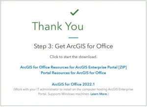
Enter the Esri official portal, or visit GISRSSTUDY for Download ArcGIS
Arc-GIS is not for hard to learn, because many sources are available to learn Arc-GIS. Learn ArcGIS Tutorial for Beginners
Create, store, and manage Geospatial content.
Easily share data, maps, apps and other items.
Visualize the data and web map application.