Web Map Service
What is Web Mapping Service?
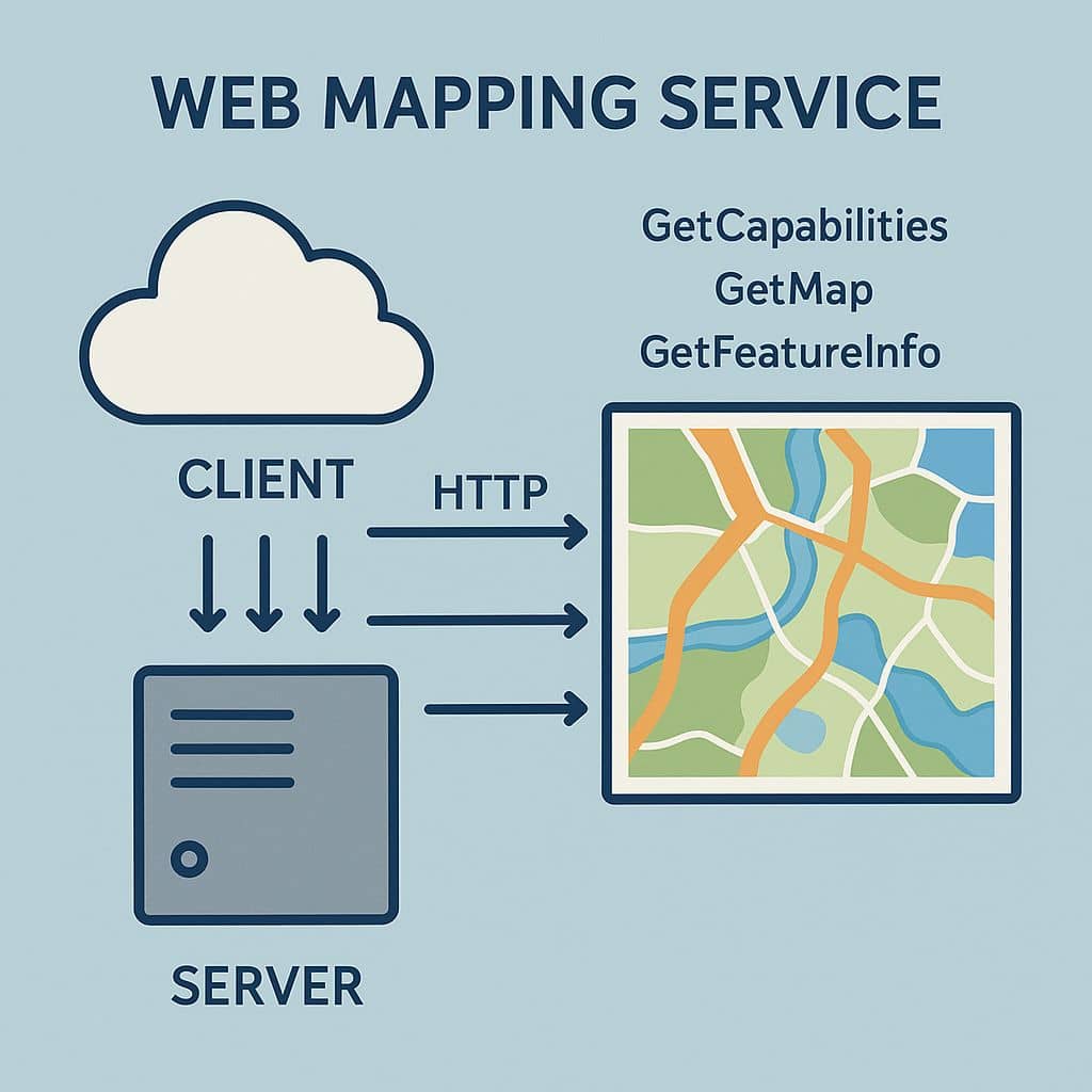
The Web Map Service (WMS)is a standard protocol developed by the Open Geospatial Consortium (OGC) for serving georeferenced map images, representation of the data for basic mapping and data visualization applications. A Geographic Information System (GIS) software application or online mapping tool that supports WMS is required for viewing the georeferenced data from the WMS server.
The WMS link provides access to data by connecting to a server over the Internet without having to download large files on your computer.
How WMS Works
A WMS client (e.g., QGIS, ArcGIS, web app) sends an HTTP request to a WMS server with parameters like:
- Layers to display (e.g., roads, rivers, elevation)
- Bounding box (spatial extent)
- Image size and format (PNG, JPEG, etc.)
- Spatial reference system (e.g., EPSG:4326)
The server responds with a map image rendered according to those parameters.
Common WMS Clients
- Desktop GIS: QGIS, ArcGIS, gvSIG
- Web Maps: Leaflet, OpenLayers
- Programming: Python (OWSLib), JavaScript APIs
Benefits of WMS
- Server-side rendering: No need to download raw data
- Interoperability with many clients
- Real-time map updates
- Layer-based control and styling
USGS Web Mapping Service
WMS On-Demand Request is available for select USGS Earth Explorer data sets.
WMS requests can be placed for the following datasets:
- GLS 1975
- GLS1990
- GLS2000
- GLS2005
- GLS2010
- EO-1 ALI
- EO-1 Hyperion
- ASTER Level 1T
- Landsat 7 ETM+ C1 Level-1
- Landsat 4-5 TM C1 Level-1
USGS WMS On-Demand Request
At first search the data.
After search results are returned and displayed on the Results tab, individual data scenes can be added to the Item Basket using the Order Scene icon.
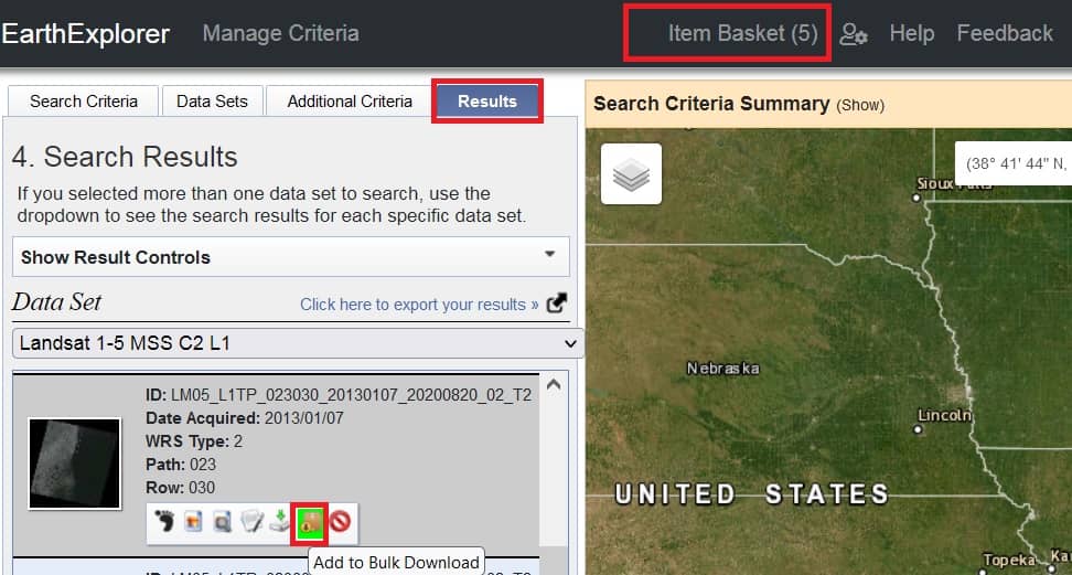
After adding the scenes to the shopping cart, click on the “Item Basket” in the menu to display the data sets available for the Orders.
Expand each data set to view the selected scenes and to see the Product options.
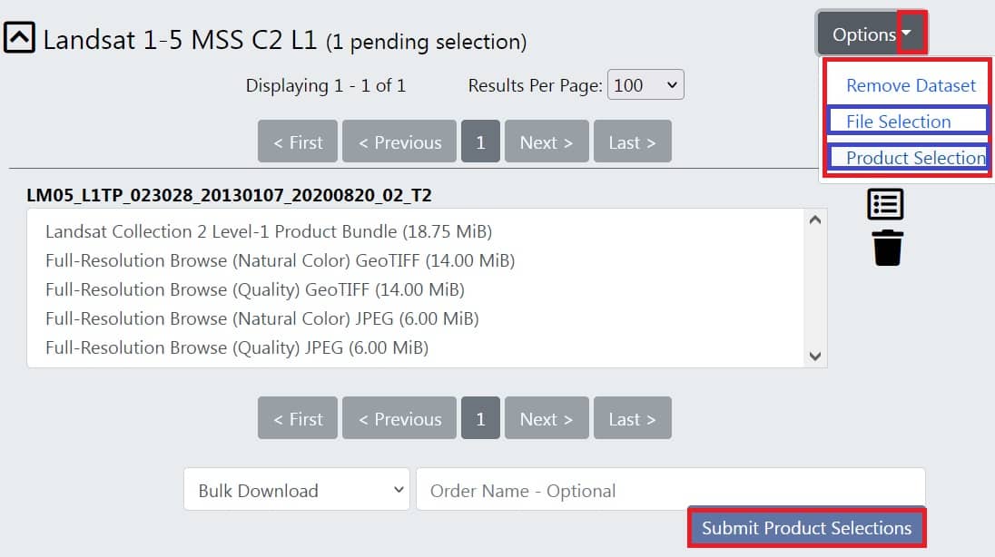
Review the scenes in the WMS request. The order can be modified by selecting Options Dropdown and Remove Scene. If the order options are correct for each scene, click “Submit Product Selections.” Order is submitted for WMS request processing.
Click on the “Order Tracking” to displays a list of scenes.
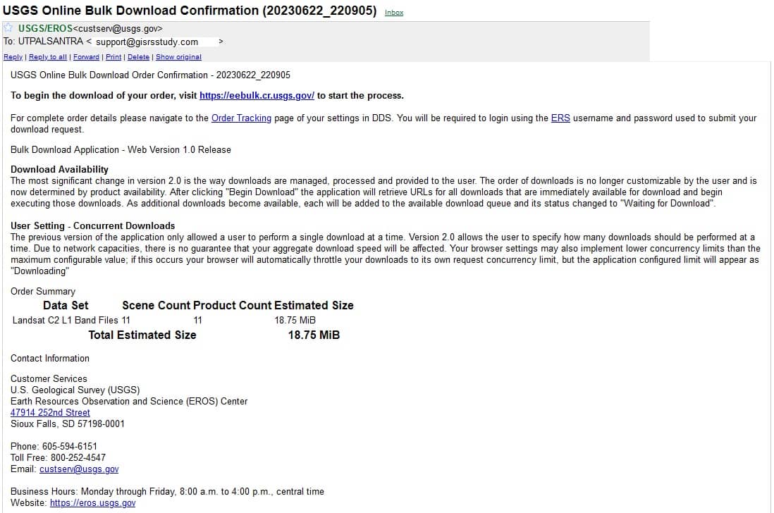
A USGS Online Order Confirmation email will be sent with the order details.
When compilation of the order is complete, an email notification that contains the WMS link is delivered. The link can be copied into a GIS software package or mapping tool to access the data.
[Note: The WMS link will be available for two weeks.]
Web Mapping Service ArcGIS
Open ArcGIS application.
To add the WMS layer to ArcMap, go to the Catalog window.
Navigate to GIS Servers in the Catalog window, and select Add WMS Server, then double click.

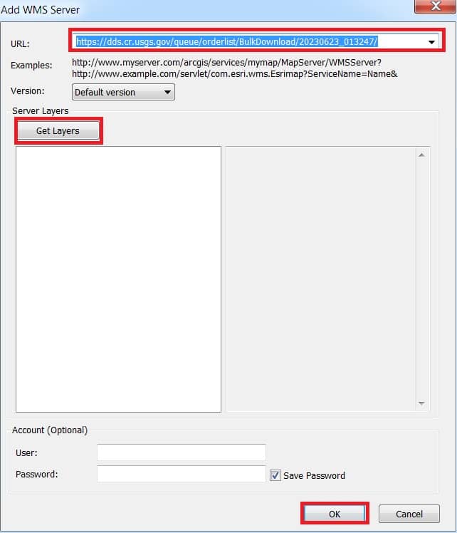
The Add WMS Server dialog box open, now insert the WMS link, you received in the email into the “URL” field. Paste the WMS link into the URL field and click Get Layers, list of scenes is displayed in the WMS request, then Click OK.
Select “USGS WMS server on earthexploer.usgs.gov”, and click Add button.
Now view the scenes WMS link in the ArcMap.