USGS Earth Explorer Tutorial
USGS– United States Geological Survey was established on March 3, 1879, it has knowledge to the progress of science and technology. It is sought out by thousands of partners and customers for its natural science expertise and its vast earth and biological data holdings.
The USGS mission is to monitor, analyze, and predict current and evolving dynamics of complex human and natural Earth system.
USGS Earth Explorer
The USGS Earth Explorer is the web portal to Download different types GIS and Remote Sensing Data, liike DEM Data, Aerial imagery, Satellite imagery, and more.
USGS Earth Explorer Tutorial
Navigate Earth Explorer, it is composed of the Search Criteria and the Map Viewer components.
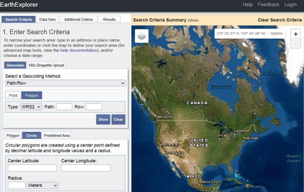
Search Criteria
Search Criteria is located on the left side of the Earth Explorer element. It is allows you to enter search criteria, select datasets to query, enter additional criteria, and review results in a tabular window.
Geocoder/KML Shapefile
Select a Geocoding Method– i) Feature(GNIS) ii) Path/Raw, or Upload KML/Shapefile
[The search result limit is 100 records; select a Country, Feature Class, or Feature Type to reduce your chances of exceeding this limit.]
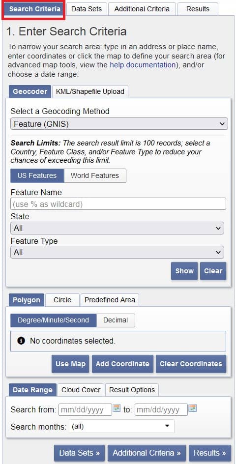
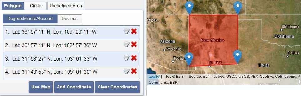
Polygon/Circle/Predefined Area
- In the Polygon section add Point, or select Area of interest (AOI) using the map view, or Add Coordinates.
- The Circle section, Circular polygons are created using a center point defined by decimal Latitude and Longitude values and a Radius.
- Predefined Area prefer to Add Shape only United State Area.
Data Range/Cloud Cover/Result Options
- The Date Range, select start to end data, and search your require data.
- Additionally, if you need Cloud Cover, you can alter the range of Cloud Cover. This filter will only be applied to data sets that support cloud cover filtering.
- Result Options show to your search result.
Map Viewer
The Map Viewer is located on the right side of the Earth Explorer. The Map application interface embeds Google Maps within the Earth Explorer client.
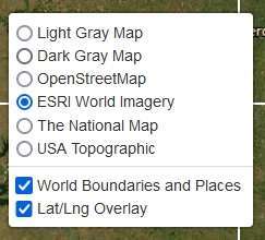
You can also change the map layout, for better understand.
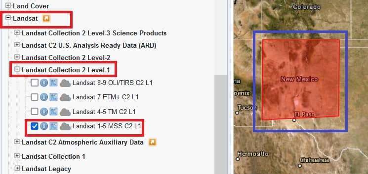
Data Sets
Earth Explorer Datasets
- Aerial Imagery
- AVHRR
- CEOS Legacy
- Commercial Satellites
- Declassified Data
- Digital Elevation (DEM)
- Digital Line Graphs
- Digital Maps
- EO-1, Global Fiducials
- HCMM, ISERV
- Land Cover
- Landsat
- NASA LPDAAC Collections
- Radar, Sentinel
- UAS
- Vegetation Monitoring
- ISRO Resourcesat
Select any Data type as your require, click ‘+‘ to dropdown then click data checkbox.
Select Result button and show list of all data sets.

You can also add Additional Criteria to click Additional Criteria button.
[If you have more than one data sets selected, use the dropdown to select the additional criteria for each data set.]
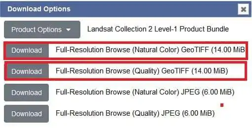
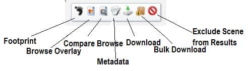
Download Data
1st step, you must be logged in to download data.
Click the Download option![]() for download Satellite date (GeoTIFF)
for download Satellite date (GeoTIFF)