RRC GIS
RRC GIS stands for RailRoad Commission of Texas Geographic Information System.
The RRC GIS Viewer allows you to view information about wells, pipelines, surveys, LPG/CNG/LNG, Operator Cleanup Program, Voluntary Cleanup Program, Brownfield Response Program, Commercial Waste Disposal sites, Discharge Permits and related features in a map view
The default view when you open the RRC map viewer is a state map with the Oil/Gas Districts layer visible.
The Oil/Gas Districts layer displays the Railroad Commission’s Oil and Gas Division district boundaries and numbers in green.
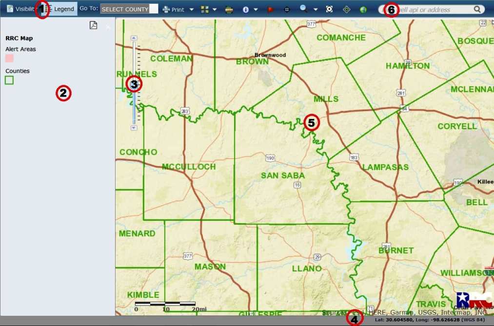
- Toolbar: Allows you to access the available tools and features for the GIS viewer.
- Visibility/Legend Pane: Allows you to toggle between the available layers and the associated legend.
- Zoom Control: Allows you to zoom in or out on the map.
- Coordinates: Displays the World Geodetic System 1984 (WGS 84) coordinates for the location of your cursor on the map.
- Map View: Displays the map and layers.
- Search bar: Allow find places or address.