Massachusetts Bureau of Geographic Information (MassGIS)
Table of Contents
What is MassGIS?
MassGIS is the Commonwealth’s Massachusetts Bureau of Geographic Information within the Executive Office of Technology Services and Security (EOTSS).
It’s provides a large amount of public domain geographic data for Massachusetts. They distribute LiDAR, DEMs, and other elevation data, in addition to soils maps, hydrologic, cultural, environmental, and geological data.
Use interactive MassMapper to make your own maps. Also, you can explore a selection of topic-specific interactive maps. GIS users can access data and web services for their software and applications. MassGIS also coordinates GIS activities in state and local government and sets GIS data standards.
MassGIS Data Layers
- Census/Demographic Data
- Coastal and Marine Features
- Conservation/Recreation
- Cultural Resources
- Environmental Monitoring
- Image Data
- Indexes
- Infrastructure
- Physical Resources
- Political/Administrative Boundaries
- Regulated Areas
- Miscellaneous
- Contact
- Others
MassGIS Oliver
Oliver was launched in 2004 and was revamped once in 2010. MassMapper replaces Oliver with a more streamlined, user-friendly interface with speedier rendering of the interactive map.
Added new features in MassMapper include: printing directly to a PDF, and tools to draw lines and text on the map.
MassGIS Base Map
The map was designed by MassGIS staff in ESRI’s ArcMap 10.x software and was cached into tile layers for the Web using ArcGIS Server.
In MassMapper, the full base map actually is constructed with terrain, natural features, that may be added from the Basemaps menu in the upper right corner of the MassMapper interface, and overlaid with three cached “tiled layers“.
“Topographic Features for Basemap” Terrain and natural features including Shaded Relief, States outside Massachusetts, Water bodies and rivers, Wetlands, Cranberry Bogs, Tidal Flats, Elevation Contours, Protected Open Space.
Applications
ArcGIS Online Web mapping platform, where you will find a collection of interactive map applications, basemaps, and Mapping applications created by Mass-GIS.
Massachusetts Master Address Points
Sexual Assault & Domestic Violence facilities and resources
Surficial Geology 24k Map with shaded relief and USGS topographic quad overlay.
Dashboard displays parcel status information by city and town, on map, table and pie chart.
Explore 30 years of Massachusetts ortho photos in this time series application.
Web page at Mass.gov containing the Community Compact status map.
Municipal and regional public school districts in Massachusetts.
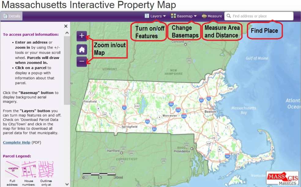
Massachusetts Interactive Property Map
Displays MassGIS Assessors’ Tax Parcels for all of the Commonwealth of Massachusetts.
The Massachusetts Interactive Property Map, enables developers, banks, realtors, businesses, and homeowners to view seamless property information across the Commonwealth.
Access Data
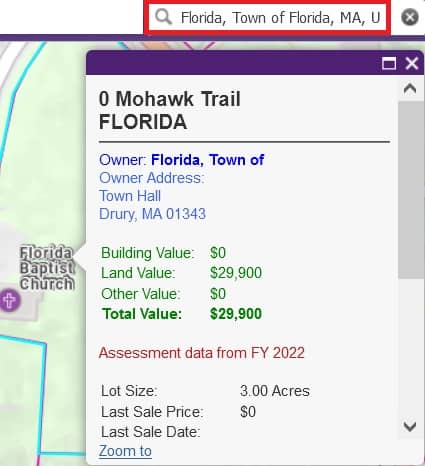
Type an address or a place to find a location. Click on the parcel to view property information such as land valuation and owner.
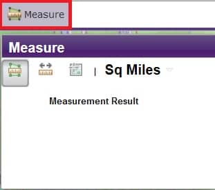
Measure Distance and Area
Draw a line between points to measure the distance, and area, in acres, miles, feet, yards, meters, kilometers, nautical miles.
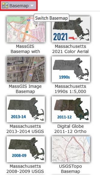
Switch Background/ Basemap
Click the “Basemap” button to change the background map. Aerial photography is also available for several years.
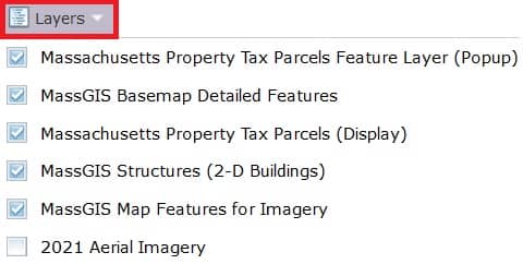
Feature Layers
Click the “Layers” button to turn map features on and off.