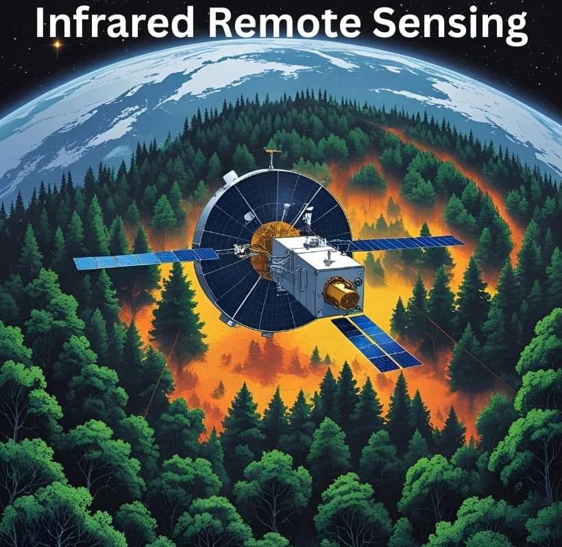
Infrared Remote Sensing
What is Infrared?
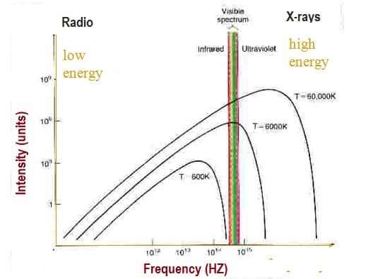
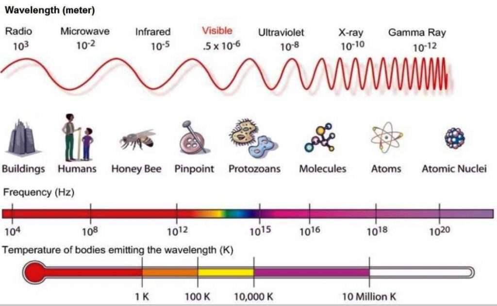
Infrared is Electromagnetic Radiation (EMR) with wavelengths longer than those of visible light and shorter than radio waves. These range from about 700 nanometers (nm) to 1 millimeter (mm).
Infrared remote sensing makes use of infrared sensors to detect infrared radiation(IR) emitted from the Earth’s surface. The mid-wave infrared (MWIR) and long-wave infrared (LWIR) are within the thermal infrared region.
These radiations are emitted from warm objects such as the Earth’s surface. They are used in satellite Remote Sensing for measurements of the earth’s land and sea surface temperature. Thermal infrared remote sensing is also often used for detection of forest fires.
Infrared Radiation Uses
It is used in a variety of applications;
- Communications and networking
- Wired and wireless operations
- Remote controls use near-infrared light, transmitted with light-emitting diodes (LEDs)
- Fiber optic cables to transmit data
Infrared Waves
The Infrared waves are longer than those of visible light, but shorter than those of radio waves. Wavelengths longer than visible light are called infrared rays. Molecules are heated by infrared waves.
| Waves | Wavelength- λ (m) | Frequency- v (hertz[Hz]) | E (electron-volt [eV]) |
|---|---|---|---|
| Infrared | 0.75☓10-6 | 4☓1014 | 1.65 |
Characteristics of Infrared waves:
- Invisible electromagnetic waves that are detected as heat
- Used in heat lamps
- Can be detected with special devices such as night goggles
- Higher energy than microwaves but lower than visible light
Infrared Spectrum
| Wave Division | Wavelength (μm) | Frequency (THz) | Characteristics |
|---|---|---|---|
| Near infra-red | 0.75-1.4 | 214-400 | Atmospheric water absorption |
| Short wave infra-red | 1.4-3 | 100-214 | Atmospheric water absorption increases significantly at 1.45 um. 1.53 to 1.56 um is used in long distance communication |
| Medium wave infra-red | 3-8 | 37-100 | Heat seeking missiles are designed to work in this spectrum |
| Long wave infra-red | 8-14 | 20-37 | Thermal imaging region |
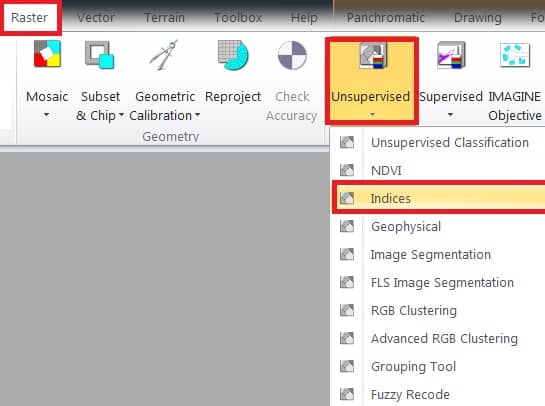
Infrared Radiation Index
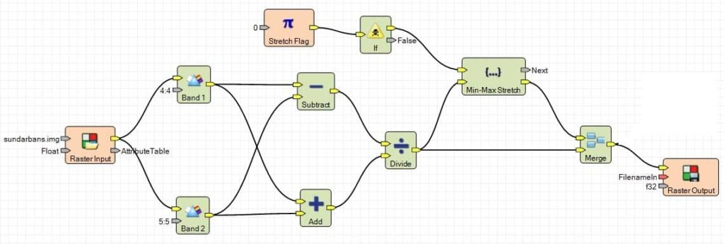
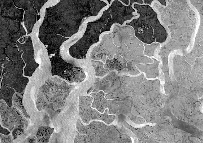
Perform Infrared Radiation (IR) Index; Sundarbans Landsat TM Satellite image, using Erdas Imagine Software.
At first open Indices window; on the main menu, select Raster > drop-down Unsupervised > click Indices.
1. Now indices window is appeared, select Input file (ex.- sundarbans), then go to destination folder and enter Output file name.
2. Choose your satellite data Sensor (ex.- Landsat 4 TM).
3. In the Index section, choose your query:- II–Infrared Index.
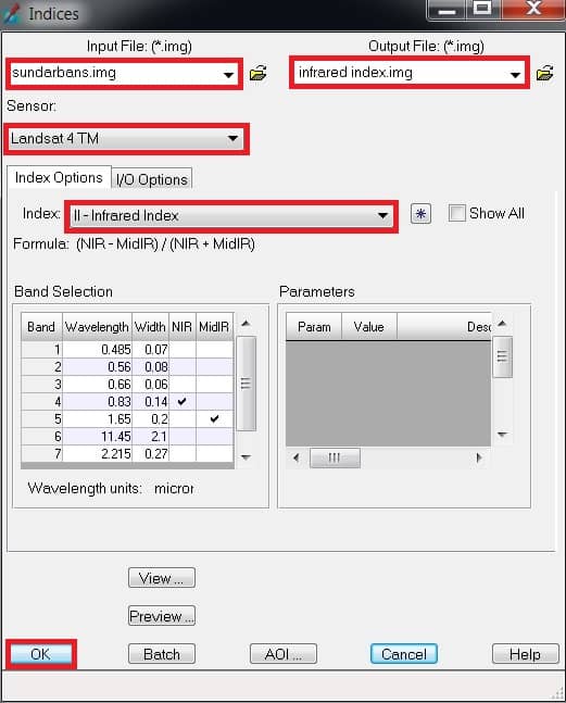
4. Finally click OK button.