Synthetic Aperture Radar
Table of Contents
What is Synthetic Aperture Radar?
A Synthetic Aperture Radar (SAR), is a airborne or spaceborne sidelooking radar system which utilizes the flight path of the platform to simulate an extremely large antenna or aperture electronically, and that generates high-resolution remote sensing imagery.
SAR uses the motion of the radar antenna over a target region to provide finer spatial resolution than conventional stationary beam-scanning radars.
The spatial resolution of radar data is directly related to the ratio of the sensor wavelength to the length of the sensor’s antenna.
Features
- SAR is a Side-looking radar system which makes a high-resolution images of the Earth’s surface.
- Continuous strips of the ground surface are “illuminated” to one side of the flight direction.
- Signal is recorded and Digital signal processing techniques in the ground are used to focus the image and obtain a higher resolution images.
- The across-track distance is called the “Range”
- The along-track distance is called the “Azimuth”.
How Does SAR Work?
A SAR is an active sensor that first transmits microwave signals and then receives back the signals that are returned, or backscattered, from the Earth’s surface.
The SAR works similar of a phased array, but contrary of a large number of the parallel antenna elements of a phased array, SAR uses one antenna in time-multiplex.
SAR Resolution
SAR has two resolutions :
- Range Resolution- is achieved by using Pulse compression technique.
- Azimuth Resolution- is achieved by using Synthetic aperture concept.
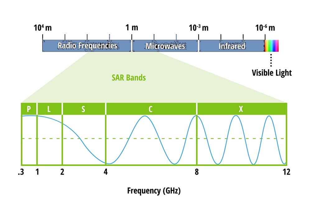
SAR Bands
| Band | Frequency | Wavelength | Typical Application |
|---|---|---|---|
| X | 8–12 GHz | 3.8–2.4 cm | High resolution SAR (urban monitoring, ice and snow, little penetration into vegetation cover; fast coherence decay in vegetated areas) |
| C | 4–8 GHz | 7.5–3.8 cm | SAR Workhorse (global mapping; change detection; monitoring of areas with low to moderate penetration; higher coherence) |
| S | 2–4 GHz | 15–7.5 cm | SAR Earth observation (agriculture monitoring, NISAR will carry an S-band channel; expends C-band applications to higher vegetation density) |
| L | 1–2 GHz | 30–15 cm | Medium resolution SAR (geophysical monitoring; biomass and vegetation mapping; high penetration, InSAR) |
| P | 0.3–1 GHz | 100–30 cm | Biomass. First p-band spaceborne SAR will be launched ~2020; vegetation mapping and assessment. Experimental SAR. |