Geographic Coordinate Systems (GCS)
What is the Geographic Coordinate System?
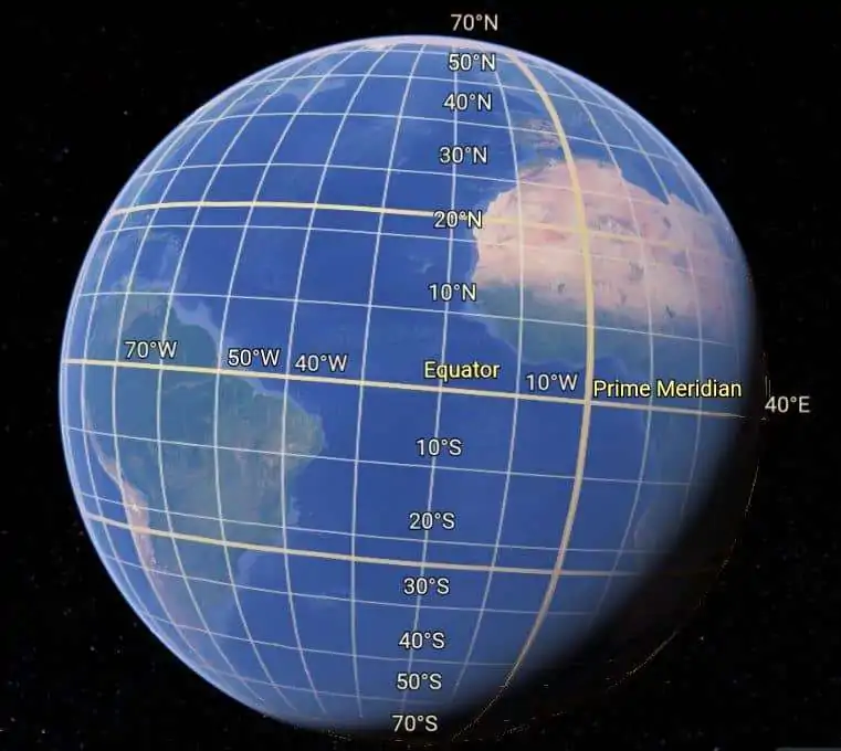
A Geographic Coordinate System (GCS) is a system that uses a three-dimensional spherical surface to determine locations on the Earth. The GCS is a spherical or ellipsoidal coordinate system for measuring and communicating positions directly on the Earth at latitude and longitude.
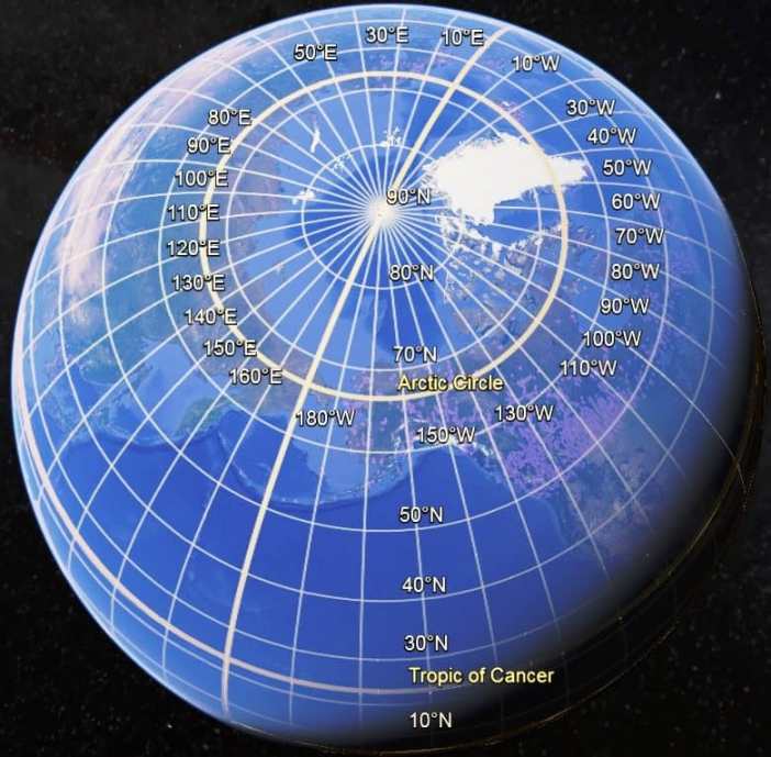
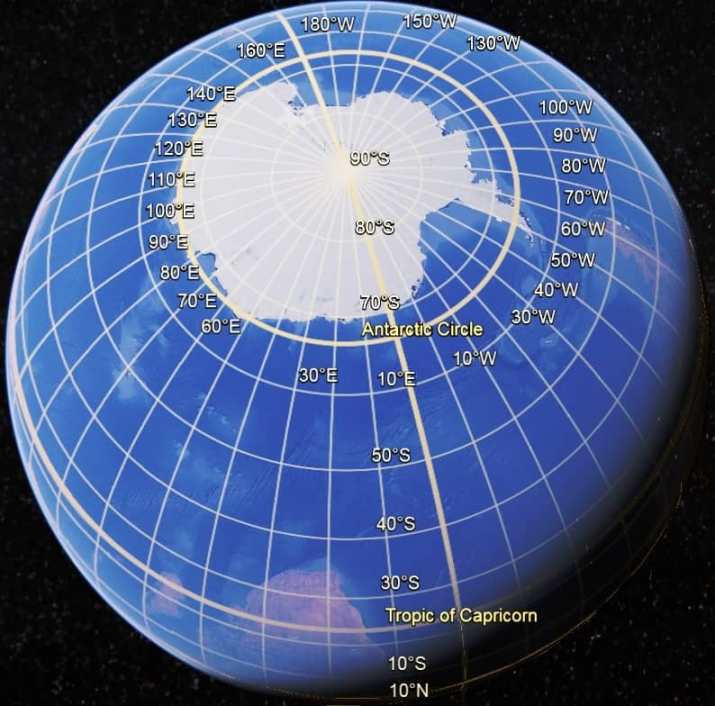
The GCS consists of latitude and longitude lines. Each line of longitude runs north–south and measures the number of degrees east or west of the prime meridian. Values range from “-180°” to “+180°”. Lines of latitude run east–west and measure the number of degrees north or south of the Equator. Values range from “+90°” at the North Pole to “-90°” at the South Pole. The equator is at an angle of 0 degree latitude.

A geographic coordinate system is a method for describing the position of a geographic location on the earth’s surface using spherical measures of latitude and longitude. These are measures of the angles (in degrees) from the center of the earth to a point on the earth’s surface when the earth is modeled as a sphere. When using a spheroid (ellipsoid), latitude is measured, extending a line perpendicular to the earth’s surface to the equatorial plane. Except at the equator or a pole, this line will not intersect the center of the earth.
In the geographic coordinate system, the sphere is divided into equal parts, usually called degrees; some countries use grads. A circle is 360° or 400 grads. Each degree is subdivided into 60 minutes, with each minute composed of 60 seconds.


Uses and Applications
Users with global datasets often use geographic coordinates to store and manage their data on a global framework but project the data into a local planar coordinate system for editing and analysis.
Map projections also use latitude and longitude values from geographic coordinate systems to reference parameters, such as the central meridian, the standard parallels, and the latitude of origin.
Geographic Coordinate Systems ArcGIS
ArcGIS data frame’s has a default unknown coordinate system. If you change the data frame’s coordinate system, all layers that have coordinate systems will be projected on the fly to the new coordinate system.
Specifying GCS in ArcMap
Steps:
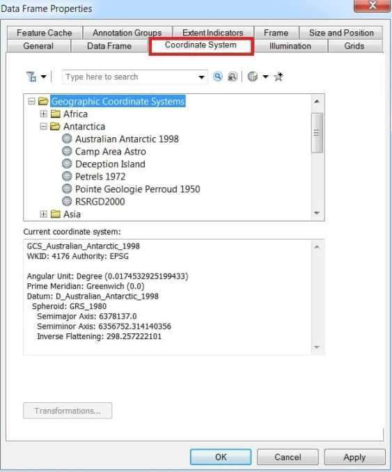
1. Open ArcMap, Right-click the data frame Layers and choose Properties to bring up the Data Frame Properties dialog box.
2. Click the Coordinate System tab and navigate to the Geographic Coordinate Systems, and select your desired coordinate system for your map display.
3. Finally, click OK.

Defining a Shapefile’s Coordinate System by specifying a new GCS
Steps:
- In ArcCatalog, click the shapefile whose coordinate system you want to define.
- Click the File menu and click Properties.
- Click the XY Coordinate System tab.
- Click New and click Geographic.
- Type a name for the new geographic coordinate system.
- Type the appropriate semi-major and semi-minor or inverse flattening values and type a name for your custom spheroid and datum.
- Type the appropriate radians per unit and type a name for your custom units.
- Type the appropriate degrees, minutes, and seconds defining the prime meridian and type a name for this line of longitude
- Click OK.
- Then, click OK on the Shapefile Properties dialog box.
Convert GCS to PCS in ArcGIS
In this process, first complete the Georeferencing, then you can perform to convert Geographic Coordinate System to Projected Coordinate System.
